Country:

 City:
City:


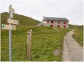
Vallorcine railway station car park. You can travel to the station by train (see timetables).
(S/E) From the forecourt of Vallorcine station, take Avenue de la Gare as far as the ‘Stop’ sign, at the junction with Route des Confins du Valais, near the town hall.
(1) Turn right onto Route des Confins du Valais, pass the tourist office, pass a construction company on your left, then continue for a few dozen metres until you reach a pedestrian crossing. Note the numerous chalets, some more modern than others.
(2) Turn right towards a footbridge to cross the Eau Noire and reach a junction. Turn left and continue along the path which climbs and passes over the railway line to join the Chemin des Diligences.
(3) Leave the return route on your right, turn left and follow the railway line until you reach the junction marked by post 498.
(4) Turn left, go under the railway line, then cross the footbridge over the torrent and turn right, following the road for about 300 m. Note the retaining wall of a path on your left.
(5) Turn sharply left onto this path; it joins a road. Cross the road and head up to the Chapelle du Clôt just after the junction marked by post 428. The chapel’s modern stained-glass windows are well worth a look.
(6) Return to the junction (post 428) and take the Route de la Villaz on the left until you reach the hairpin bend after a telecoms mast, where there is a bus stop.
(7) At the bend, take the path on the right towards Barberine and Emosson (post 494), and head uphill following the signposts. Cross the stream (Nant du Rand), then continue northwards. The path bends to the right, then to the left, and heads north again until it meets another path. Cross this path and continue for about 50 metres to the right until you reach another junction.
(8) The Barberine Waterfall is a few dozen metres to the left. The waterfall is formed by the River Barberine, which marks the border between France and Switzerland.
Return to the previous junction
(8) Take the path leading down to the left and continue, following the signs for the hamlet of La Barberine. After about 250 m, at the junction, turn left towards the first houses and marker post 401. The path joins a small road leading down towards La Barberine.
(9) Walk through the hamlet. Take the opportunity to visit the small museum, which preserves the memory of rural life in the hamlet.
Continue to the Barberine bridge, cross it and carry on until you reach the end of the bend to the left.
(10) Behind the little house, take the path that climbs to the right to join the stagecoach track after crossing the road and the railway line. Follow the stagecoach track until you reach the junction marked by post 498, which you passed on the way there.
(4) Carry on straight ahead, in the opposite direction to the outward journey, until you reach the junction you also passed on the outward journey.
(3) Carry on straight towards Vallorcine. Pass under the cable car, then continue a little further until you’ve gone past the SNCF station and reach the junction at the hamlet of Plan de l’Envers. Take note of the chalets and other houses in the village.
(11) Turn right, cross the level crossing to reach the SNCF station and its car park on the right (S/E).

 Visorando Member
 Difficult

 Very difficult