Along the Bisse du Trient

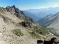
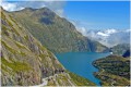
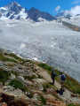
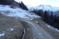
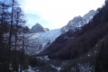
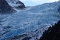
Starting from Col de la Forclaz (1527m), a short and easy out-and-back walk along the Bisse du Trient (irrigation channel) to the Chalet du Glacier (1583m), which offers a fine view of the Glacier du Trient and the Petite Pointe d'Orny (3187m).

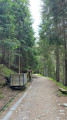
⚠️ Part of the trail has been damaged by a landslide. Bypassing is possible, but the walk is not accessible for baby carriages and wheelchairs (see practical info).

Details

n°193351
Creation:
Last update:
Last review:
  • Walking
    Activity: Walking
  • ↔
    Distance: 4.16 mi
  • ◔
    Average duration: 3h 20 
  • ▲
    Difficulty: Easy

  • ⚐
    Back to start: Yes
  • ↗
    Ascent: + 1,667 ft
  • ↘
    Descent: - 1,690 ft

  • ▲
    Highest point: 5,289 ft
  • ▼
    Lowest point: 4,954 ft

Photos

Description of the walk

Start: From Col de la Forclaz (large car park).

(S/E) In the bend at the Col (pass), take the path heading south along the Bisse du Trient (signposted).

For the rest of the walk, follow this false-flat path as it rises along the Bisse. You will see a number of information panels explaining the origins of the trail in ice mining, as well as activity games provided by Charlotte la Marmotte.

(1) After about ten minutes, you'll come to a crossroad cont. Continue straight on towards the Glacier du Trient.

Gradually the panoramic view will include the Col de Balme to the south-west... then onto the Glacier du Trient and the Petite Pointe d'Orny. Continue straight on along the Bisse until you reach the Chalet du Glacier.

(2) For the return walk, take the same route down. Allow between 45 min and 1h to return to the Col de la Forclaz (S/E).

Waypoints

  1. S/E : mi 0 - alt. 5,026 ft - Col de la Forclaz (Valais)
  2. 1 : mi 0.39 - alt. 5,121 ft
  3. 2 : mi 2.09 - alt. 5,249 ft
  4. S/E : mi 4.16 - alt. 5,026 ft

Notes

Start: From Col de la Forclaz (large car park).

Gears & Terrain : A family hike on a very easy terrain, sneakers/trainers may suffice in summer. However, as the trail is on a ledge, some passages can be vertiginous. Missteps are not recommended.

Refreshments:
On arrival, the Chalet du Glacier offers refreshments... in season!
(2) From the Chalet, you can get close to the glacier by following the path that heads East, then South-East towards Vésevey and Fenêtre d'Arpette. Be careful, it's uphill!

Note: Part of the trail has been damaged by a landslide. A few minutes after the start of the walk, you will come across repair works being carried out, clearly indicated by a sign. A bypass is possible, but not for baby carriages and wheelchairs .''

This is a temporary situation, but it is not yet known when the path will be fully restored to normal (01/10/2018). Please consult the website of the Trient locality on [https://www.trient.ch/.]

Reviews and comments

4.8 / 5
Based on 14 reviews

Reliability of the description
4.9 / 5
Ease of following the route
4.9 / 5
Route interest
4.8 / 5
osiris130
osiris130 ★

Good evening, Denisjean,

The elevation gain is calculated automatically by the Visorando software for this route based on the digital elevation model (DEM). As the route runs along a mountainside, there are often points that are sometimes above and sometimes below the path, which quickly increases the total elevation gain.

And as the duration is also calculated automatically based on the distance and elevation gain, it’s overestimated too!

Have a good evening.

Machine-translated

denisjean
denisjean

Overall rating : 4.7 / 5

Date of your route : Oct 05, 2026
Reliability of the description : ★★★★☆ Good
Ease of following the route : ★★★★★ Very good
Route interest : ★★★★★ Very good
Very busy route : No

A lovely, easy walk. However, there’s a mistake in the elevation gain: I measured 63 m from the pass, not 358 m!!
The same goes for the duration: 60 minutes out and 45 minutes back – that’s a long way from 2 hours 50 minutes!!

Machine-translated

almati07
almati07

Overall rating : 5 / 5

Date of your route : Aug 05, 2025
Reliability of the description : ★★★★★ Very good
Ease of following the route : ★★★★★ Very good
Route interest : ★★★★★ Very good
Very busy route : Yes

Very easy hike starting from the Col de la Forclaz, shaded, accessible to children with a fun trail explaining the functions of the bisse and ice harvesting until the 1930s. Refreshments and snacks available at the "chalet du glacier".

Machine-translated

Ricou31
Ricou31

Overall rating : 5 / 5

Date of your route : Jun 24, 2024
Reliability of the description : ★★★★★ Very good
Ease of following the route : ★★★★★ Very good
Route interest : ★★★★★ Very good
Very busy route : No

A gentle ascent along the old wagon track that used to bring ice down into the valley, to the chalet and the blueberry tart. Fun and accessible for children.
Beautiful views and a footbridge leaning against the mountain that can be avoided by taking the path just above for those with vertigo.
Shady and definitely worth doing.

Machine-translated

Vis8374
Vis8374

Overall rating : 5 / 5

Date of your route : Aug 08, 2022
Reliability of the description : ★★★★★ Very good
Ease of following the route : ★★★★★ Very good
Route interest : ★★★★★ Very good
Very busy route : Yes

A pleasant, easily accessible walk, much of it shaded.

Machine-translated

fada0713
fada0713

Overall rating : 5 / 5

Date of your route : Jul 10, 2022
Reliability of the description : ★★★★★ Very good
Ease of following the route : ★★★★★ Very good
Route interest : ★★★★★ Very good
Very busy route : No

A very pleasant and easy walk.
It was very hot that day and we enjoyed the coolness of "la Bisse".

Machine-translated

wake4cdr
wake4cdr

Overall rating : 5 / 5

Date of your route : Aug 04, 2020
Reliability of the description : ★★★★★ Very good
Ease of following the route : ★★★★★ Very good
Route interest : ★★★★★ Very good
Very busy route : Yes

A very pretty route along the bisse, with the option of returning along the same path, going further up towards the glacier or returning via the village of Trient, which makes the tour a little longer and adds to the gradient.

Machine-translated

gondad
gondad

Overall rating : 4.7 / 5

Date of your route : Aug 22, 2020
Reliability of the description : ★★★★★ Very good
Ease of following the route : ★★★★☆ Good
Route interest : ★★★★★ Very good
Very busy route : Yes

Easy, fun hike for children, with fantastic views of the glacier and gorges.

Machine-translated

stephcarine74
stephcarine74

Overall rating : 4.7 / 5

Date of your route : Aug 19, 2020
Reliability of the description : ★★★★★ Very good
Ease of following the route : ★★★★★ Very good
Route interest : ★★★★☆ Good
Very busy route : Yes

A very pleasant walk, very easy and fun for young children (take care, as the side of the path can be steep).
At the end, you had a magnificent view of the Trient glacier and the surrounding peaks.
For your information, at the start of the path (where the landslide occurred), there is now a perfectly safe footbridge (which can be a little impressive for people prone to vertigo).
Enjoy the walk.

Machine-translated

osiris130
osiris130 ★

Hello Dut and thank you for this information.

I'm adding it to the description of the walk.

If you have any information about the reopening of the path, don't hesitate to let us know.

Have a nice day.

Machine-translated

dutsurleweb
dutsurleweb

Overall rating : 4 / 5

Date of your route : Oct 01, 2018
Reliability of the description : ★★★★☆ Good
Ease of following the route : ★★★★☆ Good
Route interest : ★★★★☆ Good

Repair work was underway a few weeks ago because part of the track had suffered a landslide. The work zone is just a few minutes from the start and is clearly indicated on the start sign. A bypass is possible, but in this case, impossible for pushchairs and wheelchairs.

This is a transitional situation, but the date of handover is not yet known.

Machine-translated

jpr1870
jpr1870

Overall rating : 5 / 5

Date of your route : Aug 06, 2018
Reliability of the description : ★★★★★ Very good
Ease of following the route : ★★★★★ Very good
Route interest : ★★★★★ Very good

We set off at 2.30pm from the Col de la Forclaz, so there were fewer tourists at the Chalet du Glacier. We climbed to an altitude of 1,700m, but the glacier is even higher! We had to turn back because the sky was becoming dangerously heavy.

Machine-translated

jlchassot65
jlchassot65

Overall rating : 4.7 / 5

Date of your route : Jul 29, 2018
Reliability of the description : ★★★★★ Very good
Ease of following the route : ★★★★★ Very good
Route interest : ★★★★☆ Good

A lovely walk for all the family. Since the path collapsed at the start of the walk, wheelchair and rickshaw access is no longer possible (for the time being). There is a diversion through the forest.
Once you reach the refreshment station, it's a good idea to continue along the path (many don't) to get as close as possible to the glacier (well, what's left of it!) On a sunny day, stop for a picnic in the forest, as there's not much shade after that.

Machine-translated

sophiedu77
sophiedu77

Overall rating : 5 / 5

Date of your route : Oct 28, 2017
Reliability of the description : ★★★★★ Very good
Ease of following the route : ★★★★★ Very good
Route interest : ★★★★★ Very good

Magnificent walk, very easy as it is on a balcony. The colours are beautiful at the end of October.
Possibility of picnic at the refuge, even if it was closed, as there are tables and benches available. Magnificent view of the glacier.
I recommend taking the hike further to get closer to the glacier.

Machine-translated

dancingbrave
dancingbrave

Overall rating : 5 / 5

Date of your route : Oct 29, 2016
Reliability of the description : ★★★★★ Very good
Ease of following the route : ★★★★★ Very good
Route interest : ★★★★★ Very good

It was a superb, unexpectedly sunny day at the end of October. The colours were sparkling.
The walk is very easy indeed (family-friendly), but nonetheless offers an interesting way of getting close to the glacier.
The path is still very wide, so there's really nothing to worry about for those prone to vertigo.
A little anecdote: I hadn't realised that the start was in Switzerland, so after programming my destination on the GPS and leaving Chamonix, we were quite surprised to cross the border
. On the other hand, for us little Frenchies, what a pleasure it was to enjoy a nice hot Ovaltine at the glacier chalet.
Thank you for this wonderful hike.

Machine-translated

Other walks in the area

For more walks, use our search engine .

The GPS track and description are the property of this route's author. Please do not copy them without permission.