Lac Blanc via the Lacs de Chéserys from the Col des Montets

A must-do hike through the Aiguilles Rouges Nature Reserve, in the Chamonix Valley.
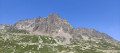
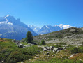
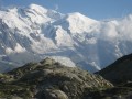
Lac Blanc, at an altitude of 2,352 metres, offers an unforgettable panorama of the Mont Blanc massif.
The route described here offers a much more idyllic and unspoilt setting than the alternative route via La Flégère, which has become far too touristy.

⚠️ This route passes through the Aiguilles Rouges Nature Reserve. Please respect the regulations in force. See practical information.

Details

23916813
Creation:
Last update:
Last review:
  • Walking
    Activity: Walking
  • ↔
    Distance: 6.72 mi
  • ◔
    Average duration: 5h 50 
  • ▲
    Difficulty: Difficult

  • ⚐
    Back to start: Yes
  • ↗
    Ascent: + 3,104 ft
  • ↘
    Descent: - 3,074 ft

  • ▲
    Highest point: 7,717 ft
  • ▼
    Lowest point: 4,705 ft

Photos

Description of the walk

Park at the Col des Montets car park, but it is often full of coaches.
If this is the case, park 300 m further down at the free Lac Blanc car park, downstream from the Col des Montets.

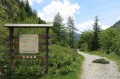
(S/E) Cross the road, then turn left at the next junction onto the path leading uphill. You will reach the junction by the chalet at the Aiguilles Rouges Nature Reserve. Here, join the Mont-BlancGRP®® trail.

(1) Turn left onto it and follow the red and yellow markings on the path coming from the Col des Montets. Pass through a very steep gully, which is well-maintained with plenty of steps. You’ll reach a small plateau.

(2) Continue along theGRP®® on an easier section of the path until you reach a crossroads with a signpost.

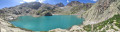
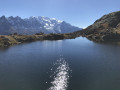
(3) Leave theGRP®® here and turn right to reach the Lacs des Chésérys. Walk alongside them, then rejoin the GRP®® a few hundred metres further on.

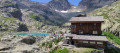
(4) Join it again on the right and continue the ascent to reach Lac Blanc and its mountain hut.

(5) Turn back to begin the descent via the same route and return to the previous junction.

(4) Here you have two options:
- turn left onto the lakes trail,
- keep to the right on theGRP®®,
in both cases, you’ll return to the junction with the signpost.

(3) From here, follow the route back in the opposite direction to return to the Col des Montets car park (S/E).


Waypoints

  1. S/E : mi 0 - alt. 4,705 ft - Car park at the
  2. 1 : mi 0.31 - alt. 4,990 ft - GRP - Track
  3. 2 : mi 1.56 - alt. 6,762 ft - Plateau
  4. 3 : mi 2.32 - alt. 6,998 ft - Carrefour des - Lacs des Chéserys
  5. 4 : mi 2.89 - alt. 7,313 ft - GRP - Path to the - Lac Blanc
  6. 5 : mi 3.34 - alt. 7,713 ft - Chalet du Lac Blanc
  7. S/E : mi 6.72 - alt. 4,705 ft - Car park at the

Notes

Tips.
Remember to take water and a cap or hat, as you’ll be in direct sunlight for three-quarters of the walk, with no shade.
There are no springs along the route in the height of summer.
Hiking boots and walking poles are strongly recommended.
Please note: there are many steps on thefirst part of the walk, in the Goulet pass.

Info.
Toilets at the refuge.
No drinking water at the refuge.
Cash only – no credit cards accepted – for drinks and/or a bite to eat.

Reserve regulations must be observed:

  • Dogs not permitted
  • Drones and flying over the reserve prohibited
  • Swimming prohibited
  • Stay on the paths
  • No littering
  • Fires prohibited
  • Picking prohibited
  • Motor vehicles prohibited
  • Camping prohibited and wild camping restricted >Book your wild camping spothere.

This route passes through a protected area, which may be subject to special regulations:

Reviews and comments

4.8 / 5
Based on 9 reviews

Reliability of the description
4.6 / 5
Ease of following the route
4.8 / 5
Route interest
5 / 5
Biquette30
Biquette30

This hike is challenging, with a significant elevation gain and rocky terrain that makes it technically demanding. In hot weather, do make sure to bring something to cover up with at the summit and by the lakes, as there is often a cool breeze.
It’s a good alternative to the other walk leading to Lac Blanc, but it features ladders that can be difficult to negotiate if you suffer from vertigo.

Machine-translated

User 9334132

Overall rating : 5 / 5

Date of your route : Aug 10, 2026
Reliability of the description : ★★★★★ Very good
Ease of following the route : ★★★★★ Very good
Route interest : ★★★★★ Very good
Very busy route : Yes

The slope starts straight away; the ascent is steep and tough for me, as I’m used to hiking in the Vosges. From the 2,200-metre mark at ‘La Tête aux Vents’ – where the path joins the route coming from La Flégère, which is accessible by ski lift – there are lots of people. The descent (along the same path) over the last 3 kilometres is difficult given how tired I am.
It’s worth noting that the path between the Cheserys lakes was closed.

Machine-translated

Biquette30
Biquette30

Overall rating : 5 / 5

Date of your route : Jul 21, 2026
Reliability of the description : ★★★★★ Very good
Ease of following the route : ★★★★★ Very good
Route interest : ★★★★★ Very good
Very busy route : No

This hike is challenging, with a significant elevation gain and rocky terrain that makes it technically demanding. In hot weather, do make sure to bring something to cover up with at the summit and by the lakes, as there is often a cool breeze.
It’s a good alternative to the other walk leading to Lac Blanc, but it features ladders that can be difficult to negotiate if you suffer from vertigo.

Machine-translated

Fouine Informatique
Fouine Informatique

You're welcome, Sophie.
Glad you enjoyed the hike.

Machine-translated

Sophie la Marmotte
Sophie la Marmotte
• Edited:

Overall rating : 5 / 5

Date of your route : May 30, 2026
Reliability of the description : ★★★★★ Very good
Ease of following the route : ★★★★★ Very good
Route interest : ★★★★★ Very good
Very busy route : Yes

Everything we love about a hike! I was already quite familiar with this area, but I’d decided to head up this weekend to see the lakes as they thawed. I wasn’t disappointed

There were still a few patches of snow on the ascent that were easy to get past. Crampons may still be useful for certain parts of the descent or around the lakes, but they aren’t essential.

The ascent is quite steep but fairly steady, and this route allows those prone to vertigo to avoid the ladders. There are no tricky sections here. Thanks for the route

Machine-translated

strappazzon
strappazzon

Overall rating : 5 / 5

Date of your route : Jun 11, 2025
Reliability of the description : ★★★★★ Very good
Ease of following the route : ★★★★★ Very good
Route interest : ★★★★★ Very good
Very busy route : Yes

Magnificent setting and pleasant trail. The slope is steep but steady. And there are ibexes all along the way. They even surprise us on the trail and are not shy at all. Superb hike, but best to do it now because it gets too crowded later in the season.

Machine-translated

User 3097462

Overall rating : 4.3 / 5

Date of your route : Sep 09, 2023
Reliability of the description : ★★★★☆ Good
Ease of following the route : ★★★★☆ Good
Route interest : ★★★★★ Very good
Very busy route : Yes

A hike with fabulous views that invites you to take your time.

Fantastic lakes and a strong desire to bivouac.
No particular difficulty in terms of vertigo, as everything is well secured.
Intensive ascent on the first part of the route.
Dogs not allowed.
In the company of ibex on the return journey.

Machine-translated

Christian 12170
Christian 12170

Overall rating : 4.7 / 5

Date of your route : Sep 29, 2023
Reliability of the description : ★★★★☆ Good
Ease of following the route : ★★★★★ Very good
Route interest : ★★★★★ Very good
Very busy route : Yes

Quite a difficult walk with more than 20% gradient over the first 3 kilometres and also over the last 500 metres.
Don't forget to take plenty of water, as the Lac Blanc refuge is not open out of season.
On the other hand, the scenery is truly magnificent!
You can also take the shorter, faster ladder circuit, but you mustn't be afraid of heights!

Machine-translated

jon_ath3
jon_ath3

Overall rating : 4.7 / 5

Date of your route : Sep 08, 2023
Reliability of the description : ★★★★☆ Good
Ease of following the route : ★★★★★ Very good
Route interest : ★★★★★ Very good
Very busy route : Yes

A very pleasant route with magnificent views all the way! Very beautiful lakes at the end.
The route has changed since the original route: you can't go along from part 3 to 4 any more, you have to keep climbing on the path to take a parallel one (which then takes you back to point 4).
As I'm a bit apprehensive about heights, the part with the ladder didn't give me any trouble at all.
A hike I can totally recommend!

Machine-translated

mariebleuet
mariebleuet

Overall rating : 4.3 / 5

Date of your route : Jul 11, 2023
Reliability of the description : ★★★★☆ Good
Ease of following the route : ★★★★☆ Good
Route interest : ★★★★★ Very good
Very busy route : Yes

What's missing from the description is that the last section between the Lac de Chezery and the Lac Blanc is steeper, with quite a few steps and a ladder passage, and that the route is very busy from the Lac de Chézery and especially at the refuge. Your route to the small lakes of Chézery is very nice and not very busy. Highly recommended!

Machine-translated

cathycoco
cathycoco

Overall rating : 5 / 5

Date of your route : Aug 24, 2022
Reliability of the description : ★★★★★ Very good
Ease of following the route : ★★★★★ Very good
Route interest : ★★★★★ Very good
Very busy route : Yes

a fairly steep climb
a lot of people on this hike
the chésery lakes were quieter

Machine-translated

Other walks in the area

For more walks, use our search engine .

The GPS track and description are the property of this route's author. Please do not copy them without permission.