


 Country:

 City:
City:


Start at Vernayaz station (the CFF station, not the Vernayaz MC station from which the Mont-Blanc Express departs for Chamonix).
(S/E) From the square in front of the station (mountain side: cross over when arriving from the Rhône side), take a cobbled path leading off to the left. Cross the Grand Rue and continue straight on towards the power station visible in the distance, passing a barrier blocking the way for cars.
(1) Walk along the right-hand side of the power station and take the wide track that winds its way uphill. An information sign marks the start: this is the Route des Diligences, the old main road to Chamonix. Follow this track almost to the end.
(2) After the final hairpin bends, when the path almost levels out, take a signposted path branching off to the right towards Marecot (the spelling of the name varies depending on the signs). Pass a house at a place called Le Roduet and carry on until you can see the hamlet of Marecot.
(3) Before the hamlet, the path turns left and begins to climb. After 50 metres, a bend in the main track leading to Marecot comes close to the path: leave the path and join this track by crossing a meadow for a few metres. Take the track to the left.
(4) At the next junction, take a path (marked again) which leads straight ahead to go round a hamlet. Behind the hamlet, continue along the path which crosses the track again. Follow it to a junction where a marked path branches off to the left towards the Dailley Gorges.
(5) Before heading towards the gorges, carry on straight ahead for a quick round trip to the Tête des Crêtes.
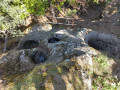
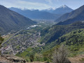
(6) The open summit of the Tête des Crêtes offers a first beautiful view of the valley, the Dent de Morcles opposite and the Dailley Gorges. Just below the summit, on the western face, you can see glacial potholes. From the summit, head back to the junction.
(5) Head towards the Gorges du Dailley on the right.
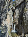
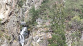
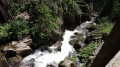
(7) At the next junction, where there is a hut with a picnic area, take a path on the right to enter the Dailley Gorges and cross the river via a suspension bridge. The path veers slightly to the right, passes via steps clinging to the cliff face, then returns along the river and climbs up through the gorges via further steps.
(8) At the top of the gorges, the path joins a road. Follow it to the right, then take the first track branching off to the right towards Grand Tête and Plan Dzora. Continue along this track until you reach a left-hand bend where several paths branch off, and a signpost indicates “Grand Tête”.
(9) In fact, the signpost is at the edge of the track, but the summit is a few dozen metres higher up. Take a path on the right which climbs to the summit (another signpost for the “Grande Tête geoglyph” themed trail indicates the level of the eye). The summit itself is in the forest and offers no view, but if you continue for 10 minutes along the path (which is rather poorly marked) that follows the ridge, you’ll reach the edge of the cliff with a new viewpoint over the valley.
(10) At the viewpoint, turn back to return to the main track.
(9) Continue to the right along this track (not along the smaller paths branching off from the same junction). Follow the track for a good while until you spot a path (marked but without a signpost) branching off to the right just before Plan Dzora.
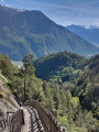
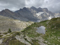
(11) Take this footpath on the right, which runs along a ledge beneath the Dent du Salentin. Several spots offer lovely views over the valley and the Dent de Morcles massif. Some sections are a little vertiginous, and although the footpath is generally of moderate difficulty, it is in fact a succession of ascents and descents!
(12) On reaching the Salantin hut, take the path leading down to the right. Follow the red and white markings: the path joins a wider track and passes a first hut (Chalet Saint-Martin) before turning right after a bend in the track to descend towards the Combabartan hut.
(13) Just before the hut, the path joins a slightly wider track: take it to the right, following the markings. You’ll then come out onto a track; take it to the left (still marked). Walk past the hut, then at the next junction turn right to head down towards La Balmaz (yellow markings).
(14) A little further on, follow the signposting indicating you should leave the track and turn left onto a path leading downhill.
(15) At the next junction, take a path (unmarked) which climbs to the right. This avoids going straight back down to the valley floor and having to take the road. After a short but steep climb, the path joins a track which heads off to the left.
(16) At the next junction, take a track that descends to the left. It soon joins the signposted path: turn left onto it. A few paths branch off to the right and lead to climbing spots; do not take them.
(17) When the path becomes a track, it splits into two: take the right-hand branch and continue to the village of Miéville. Walk straight through the village and turn right to join the county road.
(18) Take the road on the right to cross the river, then turn immediately right and follow the river (which is channelled at this point). The path isn’t very visible here, as this is a storage area for the power station opposite (but you can cross anywhere). As you follow the river, the path becomes visible again a little further on and leads to the Pissevache waterfall. This is one of the best-known waterfalls in Valais, as it is visible directly from the Rhône valley. And in the early days of tourism in the 19th century, it was much more powerful than it is today, as a dam has since been built upstream.
(19) After the waterfall, head back and continue along the signposted path to the right, at the bottom of the valley, until you reach the entrance to Vernayaz.
(20) The path crosses a stream, then the signposts turn right towards the power station. Do not follow them; instead, carry on straight ahead along a street that crosses the cantonal road and leads directly to the station (S/E).
 Visorando Member
 Moderate
 Difficult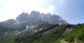
 Easy
Easy 
