Country:

 City:
City:


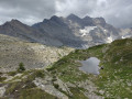
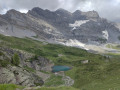
The route starts at the Auberge du Vallon de Van, at the entrance to the hamlet of Van-d’en-Bas. By car, just after crossing the Salanfe, a track branches off to the left, alongside which there are parking spaces available. By bus, the stop is a little further on: see the ‘Practical Information’ section.
(S/E) From the car park in front of the inn, continue along the track through the hamlet until you reach a crossroads.
(1) Turn left onto a path marked in yellow. Head uphill through the forest.
(2) At the first junction, turn left then immediately right onto a red and white-marked path (a sign points towards the “Sé” des Granges). Follow this path for a long way – it isn’t always very clearly marked – until you reach the summit.
(3) Head back down the other side towards La Creusaz.
(4) You’ll come out onto a track; follow it to the left.
(5) At a fork in the road, turn right and start climbing again.
(6) When the piste takes a hairpin bend to the right, take a path (still marked in red and white) which starts behind and above the piste. Climb the slope in switchbacks. Join the piste a little further up and follow it to the left.
(7) Just before the top station of the Vélard chairlift, follow a track that branches off at an acute angle to the right (marked in red and white). After a hairpin bend, continue along a path that keeps to the right on the side of the valley (ignore a track that branches off to the left towards the chairlift). Continue along the path and cross a scree slope where the path disappears but is easy to find again once you’ve left the scree. This will take you to the Col de la Golette.
(8) Carry on straight ahead and descend towards the Lacs des Ottans and Lac de Salanfe.
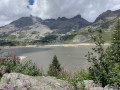
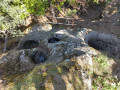
(9) At the next junction, turn left towards Lac des Ottans (there is a signpost). The path passes several entrances to the tunnels of old arsenic mines, then a hut built for the miners (now converted for use by a caving club). Just past the hut, take a path that descends to the left (still marked in red and white). This will take you to Lac des Ottans.
(10) As you walk along the lakeshore, you can follow the stream flowing out of the lake: after about twenty metres, it disappears into a sinkhole! This is a geological curiosity caused by the superimposition of layers of different types of rock. The path continues past the lake; when you join the path descending from the Col d’Emaney, head right towards Lac de Salanfe.
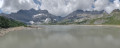
(11) At the next junction, carry on straight ahead along the lake situated below on the left. Keep going straight on until you reach the Salanfe dam.
(12) Head onto the crest of the dam and follow it to the end.
(13) Then take a track that descends to the right towards the Van valley (a popular route).
(14) Halfway down the descent, at a sign warning of a risk of rockfalls on the track, take a path branching off to the left (always following the signposting). Follow this path to a road at the entrance to the hamlet of Van-d’en-Haut.
(15) Follow the road to the right, cross a stream and turn immediately left onto a path that crosses a campsite. Cross the stream again, rejoin the road and follow it to the right until you reach the edge of the hamlet.
(16) Just past the last houses, take a path (marked in yellow) which branches off to the right and crosses the stream again.
(17) At the first junction, head down to the left along an unmarked path (take care not to miss this junction). You’ll come out onto a track; follow it to the right.
(1) At a junction you passed earlier in the walk, carry straight on to return to the starting point (S/E).
 Visorando Member
 Moderate
 Difficult
 Easy
Easy