Finhaut – Cabane du Vieux Emosson

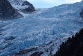
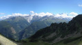
This fifth stage will take you from Finhaut to the Cabane du Vieux Emosson. From Finhaut, the route follows the small road to Giétroz to rejoin the Chemin des Cols Alpins. From Giétroz, a fairly steep climb leads to the Col de la Gueulaz. The route continues with a descent to the Emosson Dam, which offers a magnificent panoramic view of the Mont Blanc massif. The stage ends at Vieux Emosson, following a geological trail in the footsteps of the dinosaurs.

Details

n°111359348
Creation:
Last update:
Last review:
–
  • Walking
    Activity: Walking
  • ↔
    Distance: 6.52 mi
  • ◔
    Average duration: 6h 30 
  • ▲
    Difficulty: Difficult

  • ⚐
    Back to start: No
  • ↗
    Ascent: + 4,045 ft
  • ↘
    Descent: - 1,024 ft

  • ▲
    Highest point: 7,320 ft
  • ▼
    Lowest point: 4,045 ft
  • ⚐ Country: Switzerland
  • ⚐
    Area: Alps
  • ⚐ City: Finhaut 
  • ⚑
    Start: N 46.083167° / E 6.975925°
  • ⚑
    End: N 46.062435° / E 6.900368°
  • ❏
    IGN map(s): Ref. 3530ET, 3530ETR, 3630OT, 3630OTR
  • Hour-by-hour weather

Waypoints

  1. S : mi 0 - alt. 4,104 ft - Finhaut – Hôtel Les Alpes
  2. 1 : mi 1.86 - alt. 4,482 ft - Sign No. 6 – Giétroz
  3. 2 : mi 3.22 - alt. 5,968 ft - Les Montuires
  4. 3 : mi 3.79 - alt. 6,329 ft - Hiking sign
  5. 4 : mi 3.99 - alt. 6,457 ft - Col de la Gueulaz (1965 m)
  6. 5 : mi 4.15 - alt. 6,302 ft - Barrage d'Émosson
  7. 6 : mi 4.82 - alt. 6,365 ft - Hiking sign - Lac d'Émosson
  8. 7 : mi 5.77 - alt. 7,054 ft - Hiking sign
  9. 8 : mi 6.22 - alt. 7,162 ft - Hiking sign
  10. E : mi 6.52 - alt. 7,123 ft - Vieux Emosson Hut - Lac du Vieux Émosson

Notes

This hiking route follows the Chemin des cols alpins, which is marked on Swiss maps.

Signposting: at every major junction, you will find signposts:
- Sign No. 6 with a No. 6 sticker indicating this trail.
- R sign: Yellow sign with a hiker pictogram

Before setting off, it is advisable to check the Suisse Topo website for any trail closures and diversions. This information is updated in real time.

As well as the Visorando app, you can also download the swisstopo app ( free of charge), where you’ll find this information too.

Transport: Timetables

Weather: before setting off, check the Swiss Weather Service or Météo Blue

Hiking equipment, particularly good walking boots.

Accommodation:

Other walks in the area

For more walks, use our search engine .

The GPS track and description are the property of this route's author. Please do not copy them without permission.