


Refine your search for walks in Laval-du-Tarn
Laval-du-Tarn walks
 The Causse Méjean from Saint-Chély du Tarn
 Visorando Member
 10.23 mi
 +2,175 ft
 -2,149 ft
 6h 35
6h 35
 Moderate
 Departure from Sainte-Enimie (Lozère)
In the heart of the Tarn Gorges, Saint-Chély du Tarn is a little gem nestled in the cirque of the same name. Its wealth comes from the limestone plateau above and the bridge that crosses the river. What a contrast between the cool, green gorge and the arid plateau! But these are two sides of the same interactive landscape. It's up to you to discover them.
Saint-Chély-du-Tarn and Mont Verzy
 9.70 mi
+2,477 ft
-2,470 ft
6h 35
Moderate
Departure from Mas-Saint-Chély (Lozère)
9.70 mi
+2,477 ft
-2,470 ft
6h 35
Moderate
Departure from Mas-Saint-Chély (Lozère)
This Causse hike is divided into two distinct sections. The first, a very classic route, crosses the Cirque de Saint-Chély and leads to the charming village from which it takes its name, an iconic site in the Gorges du Tarn. The second, more original and far less frequented, climbs up onto the Causse Méjean to explore Mont Servy. This small, unjustly overlooked peak, rising to an altitude of 1,105 metres, offers an exceptional panorama that alone makes the entire route worthwhile.
From Sainte-Énimie to Les Vignes
 17.11 mi
+2,864 ft
-3,097 ft
10 hrs
17.11 mi
+2,864 ft
-3,097 ft
10 hrs
 Very difficult
Departure from Sainte-Enimie (Lozère)
Very difficult
Departure from Sainte-Enimie (Lozère)
On this fifth stage, we’ll follow the River Tarn as closely as possible, often right by the water’s edge in a rural setting or on a riverside terrace, always on the left bank. If you want to enjoy it at a leisurely pace, you’ll need to split it into two stages, heading towards La Malène, for example.
Visit to Sainte-Énimie
0.96 mi
+144 ft
-148 ft
0h 35
 Easy
Departure from Sainte-Enimie (Lozère)
Easy
Departure from Sainte-Enimie (Lozère)
A discovery walk through this very pretty little medieval town in the Gorges du Tarn, one of the “Most Beautiful Villages in France”
From Sainte-Enimie to La Malène
 9.13 mi
+1,483 ft
-1,572 ft
5h 30
Moderate
Departure from Sainte-Enimie (Lozère)
9.13 mi
+1,483 ft
-1,572 ft
5h 30
Moderate
Departure from Sainte-Enimie (Lozère)
Stage 5 in the heart of the Gorges du Tarn via the Sentier des Gorges du Tarn (left bank) from Sainte-Enimie to La Malène, passing through the picturesque hamlet (with no road access) of Hauterives.
 Canoe descent from Sainte-Enimie to La Malène
8.85 mi
+417 ft
-495 ft
4 hrs
Easy
Departure from Sainte-Enimie (Lozère)
This descent between the two beautiful villages of the Gorges du Tarn is ideal for those who want to explore the gorges at a leisurely pace, with an easy route and plenty to see.
Roc de la Truque
 National Park
 6.28 mi
+673 ft
-679 ft
3h 30
Easy
Departure from La Malène (Lozère)
6.28 mi
+673 ft
-679 ft
3h 30
Easy
Departure from La Malène (Lozère)
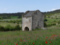
Set off to discover a rural world where tradition meets modernity, where old buildings stand alongside modern structures. A journey from the past to the present along this trail, which runs entirely across the plateau.
Circular route in the north of the Causse Mejean
 7.77 mi
+1,234 ft
-1,240 ft
4h 40
Moderate
Departure from Mas-Saint-Chély (Lozère)
7.77 mi
+1,234 ft
-1,240 ft
4h 40
Moderate
Departure from Mas-Saint-Chély (Lozère)
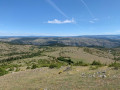
A lovely, easy circular walk in the north of the Causse Mejean with little elevation gain and stunning panoramic views.
Mas-Saint-Chely - Drigas
 7.12 mi
+584 ft
-387 ft
3h 45
Moderate
Departure from Mas-Saint-Chély (Lozère)
7.12 mi
+584 ft
-387 ft
3h 45
Moderate
Departure from Mas-Saint-Chély (Lozère)
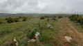
This5th stage of the Tour du Causse Méjean crosses the southern half of the Causse du Nord. From the path, you can take in the desert-like expanses of this part of the Causse. Short and easy, this stage can be completed in the same day as the6th stage from Drigas to Meyrueis for walkers wishing to complete the Tour in a circular fashion.
From Mas-Saint-Chély to Les Vignes, above the Gorges du Tarn
 12.17 mi
+807 ft
-2,602 ft
6h 20
12.17 mi
+807 ft
-2,602 ft
6h 20
 Difficult
Departure from Mas-Saint-Chély (Lozère)
Difficult
Departure from Mas-Saint-Chély (Lozère)
A long stage, culminating in the panoramic view of the Gorges du Tarn.
The Gorges du Tarn from La Malène to Les Vignes
 Association / Club / Walk leader
 7.99 mi
+1,434 ft
-1,558 ft
4h 55
Moderate
Departure from La Malène (Lozère)
7.99 mi
+1,434 ft
-1,558 ft
4h 55
Moderate
Departure from La Malène (Lozère)
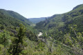
Rather than taking a canoe or a rowing boat, set off on foot along this shaded route through the gorges, where you’ll enjoy fresh perspectives on the legendary sites along this stretch of the Tarn: the ruins of Planiol, Les Détroits, the hamlet of La Croze, Les Baumes Basses and the ‘107’ footbridge! The walk ends after the Pas de Soucy in the lovely village of Les Vignes.A short section of the route towards the end is shared with the GRP® “Tour du Méjan”.
Roc des Hourtous – Les Détroits – Pas de Soucy
 10.12 mi
+2,083 ft
-2,057 ft
6h 30
Difficult
Departure from La Malène (Lozère)
10.12 mi
+2,083 ft
-2,057 ft
6h 30
Difficult
Departure from La Malène (Lozère)
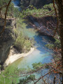
This walk takes you through part of the lower reaches of the Gorges du Tarn via three of its iconic sites: the Roc des Hourtous, the Détroits and the Pas de Soucy, which marks the end of the section accessible by canoe when coming from La Malène. The route, which mostly runs through a lovely pine forest, nevertheless offers impressive views towards the end along the River Tarn, before climbing back up onto the Causse via a very gruelling ascent for which you’ll need to save your energy. The final stretch, which is more leisurely, takes you through the meadows and sparser pine woods of the Causse Méjean, ending at the Roc des Hourtous with its exceptional panoramic view – and perhaps a stop at the local restaurant, open in spring and summer.
Gorges du Tarn: Hauterives - La Malène - Rieisse - Montignac
 10.98 mi
+2,054 ft
-2,057 ft
6h 50
Moderate
Departure from La Malène (Lozère)
10.98 mi
+2,054 ft
-2,057 ft
6h 50
Moderate
Departure from La Malène (Lozère)
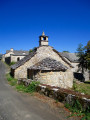
This beautiful and varied hike combines a walk along the banks of the Gorges du Tarn with the discovery of magnificent hamlets and villages in the Causse region, followed by a return trip across the Causse Méjean plateau in a remarkable wooded environment. The absolute calm of the causse contrasts with the hustle and bustle of La Malène and the constant stream of canoes descending the gorges. But the prospect of a welcome swim in the summer months will quickly help you forget this inconvenience. The harmonious blend of majestic landscapes and picturesque, well-preserved traditional buildings makes this circuit particularly appealing.
Point Sublime and Grotte des Baumes Chaudes
 9.12 mi
+1,188 ft
-1,198 ft
5h 15
Difficult
Departure from Saint-Georges-de-Lévéjac (Lozère)
9.12 mi
+1,188 ft
-1,198 ft
5h 15
Difficult
Departure from Saint-Georges-de-Lévéjac (Lozère)
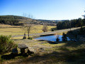
The walk begins with a tour of several villages and hamlets on the Causse de Sauveterre, featuring remarkable stone architecture, set in a rolling landscape where pine woods and meadows share the scenery. Don’t forget to take note of the numerous wayside crosses—some of which are very old stone crosses—that dot the route. The route eventually leads to the Point Sublime viewpoint, overlooking the Cirque des Baumes and offering a magnificent view of the Gorges du Tarn, both upstream and downstream. Just before reaching it, you can choose to take a more challenging but optional detour to the Grotte des Baumes Chaudes.
Causse de Sauveterre circular in Soulages
 6.66 mi
+725 ft
-748 ft
3h 40
Easy
Departure from Saint-Georges-de-Lévéjac (Lozère)
6.66 mi
+725 ft
-748 ft
3h 40
Easy
Departure from Saint-Georges-de-Lévéjac (Lozère)
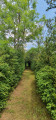
This walk takes you on a journey through the Causse de Sauveterre, the Causse de Séverac, the Causse Méjean, the Aubrac mountains and all the way to the Aigoual.
A small car park is available in the centre of the village of Soulages.
Le Violon
 Tourist office
 7.18 mi
+935 ft
-942 ft
4h 05
Moderate
Departure from La Canourgue (Lozère)
7.18 mi
+935 ft
-942 ft
4h 05
Moderate
Departure from La Canourgue (Lozère)
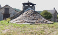
A trail linking Caussenard heritage, an old drovers' road and breathtaking views: from the heights of the Causses foothills, you can see the Lot Valley stretching into the distance, as well as the Aubrac plateau.
Three hamlets on the Causse Méjean
 5.91 mi
+696 ft
-682 ft
3h 20
Easy
Departure from Hures-la-Parade (Lozère)
5.91 mi
+696 ft
-682 ft
3h 20
Easy
Departure from Hures-la-Parade (Lozère)
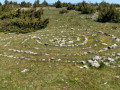
An easy hike on the Causse Méjean, passing through three hamlets. You can visit a protohistoric enclosure at the highest point of the hike and see the karstic cave near the hamlet of Hure.
Drigas – Meyrueis
 5.99 mi
+331 ft
-1,404 ft
3h 05
Easy
Departure from Hures-la-Parade (Lozère)
5.99 mi
+331 ft
-1,404 ft
3h 05
Easy
Departure from Hures-la-Parade (Lozère)
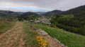
This6th and final stage of the Tour du Causse Méjean crosses the desert-like expanses of the Causse before descending into the Gorges de la Jonte to Meyrueis. This short, easy stage can be combined with the5th stage from Mas-Saint-Chely to Drigas for those wishing to shorten the Tour to five days.
Hameau des karstic caves
 4.40 mi
+315 ft
-292 ft
2h 20
Easy
Departure from Hures-la-Parade (Lozère)
4.40 mi
+315 ft
-292 ft
2h 20
Easy
Departure from Hures-la-Parade (Lozère)
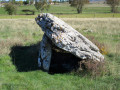
Starting from the charming hamlet of Drigas, this short hike offers a condensed version of the Causse Méjean with the discovery of a dolmen, a lavogne, a karstic cave, a beautiful stone cross and two typical hamlets with remarkable architecture. All this in an open landscape, with wide open spaces interspersed with wooded areas where pine trees reign supreme. An ideal half-day break to recharge your batteries in the great silence of the causse.
The Lot balcony in Chanac
 5.54 mi
+643 ft
-643 ft
3h 05
Moderate
Departure from Chanac (Lozère)
5.54 mi
+643 ft
-643 ft
3h 05
Moderate
Departure from Chanac (Lozère)
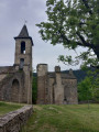
On the rocky spur overlooking the Lot, downstream from Chanac, there are two settlements: Le Villard Vieux, the first hilltop village, and Le Villard Jeune, the second village. In the Middle Ages, Le Villard was part of the domain of the Château de Chanac, an episcopal possession of which only the famous keep remains today.The route differs from the marked route by remaining below the Causse du Villard before reaching the "fortified" village. The return to Chanac, along the Lot, allows you to see the Château de Ressouches (private) along the way and offers the opportunity to visit the village at the end of the walk.
Le Villard, setting off from Chanac
 7.28 mi
+1,112 ft
-1,086 ft
4h 20
Moderate
Departure from Chanac (Lozère)
7.28 mi
+1,112 ft
-1,086 ft
4h 20
Moderate
Departure from Chanac (Lozère)
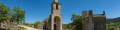
From the banks of the Lot and its lush grassy meadows, the historic private château of Ressouches presents itself magnificently to the passer-by, and the hamlet of Le Villard, just before the climb up to the plateau, is sure to make an impression.
Les Vignes - Mas-Saint-Chély
 12.03 mi
+2,690 ft
-883 ft
7h 50
Difficult
Departure from Les Vignes (Lozère)
12.03 mi
+2,690 ft
-883 ft
7h 50
Difficult
Departure from Les Vignes (Lozère)
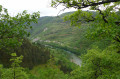
Thisfourth stage of the Tour du Causse Méjean leaves the Gorges du Tarn to climb back up onto the Causse Méjean and cover nearly half of its northern section. After a steep climb to the hamlet of La Caxe, the walker first passes through wooded areas and fields before reaching more open terrain beyond Montignac. A detour via the Roc des Hourtous, with its breathtaking views of the Gorges du Tarn and the vultures, is one of the highlights of the stage.
From Les Vignes to Le Rozier, along the Tarn
 7.15 mi
+791 ft
-837 ft
4h 00
Moderate
Departure from Les Vignes (Lozère)
7.15 mi
+791 ft
-837 ft
4h 00
Moderate
Departure from Les Vignes (Lozère)
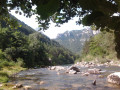
The final stage of this walk, and undoubtedly the easiest. The path follows the course of the Tarn and offers beautiful views of the river at various points.
The hamlet of Fretma from Nivoliers
 9.21 mi
+846 ft
-817 ft
5h 00
Moderate
Departure from Hures-la-Parade (Lozère)
9.21 mi
+846 ft
-817 ft
5h 00
Moderate
Departure from Hures-la-Parade (Lozère)
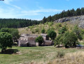
An easy hike on the Causse Méjan starting from Nivoliers via La Bégude Blanche and La Fretma, a remarkably restored hamlet on the Causse. TheGR®60passes through the wide open spaces reserved for Przewalski's horses... but you'll need a bit of luck to spot them!
Circular of Paros
 6.46 mi
+1,175 ft
-1,181 ft
4h 00
Moderate
Departure from Ispagnac (Lozère)
6.46 mi
+1,175 ft
-1,181 ft
4h 00
Moderate
Departure from Ispagnac (Lozère)
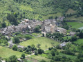
Starting from the small village of Paros (no, don't dream, it's not the Cyclades!) above Molines (commune of Ispagnac) in Lozère, this is a beautiful hike with views of the Tarn in the first part, then of the Causse du Sauveterre.
Around the Ravin du Valat de la Curée
 4.66 mi
+876 ft
-869 ft
2h 55
Moderate
Departure from La Canourgue (Lozère)
4.66 mi
+876 ft
-869 ft
2h 55
Moderate
Departure from La Canourgue (Lozère)
This fairly demanding route, despite being only 8 km long, takes you along the edge of the Ravin du Valat de la Curée before returning via the hamlet of Les Balmes. A steep descent then follows to reach the site of the Chapelle Saint-Frézal, a picnic area to the south of the village of La Canourgue.
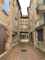
To extend the walk, a visit to this picturesque village – known as ‘the little Venice of Lozère’ – allows you to discover, as you wander through the old cobbled streets, a Renaissance house, the Place au Blé, with its medieval half-timbered house, the Place du Portal and the Clock Tower – a remnant of the old citadel – as well as many other sights, by following a route suggested by the tourist office.
On the Causse de Sauveterre from Molines
7.86 mi
+1,762 ft
-1,749 ft
5h 10
Moderate
Departure from Ispagnac (Lozère)
To the west, the Ispagnac valley is closed off by the Causse de Sauveterre, which overlooks it by about 500 metres. The route takes you up from this pleasant countryside to the much harsher landscape of the causse. The two hamlets of Paros and Mas André mark this route, which winds through the woods for almost half of its length.
Circular walk around the abandoned hamlet of Les Paillers
 1.36 mi
+23 ft
-23 ft
0h 40
Easy
Departure from Balsièges (Lozère)
1.36 mi
+23 ft
-23 ft
0h 40
Easy
Departure from Balsièges (Lozère)
On the Causse de Sauveterre, a short walk to a hamlet, Les Paillers, which, like many villages on this plateau, was long completely abandoned by its inhabitants.
Today, several houses are coming back to life.
Short circuit starting from La Condamine
4.34 mi
+423 ft
-423 ft
2h 20
Easy
Departure from Montbrun (Lozère) (Lozère)
An easy hike in the mineral world of the Causse Méjean: a plateau marked by both austerity and gentle tranquillity. You will stroll through a landscape full of curves, between hills and sinkholes at the bottom of which you will discover a lavogne (a small, circular depression in the ground) or a small cultivated field: one of the characteristic landscapes of the UNESCO-listed sites. (Route information provided by the Gorges du Tarn, Causses & Cévennes tourist office).
La Rocherousse
 5.15 mi
+915 ft
-892 ft
3h 10
Moderate
Departure from Esclanèdes (Lozère)
5.15 mi
+915 ft
-892 ft
3h 10
Moderate
Departure from Esclanèdes (Lozère)
The 13th-century Church of Sainte-Hippolyte, destroyed by the Huguenots in 1562, was rebuilt in 1630. It is partly built of limestone tuff. Several quarries were located in the area near the streams.
The village and the Saint-Saturnin cirque
 5.27 mi
+997 ft
-997 ft
3h 15
Moderate
Departure from Saint-Saturnin (Lozère) (Lozère)
5.27 mi
+997 ft
-997 ft
3h 15
Moderate
Departure from Saint-Saturnin (Lozère) (Lozère)
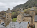
A walk along the edge of the Causse de Sauveterre around the village of Saint-Saturnin and its feudal castle.
La Devèze from Massegros
 3.74 mi
+443 ft
-436 ft
2h 05
Easy
Departure from Le Massegros (Lozère)
3.74 mi
+443 ft
-436 ft
2h 05
Easy
Departure from Le Massegros (Lozère)
A short walk above Massegros among boxwood, juniper and Scots pine trees, with a beautiful panorama of the western part of the Causse de Sauveterre, the Monts du Lévézou and the foothills of the Aubrac.
Balcon du Tarn via the Gaupillat path
 4.56 mi
+1,923 ft
-1,932 ft
3h 45
Difficult
Departure from Les Vignes (Lozère)
4.56 mi
+1,923 ft
-1,932 ft
3h 45
Difficult
Departure from Les Vignes (Lozère)
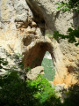
A superb walk along the left bank of the Gorges du Tarn. The Gaupillat path, which is little-used and unspoilt, first crosses the Pas de l’Arc, then continues along the hillside to lead to the foot of the Cinglegros, the region’s iconic rock. The real frustration of no longer being able to climb the ladders leading to the summit – following an indefinite ban – is, however, offset by the climb up the Pas des Trois Fondus. The numerous rungs set into the rock and the three metal ladders to be scaled quickly get the adrenaline pumping and add a very challenging element to the route. The return journey is a leisurely one along the Martel path, passing close to the last point of interest encountered, the Baousso del Biel, another natural arch of remarkable size. Once back in La Bourgarie, you can take the time to admire the Causse architecture of this tiny, timeless hamlet, where the stone buildings are very well preserved.
Baus del Biel trail
 4.56 mi
+1,204 ft
-1,230 ft
3h 10
Moderate
Departure from Les Vignes (Lozère)
4.56 mi
+1,204 ft
-1,230 ft
3h 10
Moderate
Departure from Les Vignes (Lozère)
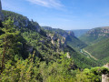
Hike on the Corniches du Causse Méjean above the Gorges du Tarn.
Hyelzas - Le Rozier
 9.94 mi
+1,424 ft
-3,281 ft
5h 50
Moderate
Departure from Hures-la-Parade (Lozère)
9.94 mi
+1,424 ft
-3,281 ft
5h 50
Moderate
Departure from Hures-la-Parade (Lozère)
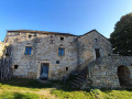
Thissecond stage of the Tour du Causse Méjean crosses the lush south-western part of the Causse before descending to Le Rozier, at the confluence of the Tarn and the Jonte. Along the way, the beautiful church of Saint-Pierre-des-Tripiers, the Gallo-Roman village of Les Résiniers, and the Rocher de Capluc. The route described does not pass through the famous Vases de Chine and Sèvres above the Gorges de la Jonte; this more technical and better-known section can easily be found on other Visorando guides for those who are keen to see them.
Ridge walk from Hyelzas
3.53 mi
+335 ft
-348 ft
1h 55
Easy
Departure from Hures-la-Parade (Lozère)
An easy walk through the wooded part of the Causse Méjean, bordering the Causse Nu. From the ridges, you’ll discover a variety of landscapes, both near and far.
From La Viale to Meyrueis via the Aven Armand
 12.23 mi
+1,385 ft
-1,952 ft
6h 50
Difficult
Departure from Saint-Pierre-des-Tripiers (Lozère)
12.23 mi
+1,385 ft
-1,952 ft
6h 50
Difficult
Departure from Saint-Pierre-des-Tripiers (Lozère)
This is the stage with the greatest horizontal distance (nearly 20 km). It starts in a wooded area before continuing across the Causse and through pastures. The stage ends with a descent into the valley, as required by the accommodation arrangements.
Saint-Pierre Arch Trail
 2.29 mi
+269 ft
-266 ft
1h 15
Easy
Departure from Saint-Pierre-des-Tripiers (Lozère)
2.29 mi
+269 ft
-266 ft
1h 15
Easy
Departure from Saint-Pierre-des-Tripiers (Lozère)
Hike on the Causse Méjean, in an environment that was inhabited thousands of years ago...
Rocher du Lion de Balsièges and Fonts route
 4.59 mi
+1,050 ft
-1,066 ft
3h 00
Moderate
Departure from Balsièges (Lozère)
4.59 mi
+1,050 ft
-1,066 ft
3h 00
Moderate
Departure from Balsièges (Lozère)
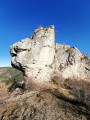
This route allows you to discover the unusual "Lion" that dominates Balsièges. From its rocky outcrop, it watches over the valley. The hiking trail that runs along the Ravin du Choizal and the slopes of the Causse de Sauveterre will take you to the village of Les Fonts.
Circular Route of the Douzes via the Pellalergues and Castèle ravines
 6.44 mi
+1,568 ft
-1,545 ft
4h 20
Moderate
Departure from Saint-Pierre-des-Tripiers (Lozère)
6.44 mi
+1,568 ft
-1,545 ft
4h 20
Moderate
Departure from Saint-Pierre-des-Tripiers (Lozère)
Starting from Les Douzes, a lovely (and short) hike through the “ravines” of Pellalergues on the way out, and La Castèle on the way back.
Best undertaken in dry weather (slippery ground, especially on the descent)
Montialoux Castle as seen from Rouffiac
 3.58 mi
+1,093 ft
-1,070 ft
2h 35
Moderate
Departure from Saint-Bauzile (Lozère) (Lozère)
3.58 mi
+1,093 ft
-1,070 ft
2h 35
Moderate
Departure from Saint-Bauzile (Lozère) (Lozère)
A walk to explore the ruins of Montialoux Castle through the Mende State Forest. The castle is situated in the commune of Saint-Bauzile, in Lozère, right in the heart of the Valdonnez valley, in the former province of Gévaudan. Please note: this short walk involves a significant elevation gain.
The troglodytic chapel and hermitage of San-Chaousou
 3.34 mi
+712 ft
-696 ft
2h 10
Moderate
Departure from Balsièges (Lozère)
3.34 mi
+712 ft
-696 ft
2h 10
Moderate
Departure from Balsièges (Lozère)
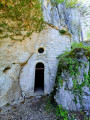
Discover the troglodytic chapel and hermitage of San-Chaousou (Saint-Joseph in the local dialect) on the slopes of the Causse de Changefège.
Circular route on the Causse Méjean from Galli
 6.95 mi
+581 ft
-591 ft
3h 40
Moderate
Departure from Vebron (Lozère)
6.95 mi
+581 ft
-591 ft
3h 40
Moderate
Departure from Vebron (Lozère)
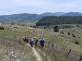
Starting from Galli, this is a lovely circular route on the Causse Méjean that passes through the beautiful setting of the charmingly restored Fretma farm. A short detour allows you to see the Berre reservoir, not to be confused with the lake of the same name.
Discover the Causse Méjean starting from the chaos of Nîmes le Vieux
 12.37 mi
+1,066 ft
-1,053 ft
6h 35
Difficult
Departure from Fraissinet-de-Fourques (Lozère)
12.37 mi
+1,066 ft
-1,053 ft
6h 35
Difficult
Departure from Fraissinet-de-Fourques (Lozère)
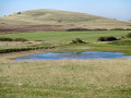
Starting from the hamlet of L'Hom, this hike first takes you to discover the endless spaces of the southern part of the Causse Méjean. Endless grassy and rocky hills, interspersed with cultivated plots and coniferous woods, allow you to take in the immensity of the landscape. It concludes with a visit to the discovery trail of the chaos of Nîmes le Vieux, bristling with hundreds of strangely shaped rocks sculpted by erosion. Informative panels are strategically placed along the trail to complement the experience. A beautiful day, punctuated by visits to the Causse hamlets of L'Hom, Le Veygalier and Villeuneuve, with their remarkable architecture.
From Liaucous to Églazines
 5.13 mi
+1,325 ft
-1,325 ft
3h 30
Moderate
Departure from Mostuéjouls (Aveyron)
5.13 mi
+1,325 ft
-1,325 ft
3h 30
Moderate
Departure from Mostuéjouls (Aveyron)
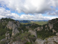
A beautiful hike along the edge of the Causse de Sauveterre, above the Tarn valley.
Hike modified on 17/05/2023. See practical information.
Author's note, July 2023: I redid this route (July 2023) and found it completely disrupted by a recent fire in the upper part of the route. A well-marked trail has been marked in yellow since this event. It deviates slightly from the original route in places but is easy to follow.