From Sainte-Enimie to La Malène

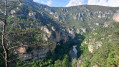
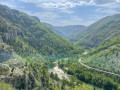
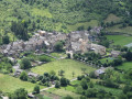
Stage 5 in the heart of the Gorges du Tarn via the Sentier des Gorges du Tarn (left bank) from Sainte-Enimie to La Malène, passing through the picturesque hamlet (with no road access) of Hauterives.

This walk is part of a multi-day hike: Entre Causse Méjean et Gorges du Tarn

Details

2207225
Creation:
Last update:
Last review:
  • Walking
    Activity: Walking
  • ↔
    Distance: 9.13 mi
  • ◔
    Average duration: 5h 30 
  • ▲
    Difficulty: Moderate

  • ⚐
    Back to start: No
  • ↗
    Ascent: + 1,483 ft
  • ↘
    Descent: - 1,572 ft

  • ▲
    Highest point: 1,818 ft
  • ▼
    Lowest point: 1,440 ft

Photos

Description of the walk

Start on the Route de Florac.

GR®60signposting (white and red)

(S) Return to the village via the Route du Front du Tarn. Turn left to cross the river via the road bridge. Continue along the Route de Meyrueis.

(1) Turn left onto Rue du Bassin, which runs alongside the main road on a balcony-like path.

Signposted: Sentier des Gorges du Tarn (Yellow and Green)

(2) At the Fork in the road, turn right onto the Sentier des Gorges du Tarn (ignore theGR® heading left). Rejoin the D986 road at the sign marking the entrance to the village. Cross the road a little further on and head down a path.

(3) At a house, turn left onto the path overlooking the river.

(4) At the next fork in the road, take the path on the right (leaving the Coperlac path on your left). Follow this path, which runs more or less parallel to the river and high above it, for about 3 km. Then descend via a series of hairpin bends to Saint-Chély-du-Tarn.

(5) Turn left onto the dead-end road leading to the village houses. At the end of the tarmac, take a sharp left-hand bend and you’ll reach a junction.

(6) Turn sharply right. Walk round a reservoir in the Ravin del Pous. Cross two streams in the Cirque de Saint-Chély and follow the contours of the Tarn along the cliff edge.

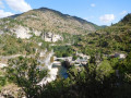
Head back down towards the riverbank (view of the cirque and the hamlet of Pougnadoires on the opposite bank). Climb up over a rocky outcrop, then descend through the beech trees. On the opposite bank, you’ll see the Château de la Caze (a luxury hotel). Carry on along the cliff edge through the pine woods, then out into the open until you reach a junction.

(7) Carry on straight ahead (passing aPR® sign on the left). You’ll arrive at Hauterives.

(8) Cross the hamlet and carry on to the scree ravine at a bend in the Tarn.

(9) Head down to the right into the gully until you reach the riverbank. Follow the river on your right-hand side.

(10) Following the collapse of the path, repair work was carried out in June 2019. To avoid a tricky section, the path now runs over a rock. Then go down a wooden staircase.

Continue for approximately 3 km along a fishermen’s path that runs alongside the river. You’ll come out onto the D43; follow it as far as a bridge.

End of the Tarn Gorges Trail

(11) Cross the river via the bridge. Enter La Malène and you’ll find the stopover lodge on the left (E).

Waypoints

  1. S : mi 0 - alt. 1,545 ft - Saint-Enimie – village - Tarn (rivère)
  2. 1 : mi 0.28 - alt. 1,558 ft - Rue du Bassin
  3. 2 : mi 0.44 - alt. 1,670 ft - Fork in the road
  4. 3 : mi 1.06 - alt. 1,601 ft - Gougoussac junction
  5. 4 : mi 1.4 - alt. 1,693 ft - Fork in the road
  6. 5 : mi 3.31 - alt. 1,555 ft - Saint-Chély-du-Tarn
  7. 6 : mi 3.49 - alt. 1,673 ft - Junction
  8. 7 : mi 6.73 - alt. 1,568 ft - Junction
  9. 8 : mi 6.84 - alt. 1,503 ft - Hauterives
  10. 9 : mi 7.16 - alt. 1,581 ft - Ravine – Junction
  11. 10 : mi 7.8 - alt. 1,512 ft - Bypass
  12. 11 : mi 9.03 - alt. 1,447 ft - La Malène Bridge
  13. E : mi 9.13 - alt. 1,480 ft - La Malène

Worth a visit

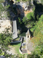
View of the Pougnadoires cirque and its semi-troglodyte houses on the left bank (Causse de Sauveterre)

Make the most of your stop in La Malène to visit this picturesque little village in the Gorges du Tarn.

Always be cautious and plan ahead when you're outdoors. Visorando and the author of this route cannot be held responsible for any accidents occurring on this route.

The GR® and PR® markings are the intellectual property of the Fédération Française de Randonnée Pédestre.

Reviews and comments

4.8 / 5
Based on 2 reviews

Reliability of the description
5 / 5
Ease of following the route
5 / 5
Route interest
4.5 / 5
Repos
Repos

Overall rating : 5 / 5

Date of your route : Sep 09, 2026
Reliability of the description : ★★★★★ Very good
Ease of following the route : ★★★★★ Very good
Route interest : ★★★★★ Very good
Very busy route : No

A lovely walk: well signposted, not very busy, with beautiful views. St Chely du Tarn is a lovely village and the only place from which you can access the River Tarn.

Machine-translated

Vaboha
Vaboha
• Edited:

Overall rating : 4.7 / 5

Date of your route : May 22, 2020
Reliability of the description : ★★★★★ Very good
Ease of following the route : ★★★★★ Very good
Route interest : ★★★★☆ Good
Very busy route : No

This route follows the “Sentier des Gorges du Tarn” trail, marked in yellow and green. It’s important to note that this isn’t a circular route, so you’ll either have to walk there and back, or return by bus, hitchhiking, or using a second vehicle left parked at the start. It’s a lovely route to do in its entirety if possible, but you can also shorten it by stopping off at St Chély du Tarn. If you can, make sure you pass through the hamlet of Hautes Rives – it’s magnificent! One last thing: you can only swim in the Tarn near St Chély du Tarn, as the path often runs high above the gorges....

Machine-translated

Other walks in the area

For more walks, use our search engine .

The GPS track and description are the property of this route's author. Please do not copy them without permission.