Around the Ravin du Valat de la Curée

This fairly demanding route, despite being only 8 km long, takes you along the edge of the Ravin du Valat de la Curée before returning via the hamlet of Les Balmes. A steep descent then follows to reach the site of the Chapelle Saint-Frézal, a picnic area to the south of the village of La Canourgue.
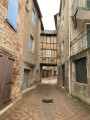
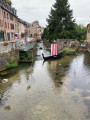
To extend the walk, a visit to this picturesque village – known as ‘the little Venice of Lozère’ – allows you to discover, as you wander through the old cobbled streets, a Renaissance house, the Place au Blé, with its medieval half-timbered house, the Place du Portal and the Clock Tower – a remnant of the old citadel – as well as many other sights, by following a route suggested by the tourist office.

Details

43329624
Creation:
Last update:
Last review:
  • Walking
    Activity: Walking
  • ↔
    Distance: 4.66 mi
  • ◔
    Average duration: 2h 55 
  • ▲
    Difficulty: Moderate

  • ⚐
    Back to start: Yes
  • ↗
    Ascent: + 876 ft
  • ↘
    Descent: - 869 ft

  • ▲
    Highest point: 2,677 ft
  • ▼
    Lowest point: 1,864 ft

Photos

Description of the walk

Access: from junction 40 on the A75, head for La Canourgue after Banassac-Canilhac. Drive through the village towards the Gorges du Tarn (D998) and, at the roundabout on the outskirts of the town, take the
second exit, Rue du Patus, towards the Saint-Frézal site.

La Canourgue – Car park under the trees on Rue du Patus (Square 19 Mars 1962).

(S/E) Walk along the square until you reach the junction with Rue Callongue. Without crossing the road bridge, turn left onto Rue Callongue and walk for 200 metres until you come to a signpost.

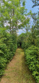
(1) Look out for a few steps on the right, where the Chemin de la Can begins. Climb steeply along the edge of the Valat de la Curée cliff. The gradient eases after 600 m. Pass through two small gates on the plateau and continue along a more comfortable path, under the canopy. After a left-right bend, join theGR® 60 at Plo de la Can

(2) Follow theGR® to the right along a very scenic path (pass through two wooden gates). Emerge onto a small road

Leave theGR® 60, which heads off to the left

(3) Take the Route des Balmes opposite. Walk through the hamlet and cross the start of the Valat de la Curée ravine. Follow a sweeping curve before reaching a small pass.

(4) Keep to the right, on the road that passes through Fraissinet, following a newPR® sign. Pass the farm on your left, then leave thePR® as it heads left towards Coustous. Continue for a further 650 m on the tarmac before finding a path on the left.

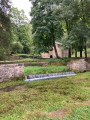
(5) Take the path on the left (marked with a blue line), which splits into two. Go through the gate on the left and follow the path down towards the Chapel of Saint-Frézal. Take care on this descent as it is very steep. Winding down through hairpin bends and steps, make your way down into the valley and reach the chapel. The developed site is ideal for a longer stop to enjoy this idyllic spot.

(6) Set off again towards the Lycée Louis Pasteur, then turn right onto the Allée de Saint-Frézal, which runs alongside the Urugne. At the crossroads, cross the Valat de la Curée before it joins the Urugne, then take the Rue du Patus to return to the car park under the trees on the Rue du Patus (Square 19 mars 1962) (S/E).

Waypoints

  1. S/E : mi 0 - alt. 1,867 ft - ::S/E:: La Canourgue – Car park, Rue du Patus - Urugne (rivière) - Affluent du Lot
  2. 1 : mi 0.16 - alt. 1,893 ft - Chemin de la Can on the right
  3. 2 : mi 1.04 - alt. 2,388 ft - Junction with the GR 60 and the Tour du Sauveterre
  4. 3 : mi 1.83 - alt. 2,667 ft - The trail emerges onto the road to Cadoule
  5. 4 : mi 2.62 - alt. 2,552 ft - Fraissinet – Petit Col
  6. 5 : mi 3.61 - alt. 2,241 ft - Path to the chapel on the left
  7. 6 : mi 4.34 - alt. 1,896 ft - Saint-Frézal site
  8. S/E : mi 4.66 - alt. 1,870 ft - ::S/E:: La Canourgue – Car park, Rue du Patus

Notes

A steep descent along a footpath with a few tricky sections for those prone to vertigo. Best avoided in wet weather (slippery rocks).

There is a picnic area at the Chapelle Saint-Frézal with several picnic tables.

Worth a visit

The Saint-Frézal Chapel
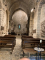
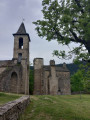
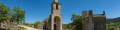
Tucked away in a small, shaded valley, cradled by the clear waters of a spring said to have miraculous properties, lies the Chapel of Saint-Frézal. The site is famous for having been the setting for many customs and events throughout the ages: initially a place of pagan worship, it was later Christianised; it was here that the famous Bishop Frézal carried his head after his nephew, driven by the devil, had severed it. The holy man was therefore buried here, where a chapel was built, restored and rebuilt over the centuries. Today, it is possible to enter the chapel in the summer or during guided tours of the village. Outside these periods, the entrance gate remains open but is protected by a grille.

La Canourgue
You simply must wander and linger amongst the village’s narrow cobbled streets, pass by the Clock Tower, stroll alongside the Urugne and Merderic streams, and walk through the vaulted passageways, and so on. A route, organised by the Tourist Office, allows you to experience all of this!

Always be cautious and plan ahead when you're outdoors. Visorando and the author of this route cannot be held responsible for any accidents occurring on this route.

The GR® and PR® markings are the intellectual property of the Fédération Française de Randonnée Pédestre.

Reviews and comments

4.5 / 5
Based on 2 reviews

Reliability of the description
4.5 / 5
Ease of following the route
4.5 / 5
Route interest
4.5 / 5
User 7403625

Overall rating : 4 / 5

Date of your route : Aug 04, 2025
Reliability of the description : ★★★★☆ Good
Ease of following the route : ★★★★☆ Good
Route interest : ★★★★☆ Good
Very busy route : No

Caution: the end of the trail is tricky above the chapel (not for those with a fear of heights as there is a steep drop below). Not recommended for young children.

Otherwise, it is a pleasant walk with beautiful panoramic views of Saint Genier d'Olt

Machine-translated

julien26
julien26

Overall rating : 5 / 5

Date of your route : Apr 28, 2025
Reliability of the description : ★★★★★ Very good
Ease of following the route : ★★★★★ Very good
Route interest : ★★★★★ Very good
Very busy route : No

First point: the walk is absolutely lovely. It’s short but offers some truly beautiful and varied scenery.
Easy to follow.
The very start is indeed very steep, but it levels out afterwards.
The only downside is the stretch of road between points 3 and 5, but it’s over quickly. And make sure you spot point 5 clearly – it’s just to the left of the road as you head downhill.

Machine-translated

Other walks in the area

For more walks, use our search engine .

The GPS track and description are the property of this route's author. Please do not copy them without permission.