From Mas-Saint-Chély to Les Vignes, above the Gorges du Tarn

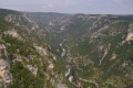
A long stage, culminating in the panoramic view of the Gorges du Tarn.

This walk is part of a multi-day hike: Tour du Causse Méjan

Details

83252
Creation:
Last update:
Last review:
  • Walking
    Activity: Walking
  • ↔
    Distance: 12.17 mi
  • ◔
    Average duration: 6h 20 
  • ▲
    Difficulty: Difficult

  • ⚐
    Back to start: No
  • ↗
    Ascent: + 807 ft
  • ↘
    Descent: - 2,602 ft

  • ▲
    Highest point: 3,182 ft
  • ▼
    Lowest point: 1,368 ft

Photos

Description of the walk

Starting from the hotel in Mas-Saint-Chély (southern exit of the village).

Red and yellow markings

(S) From the hotel, walk a few metres south, then turn right onto a path heading west. This path runs alongside a woodland and then descends steeply through a cleared area.

(1) Cross the D986 and, via a small road opposite, reach Anilhac.

(2) Continue west-south-west and take a path between low stone walls. The path descends gently before joining a wider track leading to Montignac.

(3) Walk through the village (with its beautiful old houses) and continue in the same direction along a small road. You’ll reach a junction with a main road (D43).

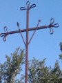
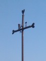
(4) Carry on straight ahead (west) along a road, which you’ll soon leave to take a track on the right. At a crossroads (marked by a ‘tooled’ cross), turn left and head for Rouveret.

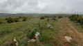
(5) Turn right at a right angle in the village and climb up a hill. The path then bends to the left and the gradient levels out. Following a pleasant route along the ‘ridge’ (with the first views of the Gorges du Tarn), you’ll reach the Col de Rieisse.

(6) Take a path to the right of the road, heading west. The path descends through woodland and then across open ground to Rieisse. Turn left shortly after entering the village.

(7) Continue westwards along the small road.

No signposting

(8) Turn right onto the small road leading down to Roc des Hourtous. Viewpoint (entrance fee; bar, light refreshments) overlooking the Gorges du Tarn.

(9) Retrace your steps.

Red and yellow signposting

(8) Turn sharply right. Walk through a more or less wooded area, join another path coming in from the left, and continue westwards. The path makes a wide circular loop to the right through the forest to go round a hill not named on the IGN map (an area known as ‘les Divises’). On leaving the forest, the slope becomes steeper.

(10) Turn right and pass by some ruined buildings. You’ll walk through a more or less wooded area once again, until you reach La Caxe (isolated houses).

Red and white markings

(11) Walk past the houses, heading west. Then begin the descent towards the Tarn valley. The slope is steep and the path winds down in numerous hairpin bends. At the top of the descent, you pass close to overhanging boulders, and the lower you go, the denser the woodland becomes. You’ll join the path that runs alongside the Tarn valley, coming from the right (north).

(12) Turn left and continue south-south-west. As you emerge from the woods, you’ll reach a small road leading to the Chapel of Saint-Préjet.

(13) Continue along the small road and head for the bridge over the Tarn. Cross this bridge to reach Les Vignes, on the opposite bank, the end of the stage (E).

Waypoints

  1. S : mi 0 - alt. 3,182 ft - Mas-Saint-Chély (Causse Méjan)
  2. 1 : mi 1.26 - alt. 2,740 ft - D986 road
  3. 2 : mi 1.75 - alt. 2,795 ft - Anilhac
  4. 3 : mi 2.74 - alt. 2,684 ft - Montignac
  5. 4 : mi 3.35 - alt. 2,657 ft - Junction of the D16 and D43
  6. 5 : mi 4.01 - alt. 2,743 ft - Rouveret
  7. 6 : mi 5.27 - alt. 3,100 ft - Col de Rieisse
  8. 7 : mi 6.4 - alt. 3,012 ft - Rieisse
  9. 8 : mi 6.65 - alt. 2,972 ft - Access to the Roc des Hourtous
  10. 9 : mi 6.91 - alt. 2,930 ft - Roc de Hourtous
  11. 10 : mi 9.29 - alt. 3,051 ft - Junction
  12. 11 : mi 10 - alt. 2,920 ft - La Caxe
  13. 12 : mi 10.84 - alt. 1,854 ft - GR6 junction
  14. 13 : mi 11.73 - alt. 1,463 ft - Église Saint-Préjet (Les Vignes)
  15. E : mi 12.17 - alt. 1,375 ft - Les Vignes – Bridge over the - Tarn (rivère)

Notes

Rieisse – Farmhouse sheep’s cheese.
Les Vignes – Hôtel-restaurant du Gévaudan: 04 66 48 81 55.

(7) Off the main route – On the right (signposted), a path leads to the Roc du Serre, which offers a view of the Gorges du Tarn. Allow a good half an hour for the round trip.

Hike undertaken by the author on 3 August 2013.

Worth a visit

Beautiful old houses in Montignac (3).

‘Decorated’ crosses (see photo) between the D43 (4) and Rouveret (5).

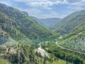
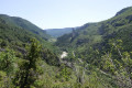
Stunning views over the Gorges du Tarn:
- As you approach the Col de Rieisse (6).
- At the Roc de Serre (not part of the hike) (7).
- At the Roc de Hourtoux (entry fee applies, not part of the hike) (8).

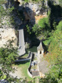
Saint-Préjet Chapel (13).

Reviews and comments

4.4 / 5
Based on 3 reviews

Reliability of the description
3.7 / 5
Ease of following the route
4.7 / 5
Route interest
5 / 5
Netra
Netra ★

Hello paga81, and thank you for your comments.

I do have one question, though:

  • The walk isn’t classified as ‘Moderate’ in the description, but as ‘Difficult’ (see the details).
  • I have a very clear memory of this section and I can’t see how it could involve a very difficult 1½-hour climb with gradients of 15 per cent!!!! given that the total elevation gain is only 251m (see the details).

The difficulty of this walk lies in the long, steep descent between the points (10) and (11).

So are these comments actually intended for this particular walk, or for another one?...

Machine-translated

paga81
paga81

Overall rating : 4.3 / 5

Date of your route : Jun 10, 2019
Reliability of the description : ★★★☆☆ Average
Ease of following the route : ★★★★★ Very good
Route interest : ★★★★★ Very good

The walk is described as ‘moderate’ in the description. Not true at all – a very difficult climb lasting 1 hour 30 minutes with gradients of
15 per cent!!!!
Even the staff at the hotel confirmed how difficult it was. It’s a shame – you really need to be a seasoned hiker to tackle this route.

Machine-translated

Joëlle C1.
Joëlle C1.

Overall rating : 4.3 / 5

Date of your route : Sep 15, 2018
Reliability of the description : ★★★★☆ Good
Ease of following the route : ★★★★☆ Good
Route interest : ★★★★★ Very good

Hello
Please note point 9
There are only RED and YELLOW markings – no sign of the GR

Otherwise, a superb and very varied stage

Machine-translated

chameziaux
chameziaux

Overall rating : 4.7 / 5

Date of your route : May 18, 2018
Reliability of the description : ★★★★☆ Good
Ease of following the route : ★★★★★ Very good
Route interest : ★★★★★ Very good

Point 9 is poorly described; it reads:
‘Turn right’, which directs the walker onto the path on the right.
On the ground, you need to veer to the right whilst taking an uphill path whose start is not very visible.
Finally, you must follow the red/yellow markings of the GR de Pays.

Machine-translated

Other walks in the area

For more walks, use our search engine .

The GPS track and description are the property of this route's author. Please do not copy them without permission.