Country:

 City:
City:


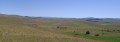
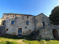
Start from the La Viale stopover lodge, a hamlet situated about 1 km south of the village of Saint-Pierre-des-Tripiers.
Red and white markings
(S) At the end of the street leading to the stopover lodge, take the road on the right. Continue northwards along a path skirting meadows and then through woodland. You’ll reach a road as you approach the village of Saint-Pierre-des-Tripiers.
(1) Do not enter the village; instead, turn right at a right angle onto a path that descends, first gently through meadows and then more steeply through the forest. After a sharp bend to the left, you’ll reach a track.
(2) Turn right (south-east) and continue down the gentle slope.
(3) At a fork in the path, about 300 metres further on, leave the track and take a narrower path on the left. Cross a small valley and, at another fork, take the path on the left. Continue along the hillside, heading south then east. You will reach the hamlet of Les Bastides.
(4) Take a small road. Cross a main road (D63) and follow a path that climbs through the forest, heading south-east. The path continues to climb, turns due east, and emerges from the forest. Carry on climbing, heading south-east, until you reach a pass from which you can see the village of Hyelzas. Continue in the same direction (south-east) until you reach the village, which you then walk through.
(5) At the cheese dairy (sign), take the track that branches off to the right along the edge of the pastures. The track runs roughly along the hillside and makes a wide circular loop to go round the Serre du Bouyssou.
(6) At a place called Les Horts (scattered houses), the track splits into two branches: take the left-hand one, which climbs up to Les Herans. Walk through the hamlet and continue along the road, heading north, then north-east towards the Aven Armand site.
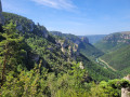
(7) Continue along the road and you will very quickly reach a pass offering sweeping views over the Causse. Look out for a small dolmen (the Tombe du Géant).
(8) Carry on along the road and, after barely 100 metres, turn onto a path branching off to the right. The path winds through meadows, heading more or less constantly south-east, and crosses several tracks or roads.
(9) Walk alongside a copse, which is one of the few shaded spots on this part of the route. Continue south-east. Take a small road for about 200 metres, then a wide track running alongside pastures. Join another track coming from the left and, very soon afterwards, reach the Croix de la Croisette.
(10) Continue south-east, then due south, ignoring the paths branching off to the left.
(11) At a fork, take the path on the right, which descends steeply towards the valley. After two hairpin bends, continue downwards until you reach a small road.
(12) Cross the road and take the path branching off to the right, which runs below the road for a while. Pass some old ruined buildings and reach a main road (the D986).
(13) Take this road to the left. At a roundabout, continue roughly straight ahead (towards Fraissinet-de-Fourques, Florac). The stopover lodge is on the left about a hundred metres further on (E).

 Tourist office
 Easy
Easy  Association / Club / Walk leader
 Moderate
  Visorando Member