Country:

 City:




Set off from the hotel, which is situated on the right bank, opposite the town centre and 900 metres from the Sainte-Énimie bridge.
(S) Return to Sainte-Énimie via the Gorges road and pass through the road tunnel carved into the cliff face. Cross the bridge to reach the left bank and take the road uphill to the left, which bends in front of the stone cross.
GR® red and white markings – Tarn Gorges Trail
(1) Follow the track, which narrows as it curves southwards before becoming a footpath. Pass anotherGR® path on the left which climbs up onto the Causse, and eventually join the D986. Follow it to the left for about 150 m.
(2) Cross the road carefully to take a track leading down to the right. The track runs through the middle of the meadows, offering a sweeping view of the River Tarn flowing to the right. Continue through the meadows. Pass a track leading to a house on the right and continue south-west, parallel to the river.
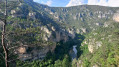
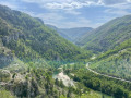
(3) At a fork in the road, take the right-hand path, towards the river. The path then climbs gently to skirt the first cliffs that frame the meandering Tarn. After about 4 km, a bend reveals the village of St-Chely-du-Tarn below. The path then winds down to the first street in the village.
(4) Follow the street to the left. After the last houses, the road gives way to a path. Pass a path on your left and continue along the one that winds into the cirque, crossing two streams. The path winds around the rocks of the cirque then descends steeply to the water’s edge through very lush greenery. Further on, the path climbs between the boulders, curving westwards round the cirque. At the next bend, you can see the Château de la Caze on the opposite bank. The path runs along a ledge through the undergrowth and rocks, following the River Tarn south-west.
(5) About 200 m before the hamlet of Hauterives, leave a signposted path on your right which climbs towards Anilhac. Walk through the hamlet of Hauterives with its houses featuring heavy slate roofs and stone walls, many of which have been restored. On the right, a metal cable links the hamlet to the opposite bank next to a jetty.
(6) The path leaves the village along low stone walls heading south, just a stone’s throw from the Tarn. It reaches a fairly steep valley floor which you must cross to climb up, moving slightly away from the bank of the Tarn and turning due west.
(7) This bend in the river skirts around cliffs which the path will follow alongside. From this point, the path winds up and down the cliff face and has been very well laid out, with handrails in the steep sections. It ends with a wooden staircase to complete the descent.
(8) Continue south-west along the path through the woodland, which runs as close as possible to the left bank for a further 2 km, until you reach the dam and the rapids upstream of La Malène. The path finally joins the road marking the entrance to La Malène and leads you to the bridge.
(9) Carry on straight ahead (do not cross the bridge). Follow theGR® signposting and take a bridle path along the riverbank. After about 300 m, at a Fork in the road, keep to the right (ignore the path on the left marked in yellow). Continue along the path beside the river for about 3 km.
(10) Take a path that climbs to the left towards Les Vignes. The climb is long, through trees and shrubs, and therefore often in the shade. Unobstructed views of the river and its canyon are limited. After 2 km along the cliff ledge, the path descends along a valley floor and leads to a junction.
(11) Turn left onto theGR® (do not follow the path on the right, which is closer to the river). You’ll emerge into a clearing (signpost). Turn left onto a path towards Les Vignes and head away from the hamlet of La Croze. Continue along the cliff edge and through the woodland towards the north-west. Further on, the path curves to follow the meandering course of the Tarn. You’ll reach a viewpoint overlooking the village of Les Vignes.
(12) Head south, following the river. Descend along the winding path.
(13) At the next junction, turn right and go round a valley. Descend to reach the hamlet of Ménial.
(14) Pass through Le Ménial and continue downhill along a small road.
(15) Walk past the Saint-Préjet cemetery and continue along the road to the bridge. Cross the bridge over the Tarn and arrive at Les Vignes (E).


 Visorando Member
 Easy
 Moderate
 Difficult
 Association / Club / Walk leader