Country:

 City:
City:


Park in the large Gravière car park, on the banks of the Tarn.
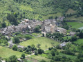
(S/E) With your back to the river, head up the street on the left-hand (west) side of the car park until you reach a junction a few metres away. Cross the street, then cross the Route de Mende to the left to take the paved slanting street leading down to the banks of the Burle. Follow the path, cross the footbridge, walk round the spring basin and pass under the Passage de Burle (beneath the town hall, information board, video). Climb the steps on the left to reach the Route de Mende; cross it and head towards the church.
(1) Walk past the church on the left and turn left at the hairpin bend to climb the paved slanting street, then the steps under the archway. You’ll come out at Place du Plô. Turn left for a round trip to Place de l’Ancienne Abbaye (ruins of the abbey, now converted into a secondary school). Return to Place du Plô and continue straight ahead.
(2) At the end of the square, turn right onto Rue du Serre. Immediately afterwards, take a return trip to the right along Rue de la Privadenche, then continue along Rue du Serre to reach a small square where the Halle au Blé is located. Turn right to reach Place au Beurre and continue on to Place du Presbytère. Then turn left onto Rue de la Volte.
(3) At the T-junction, turn left onto Rue Basse, then, for a short detour, turn left immediately, passing under an archway, to reach Place aux Oules (tools). Back on Rue Basse, continue left to reach Rue de la Combe. Turn left and walk as far as Maison Déromieux.
(4) Retrace your steps, then keep heading in the same direction to return to the Gravière car park on the east side. Take a return walk to the left along the River Tarn, then head back to the car park (S/E).
 Visorando Member
 Moderate
 Difficult
  Association / Club / Walk leader