Circular walk around the abandoned hamlet of Les Paillers

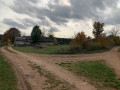
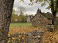
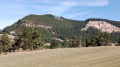
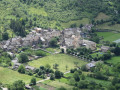
On the Causse de Sauveterre, a short walk to a hamlet, Les Paillers, which, like many villages on this plateau, was long completely abandoned by its inhabitants.
Today, several houses are coming back to life.

Details

n°4254282
Creation:
Last update:
Last review:
  • Walking
    Activity: Walking
  • ↔
    Distance: 1.36 mi
  • ◔
    Average duration: 0h 40 
  • ▲
    Difficulty: Easy

  • ⚐
    Back to start: Yes
  • ↗
    Ascent: + 23 ft
  • ↘
    Descent: - 23 ft

  • ▲
    Highest point: 3,035 ft
  • ▼
    Lowest point: 3,002 ft

Photos

Description of the walk

To reach the starting point from Mende, head towards the Gorges du Tarn and Sainte-Énimie: take the N88 to Balsièges, then take the N106 before crossing the bridge on the right (D986); signs for Sainte-Énimie are clearly marked.
Drive up to the fortified farm of Le Choizal and turn right onto the D31 towards Chanac.
It is easy to leave your car at the starting point, which is on the right-hand side of the road just past a copse, about 1.5 km from the junction.

(S/E) Follow the track that leads across the Causse to reach the hamlet of Les Paillers.
Walk through the hamlet and you’ll soon come to a crossroads with a water tank (see § During the walk).

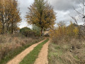
(1) Turn left onto the path, walk almost in a straight line and skirt a woodland before rejoining the D31 road.

(2) Turn left onto it and, a few hundred metres further on, you’ll reach the car park where you started (S/E).


Waypoints

  1. S/E : mi 0 - alt. 3,025 ft - Car park at the junction of the road and the track
  2. 1 : mi 0.57 - alt. 3,018 ft - Les Paillers, cistern
  3. 2 : mi 1.04 - alt. 3,035 ft - D31 junction
  4. S/E : mi 1.36 - alt. 3,025 ft - Car park at the junction of the road and the track

Notes

Depending on your mobile network provider, the area has 3G/4G coverage.
However, if you stray a little from the route, it is advisable to download the map.

Worth a visit

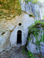
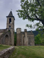
The suggested route takes you through the hamlet, where you’ll find examples of the typical architecture of the Causse.
You’ll easily spot the communal oven there.
And you’ll be able to imagine the life led by the inhabitants of this hamlet at the start of the 20th century:
- with no means of transport,
- with no other source of water apart from rainwater collected in cisterns – some of which can still be seen, built against the houses,
- living mainly off what they could grow in the surrounding fields,
- of course, with no electricity or internet, and making regular trips to the markets in Mende, which took about four hours’ walk.

With Visorando active, you might fancy extending your walk. You’ll see other trails, most of which take you back to the D31, a few hundred metres from your starting point.

Reviews and comments

4 / 5
Based on 2 reviews

Reliability of the description
3 / 5
Ease of following the route
5 / 5
Route interest
4 / 5
eric76
eric76

Overall rating : 4 / 5

Date of your route : Sep 28, 2024
Reliability of the description : Not used / Not applicable
Ease of following the route : ★★★★★ Very good
Route interest : ★★★☆☆ Average
Very busy route : No

Hello
This hamlet is inhabited; I don’t know if it’s been that way for a long time. It was a bit of a shame, as I didn’t linger as long as I would have liked to enjoy the place.

Machine-translated

pastelindigo
pastelindigo

Overall rating : 4.3 / 5

Date of your route : May 21, 2021
Reliability of the description : ★★★☆☆ Average
Ease of following the route : ★★★★★ Very good
Route interest : ★★★★★ Very good
Very busy route : No

A lovely circular route around this timeless hamlet

Machine-translated

Other walks in the area

For more walks, use our search engine .

The GPS track and description are the property of this route's author. Please do not copy them without permission.