Country:

 City:
City:


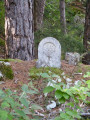
Park at the Col de Coperlac, which can be reached via the D986 linking Sainte-Énimie and Meyrueis: parking is easy with several spaces available.
Trail No. 34 is very sparsely signposted
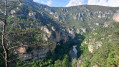
(S/E) Take the path indicated by an old wooden sign bearing the half-faded inscription ‘Saint-Chély’. Now a footpath, it begins a steady descent, takes a hairpin bend to the right and continues along a ledge, offering fine views of Saint-Chély-du-Tarn and its river bend. After another hairpin bend, this time to the left, you’ll reach a junction marked by a signpost.
Signposting: GR® white and red + PR® yellow
(1) Continue to the right, descending gently. You’ll reach the first houses in the village; look out for the start of the path on the right, which you’ll take later to continue the walk.
No signposting
(2) Turn left and cross the square, which serves as a car park. Admire the old bread oven on the left and, on the right, the beautiful Romanesque church of Notre-Dame de l’Assomption, which unfortunately is not open to visitors. Carry on across the single-arched bridge spanning the Tarn. Enjoy the breathtaking view of the village, the river with its emerald-coloured waters, and the two springs further downstream forming waterfalls.
(3) Turn back and walk up the single street to reach the start of the path you spotted earlier (signpost).
GR® white and red markings
(2) Turn left onto the narrow, stony path towards Sainte-Énimie. Navigate a series of fairly steep hairpin bends. Further on, follow the contour line as you walk along the Tarn at a higher elevation. Continue to the junction marked by a wooden post bearing a GR® marker.
No signposting
(4) Leave the signposting and turn right onto a narrow path heading in the opposite direction. Although somewhat overgrown at the start, the track then becomes much clearer and climbs steadily up to the D986.
(5) Cross the road carefully and turn right to follow the road, keeping to the left-hand side of the carriageway. Continue for about a hundred metres, then turn off onto a path rising to the left. The ensuing climb alternates between long, more or less straight sections and tight hairpin bends, allowing you to gain altitude more quickly.
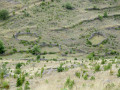
(6) Cross the Ravin de la Fage, pass through a scorched area (2021 fires) and emerge from the undergrowth onto a large cleared area where the terrain has been damaged by forestry work. You’ll reach a fork in the path at a very long pile of logs (as of September 2023) at an elevation of 925.
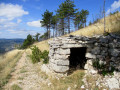
(7) Continue uphill to the left, leaving the logs on your right. Pass a drystone shelter in good condition and follow the double-track path to a narrow tarmac road.
(8) Follow this road to the right and, at the Fork in the road that appears shortly afterwards, turn right. Ignore a path on the right blocked by a metal gate and continue to the next junction.
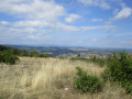
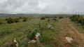
(9) Turn right onto the wide, partly grassy path which runs alongside a metal fence and continues to the left, skirting it to reach Mont Servy, whose summit is a little difficult to make out on the large grassy ridge . The 360° panorama is remarkable. To the north, the Causse de Sauveterre and its many small wooded peaks; to the south, the Causse Méjean with, in the foreground, the village of Mas Saint-Chely, where the church spire can be seen behind a curtain of conifers; to the south-east, the deep gorge of the Gorges du Tarn, from which the cliffs on the right bank emerge.
(10) Resume the route by continuing westwards along the path, the trail of which becomes less distinct on the ground. The path then turns south.
(11) Further down the descent, ignore two paths on the right in succession, both of which end in dead ends, and continue towards the road leading to Mas-Saint-Chely. Go through the metal gate in a fence and reach the road.
(12) Turn right to walk alongside the road and use the left-hand verge to avoid long stretches of tarmac. Pass a beautiful stone building on your right, topped with a very fine slate roof, and reach the Stop sign at the junction with the D986 at the Col de Coperlac. Cross carefully and head for the car park situated about a hundred metres further on to the right (S/E).

 Visorando Member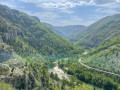

 Difficult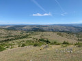
 Very difficult
  Association / Club / Walk leader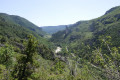
 Easy
Easy