Country:

 City:
City:



Park in the car park at the church in Saint-Chély du Tarn.
(S/E) Walk up the main square towards the cliff and take the small road that serves the houses at the bottom of the village. It continues along a stony path that starts on the slope after a hairpin bend.
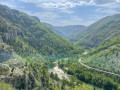
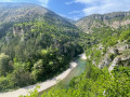
(1) After a few dozen metres, take the fork on the right towards the Gorges du Tarn trail (towards La Malène). This path runs along a balcony above the bottom of the Saint-Chély cirque and offers magnificent views of the village, the Tarn and the bridge that crosses it.
Continue along the trail to Hauterive. It winds its way along the foot of the cliffs without any difficulty, sometimes climbing over a few rocks before returning to the water's edge further on. It also offers beautiful views of the villages and houses on the other side of the river, notably the Château de la Caze, which must have been difficult to escape when crossing the gorges.
(2) Continue along the right bank of the Tarn until you reach a fork.
(3) Turn right to descend towards the village. This hamlet of about fifteen houses no longer has any permanent inhabitants due to the lack of a nearby water source.
Retrace your steps and, at the fork, turn right towards Anilhac. The slope immediately becomes steep. You will reach the hamlet of Castellos.
(4) Continue climbing beneath the ruins of the old castle. A series of hairpin bends begins as soon as you enter the shade of the first trees, softening the roughness of the path until you reach the plateau.
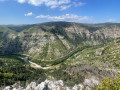
Enjoy the magnificent views from this trail over the Tarn, the two villages and the old castle, and, as you climb, over the Causse de Sauveterre on the other side of the valley.
As you approach the causse, the path turns sharply to the left. At this bend, a trail branches off to the right, through a hedge of boxwood and oak trees, leading to the Couronne viewpoint above the gorges. Don't miss it!
(5) Retrace your steps and continue along the path opposite until you reach the village of Anilhac.
(6) Cross the hamlet, turning left at the crossroads in the centre onto theGRP® du Tour du Causse Méjean marked in red and yellow. This stony path leads to the RD 986, which you must cross. Shortly afterwards, you will come to another crossroads.
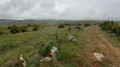
(7) Leave theGRP® towards Mas-Saint-Chély and turn left onto the Lozère drovers' road to reach the hamlet of Caussignac.
Cross the village and turn right just before the farm, onto a small path lined with low walls. This old drovers' road is a reminder of a time when communication routes did not encroach on farmland. It runs parallel to the departmental road until you reach the Col de Coperlac. Reach this pass by turning left when you reach the small road that leads to Mas-Saint-Chély.
(8) Cross the RD and take the path that branches off to the right, on the left side of the valley. This path descends to the Cirque de Saint-Chély, and the trail follows it in a large, gentle loop to the village. After the sharp bend, you will reach the viewpoint overlooking the village of Pougnadoires opposite.
(9) Continue parallel to but higher up than the right bank of the Tarn to return to the initial crossroads.
(1) Return to the car park where you started (S/E) by following the same route as on the way there.



 . The only downside was the traffic noise. Thank you for the route

 Visorando Member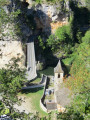

 Difficult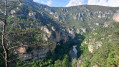
 Very difficult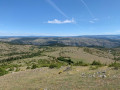
 Easy
Easy 
 Association / Club / Walk leader