Balcon du Tarn via the Gaupillat path

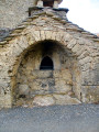
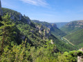
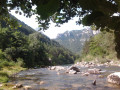
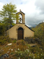
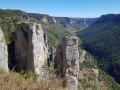
A superb walk along the left bank of the Gorges du Tarn. The Gaupillat path, which is little-used and unspoilt, first crosses the Pas de l’Arc, then continues along the hillside to lead to the foot of the Cinglegros, the region’s iconic rock. The real frustration of no longer being able to climb the ladders leading to the summit – following an indefinite ban – is, however, offset by the climb up the Pas des Trois Fondus. The numerous rungs set into the rock and the three metal ladders to be scaled quickly get the adrenaline pumping and add a very challenging element to the route. The return journey is a leisurely one along the Martel path, passing close to the last point of interest encountered, the Baousso del Biel, another natural arch of remarkable size. Once back in La Bourgarie, you can take the time to admire the Causse architecture of this tiny, timeless hamlet, where the stone buildings are very well preserved. 

Details

75966824
Creation:
Last update:
Last review:
  • Walking
    Activity: Walking
  • ↔
    Distance: 4.56 mi
  • ◔
    Average duration: 3h 45 
  • ▲
    Difficulty: Difficult

  • ⚐
    Back to start: Yes
  • ↗
    Ascent: + 1,923 ft
  • ↘
    Descent: - 1,932 ft

  • ▲
    Highest point: 2,825 ft
  • ▼
    Lowest point: 1,955 ft

Photos

Description of the walk

Reach the Causse hamlet of La Bourgarie via the very narrow tarmac road that branches off to the right or left of the D16, depending on which direction you’re coming from. It’s very difficult for vehicles to pass each other along this stretch, so you must drive carefully. Once you arrive, park in the small car park signposted on the left: motorhomes are not permitted. 

Yellow PR® signposts

(S/E) Leave the car park heading towards the houses, then turn left, walk past the lodge and continue to the end of the tarmac road, where there is a signpost indicating, amongst other things, the Cinglegros. Turn right onto the grassy path, which quickly becomes stony and descends diagonally, partly through the woodland. You’ll reach the junction marking the start of the Gaupillat path, which is not signposted on the ground.

No signposting

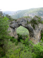
(1) Take the path on the right towards the Yellow Cross and the sign indicating that you are on private property but that passage is permitted; take care not to leave the path. Descend steeply along a series of hairpin bends before reaching the Pas de l’Arc, a magnificent natural arch carved into the rock by erosion. 

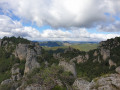
(2) Pass through this magnificent arch, then continue down the path, which becomes somewhat indistinct for a few metres before becoming clearer again and veering sharply to the left as it runs along the hillside. The route then winds its way beneath pine and deciduous trees, more or less following the contour lines, whilst skirting the base of the impressive cliffs. Take care of the rocks and roots, which can easily cause you to lose your footing on this very little-used and therefore poorly maintained – or indeed unmaintained – path. Numerous unsecured viewing points offer breathtaking views of the Gorges du Tarn, both upstream and downstream. Reach the level of Combe Rousse and come to a junction marked by a sign indicating that you are entering a protected natural area. 

(3) Keep to the path which continues to the right and walk for about a hundred metres to reach a junction that is easy to miss. 

(4) It is very tempting to carry on straight towards the Tarn and the hamlet of La Sablière without paying attention to the path that starts on the left, marked by a single small rock serving as a cairn. So take the Sentier Gaupillat on the left, which becomes more rugged, with a succession of small rocky sections, both uphill and downhill, which can sometimes be tricky to navigate. Furthermore, the vegetation is taking over again and you often have to crouch down to squeeze through the branches of the shrubs lining the path, which is sometimes barely visible. You’ll reach a junction at the foot of a rock face, where it is difficult to find your bearings on the ground, especiallyearly in the season. 

(5) To the left, a fairly easy climbing section about 3 to 4 metres high, leading to the foot of the cliff face, seems to offer a way to continue the route. This is not the case, however, as you must continue straight on through the tall grass,which completely obscures the path for a good ten metres: any tracks left by previous walkers will be a great help here. Then continue along the path, which becomes clearer again, until you reach a junction easily recognisable by the old pine trunk on the ground that partially blocks access. 

(6) Head left and tackle the very steep and gruelling climb leading to the foot of the Cinglegros, where a sign indicates that you are entering a quiet zone for small animals. Ignore the path on the right leading there, as access to the ladders used to reach the summit is currently prohibited. Carry on straight ahead and climb up to the foot of the Pas des Trois Fondus, which isthe most challenging and difficult section of the walk.

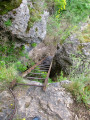
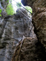
(7) A series of metal rungs set into the rock enables you to cross this very steep rocky section, leading to the two ladders you must climb;the second of these, spanning the void for a few metres, is the most impressive and requires the utmost caution. There are then a few more metal rungs, followed by a final ladder, before continuing along the very steep path which quickly leads to the signposted Martel trail, which we had left behind when setting off from La Bourgarie. 

Yellow PR® markings

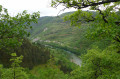
(8) Turn left. The balcony-like path allows you to recover fromthe previous exertionswhilst offering splendid views over the Tarn valley. A few short uphill or downhill sections require you to use your hands. Continue to a crossroads. 

(9) Ignore the path on the left, which runs flat and where a Yellow Cross advises against continuing in that direction. Take the path on the right for a very steep climb of a few dozen metres before reaching a flatter, easier section. 

(10) It is difficult to spot the very narrow, steeply descending path here which leads off to the left towards the Baousso del Biel, a magnificent rock arch far more imposing than the Pas de l’Arc, standing 40 metres high – 25 metres of which are under the arch – and 25 metres wide. However, it is best to stickto the signposted path so thatyou can enjoy several breathtaking views of this natural wonder as you look back. Continue on to reach the start of the Gaupillat path. 

(1) Head straight on, in the opposite direction to the way you came, to return to the hamlet of La Bourgarie and the car park at the start (S/E). 

Waypoints

  1. S/E : mi 0 - alt. 2,818 ft - La Bourgarie, car park
  2. 1 : mi 0.49 - alt. 2,585 ft - Crossroads on the circular loop
  3. 2 : mi 0.63 - alt. 2,297 ft - Pas de l’Arc
  4. 3 : mi 1.19 - alt. 2,024 ft - Junction, signpost, turn right
  5. 4 : mi 1.27 - alt. 2,008 ft - Small cairn, turn left at the fork
  6. 5 : mi 2.06 - alt. 2,418 ft - Tricky section
  7. 6 : mi 2.17 - alt. 2,037 ft - Turn left. Junction towards - La Cinglegros
  8. 7 : mi 2.28 - alt. 2,369 ft - Pas des Trois Fondus
  9. 8 : mi 2.32 - alt. 2,556 ft - Junction with the Martel path
  10. 9 : mi 3.33 - alt. 2,503 ft - Path junction, turn right
  11. 10 : mi 3.74 - alt. 2,569 ft - Baousso del Biel Trail
  12. S/E : mi 4.56 - alt. 2,818 ft - La Bourgarie, car park

Notes

The automatically calculated duration is an underestimate and does not take the terrain into account. You should allow a good 4 hours 45 minutes to complete this route at a reasonable pace. 

Despite its modest distance, this walk should not be taken lightly due to the sometimes difficult terrain, the elevation gain and the passage over the Pas des Trois Fondus, which people prone to vertigo must absolutely avoid. Similarly, bringing children along is strongly discouraged. 

(7) Pas des Trois Fondus: a series of metal rungs embedded in the rock on a very steep face. This is followed by two ladders, the first of which is leaning against the rock, whilst the secondspans the void completely. Thissection should only be attempted in dry weather, as the rungs and ladders become dangerously slippery when wet. 

(5) The route remains tricky early in the season as the path disappears for about ten metres. Eventually, the grass trampled by any previous walkers provides a very useful clue to help you avoid getting lost amongst the dwarf hazel bushes. Under no circumstances should you climb the small rock step on the left, which leads to the rock face and ends in a dead end. 

There is a drinking water tap on the right as you pass through the hamlet. 

Hiking boots are recommended due to the rocky and sometimes somewhat uneven terrain of the Gaupillat path. Walking poles are not really advisable because of the vegetation and the need to negotiate rungs and ladders. 

Worth a visit

Always be cautious and plan ahead when you're outdoors. Visorando and the author of this route cannot be held responsible for any accidents occurring on this route.

The GR® and PR® markings are the intellectual property of the Fédération Française de Randonnée Pédestre.

Reviews and comments

4.3 / 5
Based on 3 reviews

Reliability of the description
4.3 / 5
Ease of following the route
3.7 / 5
Route interest
5 / 5
jeep5354
jeep5354

Overall rating : 4 / 5

Date of your route : Sep 03, 2026
Reliability of the description : ★★★★☆ Good
Ease of following the route : ★★★☆☆ Average
Route interest : ★★★★★ Very good
Very busy route : No

It’s a shame this route isn’t maintained. Make sure you wear long trousers to avoid getting scratched – something we hadn’t done. If you don’t suffer from vertigo, the ladders are a piece of cake; the main worry is not taking a wrong turn on the path. We completed it in 4 hours and 45 minutes. A really lovely hike.

Machine-translated

Pyla33
Pyla33

Hello,
Thank you for your walk. As a guide in the Basque Country, I’m planning a multi-day hike and would like to draw on your expertise to find out whether the path that starts at point 4 on your walk and heads down to La Sablière is accessible by car?
Thank you for your advice. Kind regards,

Machine-translated

User 29905298

Overall rating : 4.7 / 5

Date of your route : Jul 13, 2026
Reliability of the description : ★★★★★ Very good
Ease of following the route : ★★★★☆ Good
Route interest : ★★★★★ Very good
Very busy route : No

A really lovely route – make sure you follow the signposts carefully, as it’s easy to get lost at some junctions
Make sure you take plenty of water with you!

Machine-translated

cecileetflo
cecileetflo

Overall rating : 4.3 / 5

Date of your route : Apr 11, 2026
Reliability of the description : ★★★★☆ Good
Ease of following the route : ★★★★☆ Good
Route interest : ★★★★★ Very good
Very busy route : No

A magnificent hike with stunning views of the Tarn and the vultures nesting on the high cliffs.
Be careful just before point no. 3: do not go down to the right along a path that looks well-trodden. The correct path climbs slightly to the left. For the rest of the walk, the directions are straightforward.
You mustn’t be afraid of heights, as to complete the circular route you have to climb ladders over the drop.

Machine-translated

Other walks in the area

For more walks, use our search engine .

The GPS track and description are the property of this route's author. Please do not copy them without permission.