Country:

 City:
City:


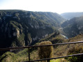
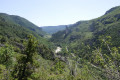
On arrival at Saint-Georges-de-Lévéjac, head towards the village centre and the church. Park in the car park next to the church.
Signposting: GR®6 (white and red) + PR® (yellow)
(S/E) Turn your back on the church and set off down a narrow street between the houses, following the dual signposting. At the end of the street, turn right onto a grassy path marked by an old wooden sign and continue on level ground until you reach a junction marked by a beautiful wayside cross. Keep to the left, join the tarmac road and walk alongside it for about twenty metres without crossing it.
Yellow PR® signposting
(1) Turn left onto a wide, stony path that winds lazily, offering lovely views of the village of Soulages on your right. After passing a first path on the left and then a second on the right, you’ll reach a large crossroads.
(2) Turn right, continue along the wide track and rejoin the tarmac road at the first farm.
No signposting
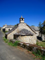
Let the PR® trail head off to the left and head towards the centre of the village. Pass an old chapel on your right with a very elegant bell tower and reach a small square where a beautiful cross stands.
(3) Turn diagonally right to follow a small cobbled street that winds its way between some very beautiful Causse-style houses. You’ll emerge at the junction with Rue de la Chapelle just after the village’s communal oven, which you can’t miss on the left. Turn right, pass a very beautiful stone cross and leave the village to reach the three-way junction just beyond the last houses.
(4) Turn right at the fork, pass another cross perched high on the embankment to the left, then veer left onto a wide path that is half earth, half gravel.
Yellow PR® markings in the opposite direction.
This path curves widely to the right and meets the D46 at the enchanting Les Fonts picnic site where, as its name suggests, a spring flows. Continue to the departmental road.
(5) Cross with care and follow the road opposite leading to the hamlet of Les Fonts as far as a bend marked by a wayside cross. Leave the road and take a grassy path that starts on the right and winds its way round a few meadows and houses.
(6) At the junction, turn left, head towards the tiny square (cross) and turn right. Further up, continue to the right to leave the hamlet and head to the last house (no. 215).
(7) A large yellow arrow on the ground indicates the turn to the left, which is not very obvious. The lovely path, lined with healthy boxwood, begins a steep climb through a pine forest before levelling out as it reaches a vast meadow. Enter the woodland again and reach a three-way junction.
(8) Keep to the right and continue the climb. Go round the Serre Méjo on the right, then follow the path almost along the contour line until you reach a wider track.
(9) Keep heading in the same direction along this path leading to the tiny hamlet of Serres, where you’ll rejoin the tarmac road. Pass a large farm shed and continue to the right until you reach the last house.
(10) Turn left, then immediately right to follow a path lined with dry-stone walls leading to a tarmac road. Follow this road to the left until you reach a junction with signposted paths on the left-hand side of the road.
GRP® yellow and red markings
(11) Leave the road and follow the wide, stony path on the right heading towards the Tarn valley. Pass two paths on the left, begin a steep climb and reach the highest point.
No markings
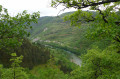
(12) Leave the marked trail by turning left onto a path between two fences. This path approaches the cliffs overlooking the Tarn and offers magnificent views of the valley, slightly upstream of the Cirque des Baumes, before veering off to reach Mas Rouch.
GR®6 white and red signposting
(13) Turn left and follow the small, balcony-like road leading to the Point Sublime as far as the recycling bins at the Cassaduc Campsite.
No signposting
(14) Leave the road and turn left onto a wide track which very quickly becomes a narrow, rugged path as it begins the descent towards the river. Caution: this section is very steep and you may need to use your hands at times to negotiate a few rocky sections. Reach the junction with a path marked by a small sign indicating the Cirque des Baumes to the right.
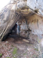
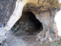
(15) Turn right here. The very narrow path continues to descend before veering to the right and levelling out, offering magnificent views of the Tarn and the Cirque des Baumes: this is a tricky section, with very narrow, unsecured passages. You’ll reach the entrance to the Grotte des Baumes Chaudes.
(16) Quickly explore the first cavity on the right, then continue along the route by crossing the second part of the cave. Back in the open air, rejoin the path which climbs back up towards the plateau just as steeply as on the descent, and where you’ll need to make sure you’ve got enough breath to spare. Emerge onto the access path to the Point Sublime site and turn right to reach the secure viewing point, where one of the most beautiful views of the Gorges du Tarn, both upstream and downstream, unfolds.
(17) Turn back and rejoin the Route de la Crête.
GR®6® white and red markings
Keep to the left, walking on the other side of the wooden safety barriers. Follow these until you reach the bend where a cross stands.
(18) Cross with care and follow the road on the right-hand side, using the verge, which is easier to walk on – at least when the brambles have been properly cleared. Continue to the junction with the D46.
(19) Turn left to return to the village centre and the car park (S/E).



 Visorando Member
 Easy
Easy 
 Moderate
  Tourist office
 National Park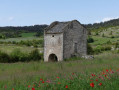
 Association / Club / Walk leader