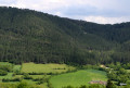
Montialoux Castle as seen from Rouffiac
A walk to explore the ruins of Montialoux Castle through the Mende State Forest. The castle is situated in the commune of Saint-Bauzile , in Lozère , right in the heart of the Valdonnez valley, in the former province of Gévaudan . Please note: this short walk involves a significant elevation gain.
Activity:
Walking
Distance:
3.58 mi
Average duration:
2h 35
Difficulty:
Moderate
Back to start:
Yes
Ascent:
+ 1,093 ft
Descent:
- 1,070 ft
Highest point:
2,946 ft
Lowest point:
2,329 ft
Start from the car park at the Rouffiac sports grounds. Yellow-marked walk.
(S/E ) Take the path between the two stadiums towards the forest until you reach a junction.
(1 ) Take the path leading uphill on the left until you reach a hairpin bend.
(2 ) Take this bend and continue along the path uphill through the forest until you reach a path branching off to the left.
(3 ) Turn onto this track, which descends to the castle, the ruins of which only come into view at the very last moment.
(4 ) Turn round and, following the route back in the opposite direction, return to the stadiums’ car park (S/E ).
Waypoints
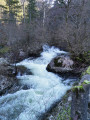
S/E : mi 0 - alt. 2,336 ft - Rouffiac sports ground car park - Bramont (rivière) 1 : mi 0.24 - alt. 2,579 ft - Junction of paths2 : mi 0.56 - alt. 2,595 ft - Hairpin bend3 : mi 1.65 - alt. 2,644 ft - Junction of paths4 : mi 1.79 - alt. 2,677 ft - Location of the ruined castleS/E : mi 3.58 - alt. 2,336 ft - Rouffiac sports ground car park
A yellow-marked walk along a footpath and hiking trail through the Mende State Forest.
In the afternoon, the forest path is in the shade for most of the way.
The walk ends at the top, at the castle, which is situated halfway up the slope and only comes into view during the final few metres of the route.
On reaching the castle, the view of the Truc de Balduc is magnificent.
Always be cautious and plan ahead when you're outdoors. Visorando and the author of this route cannot be held responsible for any accidents occurring on this route.
For more walks, use our search engine .
The GPS track and description are the property of this route's author. Please do not copy them without permission.



 Country:

 City:
City:


 Visorando Member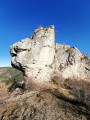

 Association / Club / Walk leader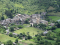
 Easy
Easy  Tourist office