Roc de la Truque

Set off to discover a rural world where tradition meets modernity, where old buildings stand alongside modern structures. A journey from the past to the present along this trail, which runs entirely across the plateau.

Details

27238896
Creation:
Last update:
Last review:
  • Walking
    Activity: Walking
  • ↔
    Distance: 6.28 mi
  • ◔
    Average duration: 3h 30 
  • ▲
    Difficulty: Easy

  • ⚐
    Back to start: Yes
  • ↗
    Ascent: + 673 ft
  • ↘
    Descent: - 679 ft

  • ▲
    Highest point: 3,084 ft
  • ▼
    Lowest point: 2,621 ft

Photos

Description of the walk

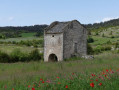
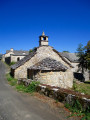
The route starts near the Cauquenas bread oven.

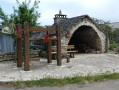
(S/E) Head towards the centre, towards the oven. At the bread oven, turn left onto the track between the farm buildings and sheds and climb up to the Col du Roc de la Truque.

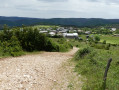
(1) Then follow the track to the right and head for the hamlet of Mazel-Bouissy. Keep left twice, then turn right. Continue in this direction until you reach Mazel-Bouissy.

(2) In the hamlet, go up the small street on the left, just after a stone cross, and join a wider track. Then turn left, then right, then right again. Continue uphill to the next junction (elevation 905).

(3) Turn left, then right at the fork. At the top of the hill, at elevation 939, continue straight ahead, due south. Keep going until you reach the hamlet of Les Cayroux.

(4) Turn right onto the road, then keep left twice. Carry on in the same direction until you reach the first track on the left (Terres Rouges).

(5) Carry on straight ahead to the Clapas de la Truque.

(6) Return to the previous junction.

(5) Turn right. At the second junction, turn left. Ignore a track on the left and continue along the drovers' road leading up towards Cauquenas. Carry on straight ahead at the next four crossroads. You’ll come to a fifth.

(7) Turn right, then left. Walk through the hamlet, and at the road, turn left to reach the car park. (S/E)

Waypoints

  1. S/E : mi 0 - alt. 2,677 ft
  2. 1 : mi 0.5 - alt. 2,844 ft
  3. 2 : mi 1.14 - alt. 2,631 ft
  4. 3 : mi 2.02 - alt. 2,972 ft
  5. 4 : mi 3.26 - alt. 2,946 ft
  6. 5 : mi 4.05 - alt. 2,831 ft
  7. 6 : mi 5.86 - alt. 2,703 ft
  8. S/E : mi 6.28 - alt. 2,677 ft

Notes

Access:
From La Malène, take the D43 towards La Canourgue, then take the first road on the left towards Cauquenas

Car park:
Car park near the bread oven

Tips:
The path offers little shade. Make sure your kit is suitable for the day’s weather conditions. Remember that the weather can change quickly in the mountains. Remember to bring plenty of water, suitable footwear and a hat. Please close any gates and fences behind you.

Worth a visit

Le Mazel Bouissy
Here, as elsewhere on the Sauveterre plateau, in the early 19th century, priority was given to milk production, driven by the Roquefort cheese-making companies. Dairies were established, the causses switched to dairy farming, and the Lacaune breed became the dominant one. On the Causses de Sauveterre, the Massegros cheese dairy is a large dairy specialising in sheep’s milk. Its signature cheese is the “Salaki”.

Clapas de la Truque
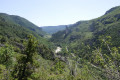
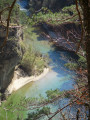
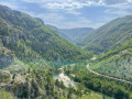
Apart from the wild panorama of the Tarn Gorges, the Roc des Hourtous and the Cirque des Baumes, the place is notable for an unusual event that took place in the past.” “In 1990, you wouldn’t have been able to get near the Roc de la Truque; hundreds of cars were parked here, and the same was true opposite, at the Roc des Hourtous. A rope had been stretched between the two rocks, spanning 1,000 metres. The tightrope walker Henry achieved the feat of crossing the distance on the rope.”

Reviews and comments

4.6 / 5
Based on 3 reviews

Reliability of the description
5 / 5
Ease of following the route
5 / 5
Route interest
3.7 / 5
yed
yed

Overall rating : 4.7 / 5

Date of your route : Jun 30, 2026
Reliability of the description : ★★★★★ Very good
Ease of following the route : ★★★★★ Very good
Route interest : ★★★★☆ Good
Very busy route : No

Beautiful views over the Causse de Sauveterre. Take a detour to the Clapas de la Truque (point 5) for a stunning bird’s-eye view of the gorges. There’s very little shade on the walk and it was very hot after our picnic...
After the walk, we drove on to Point Sublime. It’s well worth a visit!

Machine-translated

huito
huito

Overall rating : 4.7 / 5

Date of your route : Sep 02, 2025
Reliability of the description : ★★★★★ Very good
Ease of following the route : ★★★★★ Very good
Route interest : ★★★★☆ Good
Very busy route : No

Hike completed using the app
Easy hike without too much elevation gain
Especially at point 5, make sure you go back and forth for a magnificent view of the Tarn Gorges

Machine-translated

grave320
grave320

Overall rating : 4.3 / 5

Date of your route : Jul 01, 2025
Reliability of the description : ★★★★★ Very good
Ease of following the route : ★★★★★ Very good
Route interest : ★★★☆☆ Average
Very busy route : No

Nice hike but not much of a view...

Machine-translated

Other walks in the area

For more walks, use our search engine .

The GPS track and description are the property of this route's author. Please do not copy them without permission.