Country:

 City:
City:


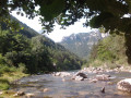
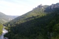
Start at the village of Les Vignes, on the right bank of the Tarn. The route follows the course of the Tarn, mostly at a higher elevation, heading south for roughly the first two-thirds of the way, then south-west.
Red and white markings
(S) Cross the bridge over the Tarn, turn immediately right and follow the road as it climbs gently.
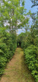
(1) Before reaching a hairpin bend, take a path on the right which, through the woodland, leads towards the riverbed. The path crosses pastures and then runs along the edge of the woods.
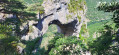
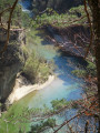
(2) The path leaves the riverbank to gain height. It then runs along a cliff ledge for a while (offering views), before descending again and drawing closer to the river (access to the riverbank is possible in places).
(3) As you approach the houses, note the cable that crosses the river high above, providing a gondola link between these houses and the road on the opposite bank. The path winds upwards in hairpin bends to bypass the houses on the left. It then heads off towards the south-west. Pass the ruins of houses at a place called Boubals.
(4) Whilst remaining broadly parallel to the Tarn, the path becomes more winding.
(5) Leave the wooded area and re-enter the woods after about one kilometre. Continue south-west, roughly along the hillside and then down a gentle slope. You’ll reach a road at a bridge over the Tarn. Carry on straight ahead and you’ll soon come to a flight of steps on the left (signposted ‘PR®’ and ‘GR®’), the start and finish point of the walk (E).




 Visorando Member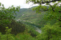
 Difficult
  Tourist office
 Easy
Easy