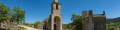
The village and the Saint-Saturnin cirque

A walk along the edge of the Causse de Sauveterre around the village of Saint-Saturnin and its feudal castle.

Details

2965069
Creation:
Last update:
Last review:
  • Walking
    Activity: Walking
  • ↔
    Distance: 5.27 mi
  • ◔
    Average duration: 3h 15 
  • ▲
    Difficulty: Moderate

  • ⚐
    Back to start: Yes
  • ↗
    Ascent: + 997 ft
  • ↘
    Descent: - 997 ft

  • ▲
    Highest point: 2,877 ft
  • ▼
    Lowest point: 2,064 ft

Photos

Description of the walk

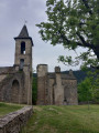
Once you reach the village of Saint-Saturnin, park behind the Romanesque church, near the castle.

(S/E) Walk between the church and the castle, then continue to the left to leave the village. Follow the road south-west.

(1) At this junction, leave the Tartaronne road on your right and carry on towards the hamlet of Roquaizou. On leaving the hamlet, follow the tarmac track which winds its way up onto the plateau near the A75. Carry on for a few more metres along the local track.

(2) Turn left onto the small path that heads into the woods and leads to a wide forest track. Continue to the left.

(3) At the junction, turn left. Keep left at the next crossroads just before the bend and walk on to the hamlet of Le Cros.

(4) Walk straight through the hamlet and continue along the tarmac track until the next junction.

(5) Take the track directly in front of you and carry on until you reach an area of meadows.

(6) Turn left onto the farm track that skirts the field bordered by a low stone wall. Further on, keep left at the Fork in the road at the end of the meadow.

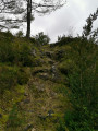
(7) Follow the yellow markings (trees, stones and low walls) which take you through the undergrowth to the steep path at the edge of the Causse, which winds its way down towards the valley.

(8) Continue to the rocky outcrop overlooking the village of Saint-Saturnin to enjoy the view before you. Resume the winding descent towards the village.

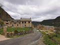
(9) As you emerge from the woodland, walk round the water intake by the side of the road and return to the car park at the end of the walk (S/E).


Waypoints

  1. S/E : mi 0 - alt. 2,116 ft - Car park
  2. 1 : mi 0.9 - alt. 2,247 ft - Turn left and follow the road
  3. 2 : mi 1.68 - alt. 2,612 ft - Turn left onto a path through the woodland
  4. 3 : mi 2.38 - alt. 2,730 ft - Forest track, to the left
  5. 4 : mi 3.27 - alt. 2,730 ft - The hamlet of Le Cros, straight on
  6. 5 : mi 3.94 - alt. 2,740 ft - Junction, opposite the track
  7. 6 : mi 4.4 - alt. 2,710 ft - Path on the left
  8. 7 : mi 4.72 - alt. 2,717 ft - Crossing through the undergrowth – Yellow markings
  9. 8 : mi 4.89 - alt. 2,635 ft - Viewpoint
  10. 9 : mi 5.17 - alt. 2,185 ft - Water catchment
  11. S/E : mi 5.27 - alt. 2,116 ft - Car park

Notes

The walk alternates between tarmac tracks, forest tracks and footpaths. These footpaths can sometimes be a little difficult to follow; at (7) in particular, as the path disappears and you have to follow the markings on the trees and rocks.
The descent to the village is quite steep from points (7) and (8).
An easier alternative route is possible by staying on the track at point (6) and joining the road at the end of the track, which leads back down to the village.

Worth a visit

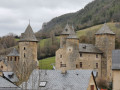
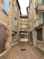
The village of Saint-Saturnin with its 13th-century castle and Romanesque church.
The hamlet of Roquaizou with its restored houses.
The hamlet of Le Cros.
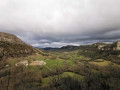
Views over the Saint-Saturnin cirque, the Lot valley and the foothills of the Aubrac.

Reviews and comments

3.2 / 5
Based on 5 reviews

Reliability of the description
3.2 / 5
Ease of following the route
3.2 / 5
Route interest
3.2 / 5
Pierre viso
Pierre viso

Overall rating : 4 / 5

Date of your route : Jul 15, 2023
Reliability of the description : ★★★★☆ Good
Ease of following the route : ★★★★★ Very good
Route interest : ★★★☆☆ Average
Very busy route : No

A lovely exploration of the village and the cirque.
It’s a shame there are so many roads and tracks (which are hard to avoid).
With a sat-nav, it’s no trouble at all to find the right path before the descent to the village.
The steep path down to St Saturnin was our favourite part as it was great fun and offered some lovely views.
Thank you

Machine-translated

gebo
gebo

Overall rating : 4 / 5

Date of your route : Oct 09, 2020
Reliability of the description : ★★★☆☆ Average
Ease of following the route : ★★★★☆ Good
Route interest : ★★★★★ Very good
Very busy route : No

Hello,
We found it very difficult to find the path leading down from the plateau. We got lost several times as there is no clear trail; we climbed all the way up to the mobile phone mast before realising we had gone well past the village. We finally found the path leading down through the cliff face. It is quite steep and not recommended for those who are not very alert or who suffer from vertigo.
That said, this route is well worth doing as the scenery is varied and, from the ridges, there are exceptional views over the valley.

Machine-translated

Paul h
Paul h

Overall rating : 3 / 5

Date of your route : Aug 19, 2020
Reliability of the description : ★★★☆☆ Average
Ease of following the route : ★★★☆☆ Average
Route interest : ★★★☆☆ Average
Very busy route : No

I can only echo the comments of the previous hiker:

We didn’t have a GPS, and it was only with the help of a local farmer that we managed to find our way to the viewpoint and down the other side. .......

From 6 to 8: the route is very difficult to follow through the thickets. Without a GPS, I’d even say it’s impossible, for several reasons.
- The trail is virtually non-existent or disappears.
- Signposting is virtually invisible.
- Furthermore, hikers seem unwelcome: bushes have been thrown across the path, and barbed wire and string block the way.
From 8 to S/E: a very tricky descent, absolutely not recommended for anyone who isn’t sure-footed. The lower part of the path disappears or becomes overgrown; you have to finish by cutting across the field

Machine-translated

HorizonVagabond
HorizonVagabond

Good evening,
Zazabebelle, from what I’ve seen of your route, you’ve done the route in the wrong direction.
It’s true that the section through the woodland, between points 6 and 8, is difficult to follow as it’s very poorly signposted, and even more so in the direction you took it. The signposting really does need a proper ‘update’.
That said, these difficulties were mentioned in the walk description.
However, the panoramic view and the walk through the village of Saint-Saturnin, as well as the hamlet of Roquaizou, are definitely worth the detour.

Machine-translated

HorizonVagabond
HorizonVagabond
• Edited:

Yes, please.
I’ll send it to you via private message.
Kind regards
Éric

Machine-translated

zazabebelle
zazabebelle

Hello

I can send you a screenshot of our call history if you have an email address?

Isabelle

Machine-translated

HorizonVagabond
HorizonVagabond

Hello,
I’m sorry to hear you encountered some problems on this walk.
Could you tell me which direction you took on the route?
Kind regards.

Machine-translated

zazabebelle
zazabebelle
• Edited:

Overall rating : 1.7 / 5

Date of your route : Jul 11, 2020
Reliability of the description : ★★☆☆☆ Disappointing
Ease of following the route : ★☆☆☆☆ Very disappointing
Route interest : ★★☆☆☆ Disappointing
Very busy route : No

We did this hike in mid-July 2020.
After the climb above the village, it was impossible to carry on. The path no longer exists and everything is blocked off by barbed wire. We took a detour along a forest track and then returned to the village via the RD. A very disappointing walk, apart from the lovely view at the start.

Machine-translated

GMIT
GMIT

Overall rating : 3.3 / 5

Date of your route : Jun 09, 2020
Reliability of the description : ★★★★☆ Good
Ease of following the route : ★★★☆☆ Average
Route interest : ★★★☆☆ Average
Very busy route : No

From 2 to 3, or even up to 5: a route of little interest.
From 6 to 8: the route is very difficult to follow through the thickets. Without a GPS, I’d even say impossible, for several reasons.
- The trail is virtually non-existent or disappears.
- Signposting is almost invisible.
- Furthermore, walkers seem unwelcome: bushes have been thrown across the path, and barbed wire and string block the way.
From 8 to S/E: a very tricky descent, absolutely not recommended for anyone who isn’t sure-footed. The lower part of the path disappears or becomes overgrown; you’ll have to finish by cutting across the fields.

A suggestion: start at 2. Save the best for last, between S/E and 2. The village of Saint Saturnin and the hamlet of Roquaizou are splendid. Unfortunately, the Villaret mill is not open to visitors.

Machine-translated

Other walks in the area

For more walks, use our search engine .

The GPS track and description are the property of this route's author. Please do not copy them without permission.