Country:

 City:
City:


Parking available near the Notre Dame Chapel in Hyelzas – Hures-la-Parade.
Signposting: blue-tipped arrow signs
(S/E) Walk north past the chapel and rejoin the road on the right until you reach the stone cross at the entrance to the village.
(1) Turn left onto the Chemin de la Traverse. Ignore the paths branching off to the left and continue until you reach a Fork in the road.
(2) Leave the Chemin de la Traverse and take the drovers' road on the right for about 1.5 km. Head down into the valley between the fields and climb back up the other side to reach the start of a path on the right.
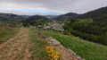
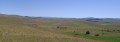
(3) Turn right, following the fence; cross it at the gap between the trees about 300 m on, then continue along the edge to the right until you reach the highest point of this first section. There’s a lovely view of the surrounding hamlets and a glimpse of Mont Gargo.
(4) Continue along the path with the Aigoual massif ahead of you. Keep heading in this direction until you reach the junction with a road marked by the Croix de Poumeyrol (Poummerol on IGN maps).
(5) Cross the road, ignore the path opposite and take the track through the boxwood, heading south-south-east. It leads to the summit of the Serre du Bouyssou. Viewpoint over the Causse Nu with the hamlet of Les Hérans.
(6) Continue to the right; after about 200 m, the path turns south-west. The Aven Armand and the Gorges de la Jonte will come into view on both sides during the descent that follows, as you walk alongside the fence. Keep heading in this direction and begin the descent to join theGR®6, which leads towards Hyelzas.
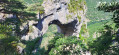
Treat yourself to one last view of the gorges by taking a 20-metre detour to the left along the GR®. If you look closely, you’ll spot the Arche du Berger below.
(7) Join theGR® again, to the right, to head back towards Hyelzas and return to the car park (S/E).

 Visorando Member
 Moderate
 Association / Club / Walk leader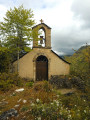
 Difficult
  Tourist office