


Guèn

 Visorando Member
 Premium user
 - Gender: man
Sign up:
Published route(s)
 Tour of the Quiberon peninsula
 17.99 mi
 +98 ft
 -102 ft
 8h 20
8h 20
 Difficult
 Departure from Saint-Pierre-Quiberon (Morbihan)
This hike is only difficult because of its length, but it allows you to appreciate the entire Quiberon peninsula from the Isthmus of Penthièvre. To the east and south, there are large beaches for swimming and numerous bars and restaurants for refreshments and meals. The wild coast to the west lives up to its name with its rocky outcrops, numerous small coves and flora and fauna to be preserved (nesting area for rare bird species in Brittany).
Anse de Sordan - Le Mané
 10.69 mi
+883 ft
-889 ft
5h 40
10.69 mi
+883 ft
-889 ft
5h 40
 Moderate
Departure from Saint-Aignan (Morbihan) (Morbihan)
Moderate
Departure from Saint-Aignan (Morbihan) (Morbihan)
First section of the tour around Lake Guerlédan, Brittany’s largest lake. Departure from Anse de Sordan towards Le Mané, passing by the Guerlédan dam. This route follows the eastern shore of the lake.
Le Mané - Anse de Sordan
 11.43 mi
+702 ft
-712 ft
5h 50
Moderate
Departure from Caurel (Côtes-d'Armor)
11.43 mi
+702 ft
-712 ft
5h 50
Moderate
Departure from Caurel (Côtes-d'Armor)
The second part of the tour of Lake Guerlédan, the most physically demanding, particularly at the start. Departure from Le Manet towards Anse de Sordan, passing by the former Abbey of Notre-Dame de Bon Repos. Return route via the western side of the lake.
Two-day tour of Lake Guerlédan
22.13 mi
+1,581 ft
-1,604 ft
2 days
Difficult
Departure from Saint-Aignan (Morbihan) (Morbihan)
A superb hike, mostly through woodland, with magnificent views of the lake from the highest points. Some sections of the trail are quite steep – ideal for giving your thighs a good workout – but these are short stretches. Walking poles may be useful for those who find the going a bit tough. There are plenty of lodges and campsites available for an overnight stay. There are seven different starting points; check the lake’s website for details: http://www.lacdeguerledan.com/.The trail is very well signposted with ‘Sentier de Guerlédan’ signposts along the entire route and the red and white markings ofthe GR®® 341 andGR®® 37. A few paths branch off from the main trail to stay close to the lake or climb a little higher into the forest, but they always rejoin the main trail.Please note! The entire route around the lake is open from 1 March to 15 September. Outside this period, sections of the trail are closed for hunting.
Circular Vilaine Route via the Arzal Dam and the Roche-Bernard Bridge
 14.39 mi
+1,083 ft
-1,070 ft
7h 35
Difficult
Departure from Arzal (Morbihan)
14.39 mi
+1,083 ft
-1,070 ft
7h 35
Difficult
Departure from Arzal (Morbihan)
A pleasant, easy walk along the banks of the Vilaine through wooded countryside, forests and small villages.
The path is fully signposted in white and red by theGR®39(left bank) andGR®349(right bank).
The lakes of Curtalés, Rond, Cornu and Vert from Valmeinier
 9.91 mi
+2,690 ft
-2,684 ft
6h 55
Moderate
Departure from Valmeinier (Savoie)
9.91 mi
+2,690 ft
-2,684 ft
6h 55
Moderate
Departure from Valmeinier (Savoie)
A lovely hike through the Neuvache valley to reach Lac Curtalés and the neighbouring lakes, with a detour to the beautifully coloured Lac Vert. The ascent follows a balcony path on the right bank of the Neuvache, offering superb views of the valley and the mountains. The return route, following the left bank along the stream, offers some pleasant shaded areas during hot weather.
Yellow markings and signposts to help you find your way.
Lake Savine and the Col Clapier or Col de Savine as seen from Le Suffret
 10.72 mi
+2,887 ft
-2,867 ft
7h 25
Moderate
Departure from Bramans (Savoie)
10.72 mi
+2,887 ft
-2,867 ft
7h 25
Moderate
Departure from Bramans (Savoie)
A long hike offering the chance to follow in the (potential, as they are unproven) footsteps of Hannibal and his elephants during his war against the Roman Empire.
Aside from this historical fact, this walk winds through the beautiful and wild Savine valley, leading to the lake of the same name and to the Col du Clapier or Col de Savine on the France–Italy border.
Circular Grand Perron des Encombres path via the ridge path
 5.84 mi
+2,838 ft
-2,831 ft
5h 10
Moderate
Departure from Saint-Martin-de-la-Porte (Savoie)
5.84 mi
+2,838 ft
-2,831 ft
5h 10
Moderate
Departure from Saint-Martin-de-la-Porte (Savoie)
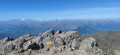
A beautiful and fairly short walk through the mountain pastures leading to the Grand Perron des Encombres, which dominates the area and offers a superb panoramic view of all the neighbouring mountain ranges: Écrins, Belledonne, Mont Blanc, etc.
Yellow markings and signposts.
Aiguille de l’Épaisseur
 8.62 mi
+5,062 ft
-5,062 ft
8 hrs
8.62 mi
+5,062 ft
-5,062 ft
8 hrs
 Very difficult
Departure from Valloire (Savoie)
Very difficult
Departure from Valloire (Savoie)
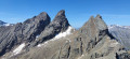
Although it looks like a large hill from its south-eastern slope, the ascent of the Aiguille de l’Épaisseur is very physically demanding in its final section, from the refuge, with 970 m of elevation gain over 3 km, representing an average gradient of over 35 per cent. However, it probably offers the finest view of the Aiguilles d’Arves you can get, not to mention a magnificent 360° panorama.
This hike is not very popular, which is hardly surprising given the final ascent. It is reserved for seasoned hikers who are not too prone to vertigo.
Route via Picheru and Col de la Bailletaz from Val-d'Isère
 10.53 mi
+4,731 ft
-4,738 ft
9h 00
Difficult
Departure from Val-d'Isère (Savoie)
10.53 mi
+4,731 ft
-4,738 ft
9h 00
Difficult
Departure from Val-d'Isère (Savoie)
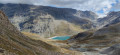
A fairly strenuous hike offering the chance to enjoy the Grande Sassière Nature Reserve, as well as the Bailletaz Nature Reserve, via two passes. The route offers stunning views of the Aiguille de la Grande Sassière and La Tsanteleina to the north.
As the route passes through two nature reserves, please respect the wildlife.
Yellow markings and signposts.
The Ardiden lakes
 6.51 mi
+3,484 ft
-3,484 ft
6h 00
Difficult
Departure from Sazos (Hautes-Pyrénées)
6.51 mi
+3,484 ft
-3,484 ft
6h 00
Difficult
Departure from Sazos (Hautes-Pyrénées)
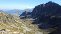
This is a fairly uncrowded hike leading to magnificent lakes below the Pic d'Ardiden, crossing small mountain pastures and ending in a fairly rocky area.
Pointe de Méan Martin via the Col de la Rocheure and the Pointe du Pisset
12.37 mi
+4,836 ft
-4,836 ft
8 hrs
Very difficult
Departure from Val-d'Isère (Savoie)
A long hike in the heart of the Vanoise National Park, through a largely rocky landscape, where you experience a striking sense of solitude when you don’t come across anyone – which isn’t necessarily unpleasant. At the summit of the Pointe de Méan Martin, a lunar-like panorama – which could be described as magnificent desolation – awaits you.
The path is well marked along almost the entire circular route. One section involves off-trail walking from the Pointe du Pisset, for 600 to 700 metres, to rejoin the path leading to the highest point of this route.
Tour of Île aux Moines
12.09 mi
+249 ft
-253 ft
5h 45
Moderate
Departure from Île-aux-Moines (Morbihan)
It is the largest of the Gulf of Morbihan islands and ideally located for those prone to seasickness, with only a 5-minute boat crossing from Port-Blanc to Baden. A tour of the island allows you to appreciate all aspects of the Gulf. The southern and eastern points of the island are the wildest, while the northern and western points are home to most of the shops and houses.
Camors Forest
10.75 mi
+440 ft
-433 ft
5h 20
Moderate
Departure from Camors (Morbihan)
A lovely walk in the Camors State Forest following thePR® (signposted) trails and combining two well-known forest routes: the Circuit de l’Eau and the Circuit de l’Étoile. Almost always in the shade of the trees, it is ideal during hot weather. Enjoy the many small ponds, streams, fountains and standing stones that adorn this beautiful Korrigans Valley!
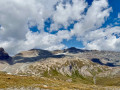
Aiguille Pers depuis le Col de l'Iseran
 4.86 mi
+2,162 ft
-2,149 ft
4h 05
Moderate
Departure from Bonneval-sur-Arc (Savoie)
4.86 mi
+2,162 ft
-2,149 ft
4h 05
Moderate
Departure from Bonneval-sur-Arc (Savoie)
Courte randonnée pour accéder à un 3000 m assez facile avec un superbe panorama sur tous les hauts sommets du département. Idéale quand on a un timing serré pour faire une randonnée.
Pics de Batoua (or Culfreda)
9.23 mi
+5,082 ft
-5,082 ft
7 hrs
Very difficult
Departure from Saint-Lary-Soulan (Hautes-Pyrénées)
Three 3,000-metre peaks for the price of one! That’s what this hike offers, taking in the three Pic de Batoua peaks from Rioumajou, through a wild and magnificent valley. The route between the Port de Cauarère and the three peaks follows a superb ridge along the French-Spanish border, offering stunning views of the 3,000-metre peaks of the Pyrenees.
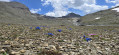
L'Ouille Noire depuis le Col de l'Iseran
 4.50 mi
+2,175 ft
-2,205 ft
4h 00
Moderate
Departure from Bonneval-sur-Arc (Savoie)
4.50 mi
+2,175 ft
-2,205 ft
4h 00
Moderate
Departure from Bonneval-sur-Arc (Savoie)
Courte randonnée pour accéder à un 3000 m, assez facile en l'absence de neige (comme pour sa voisine l'Aiguille Pers), et dans un environnement très vite minéral. Elle peut être très fréquentée du fait de son accès aisé, mais le panorama au sommet en vaut le détour.
Turon de Néouvielle
 13.67 mi
+5,039 ft
-5,036 ft
8 hrs
Very difficult
Departure from Barèges (Hautes-Pyrénées)
13.67 mi
+5,039 ft
-5,036 ft
8 hrs
Very difficult
Departure from Barèges (Hautes-Pyrénées)
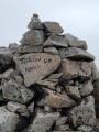
One of the most beautiful hikes you can do! A 3,000-metre peak, a multitude of lakes and tarns, torrents, mountain pastures, forests, rocky terrain and a ridge path. All this combined in a single hike! Its commanding position offers panoramic views of the magnificent Néouvielle Nature Reserve and its highest point, the Pic de Néouvielle. A feast for the eyes!
You can split the hike over two days by staying overnight at the Refuge de La Glère.
Le Petit Vignemale via the Ossoue Dam
10.59 mi
+4,347 ft
-4,344 ft
8h 40
Difficult
Departure from Gavarnie (Hautes-Pyrénées)
Overlooking its imposing neighbours (the Vignemale and Pique Longue), the Petit Vignemale offers a beautiful panorama of the Vignemale massif and its glacier, as well as the 3,000-metre peaks of the Cirque de Gavarnie.
A high-mountain hike, suitable only for experienced walkers.
Pic Maubic
7.55 mi
+3,543 ft
-3,530 ft
6h 35
Difficult
Departure from Aragnouet (Hautes-Pyrénées)
Another 3,000-metre peak in the Néouvielle range accessible by foot, yet little visited due to its more famous neighbours: the Pics d’Estaragne, Campbieil, Long, Maou and Badet. A striking rocky landscape lends it a wild appearance and, above all, a tranquillity that its neighbours must envy.
Grand Pic de Tapou and Pic du Milieu
7.80 mi
+4,698 ft
-4,698 ft
7h 40
Difficult
Departure from Gavarnie (Hautes-Pyrénées)
Two 3,000-metre peaks often overlooked by hikers, who tend to prefer the nearby Vignemale, even though the panoramic views from the summit are well worth the detour. With summer pastures, lakes and a final stretch along the ridge, these two peaks have everything to offer.
Portella Blanca d’Andorra, Pic Negre d’Envalira and Pic d’Engaït
 14.57 mi
+4,429 ft
-4,419 ft
10h 35
Very difficult
Departure from Porta (Pyrénées-Orientales)
14.57 mi
+4,429 ft
-4,419 ft
10h 35
Very difficult
Departure from Porta (Pyrénées-Orientales)
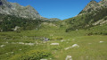
A hike leading to the French-Spanish-Andorran borders via the Chemin des Bonshommes and the final stage ofthe GR®7. It offers an alternative to the classic ascent of Pic Negre d’Envalira and Pic d’Engaït (from Pas de la Casa, which is shorter) through the magnificent Ribera de Campcardós valley.
Tusse de Montarqué from Les Granges d'Astau
 14.61 mi
+6,198 ft
-6,198 ft
10 hrs
Very difficult
Departure from Oô (Haute-Garonne)
14.61 mi
+6,198 ft
-6,198 ft
10 hrs
Very difficult
Departure from Oô (Haute-Garonne)
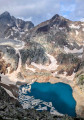
A more demanding hike than it appears, passing by famous lakes in the Pyrenees: Lac d’Oô and its superb waterfall, Lac d’Espingo, Lac de Saussat and Lac du Portillon. The view from the summit of the Tusse de Montarqué is magnificent, set in a cirque surrounded by numerous 3,000-metre peaks, which may inspire ideas for future hikes.
Tour of Lake Drennec
4.07 mi
+56 ft
-56 ft
1h 55
 Easy
Departure from Sizun (Finistère)
Easy
Departure from Sizun (Finistère)
At the gateway to the Monts d'Arrée, this is a short, easy and bucolic walk that never strays far from the lake and is shaded by trees. Crossing the floating footbridge adds a nice touch to this walk.
Pic de Montfaucon from the Hourquette d'Ancizan
8.42 mi
+3,983 ft
-3,980 ft
7h 20
Difficult
Departure from Ancizan (Hautes-Pyrénées)
On a mountain often overlooked in favour of its neighbour, the Arbizon, or the 3,000-metre peaks of the Néouvielle, this hike offers stunning views. The route through the mountain pastures to Lac d’Arou and then over scree to the summit requires good experience of walking on ground that gives way easily underfoot. Please take full note of the comments regarding the mountainous terrain.
This hike should only be undertaken when there is no snow!
Aygues-Cluses Refuge - Campana de Cloutou Refuge
 4.62 mi
+2,146 ft
-1,867 ft
4h 00
Difficult
Departure from Barèges (Hautes-Pyrénées)
4.62 mi
+2,146 ft
-1,867 ft
4h 00
Difficult
Departure from Barèges (Hautes-Pyrénées)
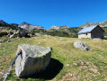
Day three of the four-day Tour du Massif de Néouvielle, the shortest route of the four days, but no less magnificent.This hike is classified as difficult due to the ascent of Pic d'Aygues-Cluses (T5 ridge). See the variants if you wish to avoid the peak or climb it in the other direction (less complicated).
Pic d’Ayré from Lienz
 8.57 mi
+3,045 ft
-3,018 ft
6h 35
Moderate
Departure from Barèges (Hautes-Pyrénées)
8.57 mi
+3,045 ft
-3,018 ft
6h 35
Moderate
Departure from Barèges (Hautes-Pyrénées)
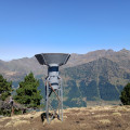
A fairly short hike, but more physically demanding than it appears, featuring a short, exposed ridge to reach thesecond summit of the Pic d’Ayré, which is slightly higher. The summit offers a beautiful view of the 3,000-metre peaks of the Néouvielle range.
Circular Pic de la Géla hike via the Hourquettes de Chermentas and Héas
9.82 mi
+3,717 ft
-3,714 ft
7h 45
Difficult
Departure from Aragnouet (Hautes-Pyrénées)
A magnificent hike leading to Pic de la Géla overlooking the Cirque de Barroude with its lakes and immense grey cliffs. A superb 360° panorama awaits us, with the added bonus of the 3,000 m Cirque de Gavarnie, Troumouse, Mont Perdu and Vignemale.The Crête des Aguilous, after (5), is reserved for experienced hikers (rated T4).
Pic de l’Har
10.69 mi
+5,594 ft
-5,591 ft
9h 45
Difficult
Departure from Sentein (Ariège)
A magnificent viewpoint over the high peaks of the Couseran. An easily accessible summit, passing by the old Bentaillou Mines and the Étang d’Araing.
Please note: the return route via the Col de Clos requires a basic knowledge of navigation (especially in bad weather).
Circular walk around the Pics d’Estaragne, Campbieil and Lentilla
8.29 mi
+4,150 ft
-4,127 ft
7h 25
Very difficult
Departure from Aragnouet (Hautes-Pyrénées)
A beautiful circular route passing over three peaks at over 3,000 metres, culminating at Campbieil, which offers a sublime panorama of the Pyrenean massif. The ridge paths are not particularly technical (T2 difficulty), but the significant elevation gain requires a good level of fitness.
Suitable for experienced walkers only
Tour of Lake Arguenon
19.96 mi
+1,250 ft
-1,234 ft
10h 15
Very difficult
Departure from Jugon-les-Lacs (Côtes-d'Armor)
The walk around Lac de l’Arguenon allows you to discover the full beauty of the Breton countryside through a wooded route. Dotted with steep rocky outcrops, the path offers a succession of magnificent views.
Please note: this is a very long hike.
Cirque de Lis or Érès Lits
 6.37 mi
+2,264 ft
-2,264 ft
4h 55
Moderate
Departure from Gèdre (Hautes-Pyrénées)
6.37 mi
+2,264 ft
-2,264 ft
4h 55
Moderate
Departure from Gèdre (Hautes-Pyrénées)
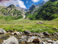
A short but exotic hike in the wild Barrada valley, accessible in summer and winter (with snowshoes), leading to the small Cirque d'Érès Lits through woods and mountain pastures.
Marc's Lodge - Refuge du Pinet
4.31 mi
+4,012 ft
-36 ft
5h 30
Difficult
Departure from Auzat (Ariège)
The first stage of the journey, the shortest and easiest, to warm up your legs, passing through the Bois de Fontanal and the Étang Sourd to the Refuge du Pinet. The elevation gain is still significant.
Refuge du Pinet - Montcalm/Estats/Verdaguer Peaks - Refuge Vallferrera
7.84 mi
+3,786 ft
-4,790 ft
6h 55
Very difficult
Departure from Auzat (Ariège)
The second day is a high-mountain stage passing through the highest point of this itinerary: Pic d'Estats, as well as two other peaks over 3,000 m nearby, Pic du Montcalm and Pic de Verdaguer. The route is largely over scree and rocky terrain, which will greatly appeal to mineral enthusiasts. The trail largely follows the Porta del Cel hike and the GR®T61. Although not particularly technical, this stage should not be taken lightly due to its altitude (three peaks over 3,000 metres), its length, its elevation gain and its trails composed of loose stones that can make progress difficult.
Vallferrera Refuge - Pic de Comapedrosa - Comapedrosa Refuge
6.88 mi
+3,727 ft
-2,549 ft
6h 25
Very difficult
Departure from Alins (Lleida)
Third stage passing through the highest point in Andorra: Pic de Comapedrosa. A high-mountain stage with no particular difficulties apart from the climb to Portella de Baiau over scree and the descent along the somewhat exposed ridge of Pic de Comapedrosa.
Comapedrosa Refuge - El Serrat
8.64 mi
+2,329 ft
-4,610 ft
6h 00
Moderate
Departure from La Massana (Andorra)
The fourth stage is in the high mountains, easier than the previous two, allowing you to reduce your effort. Many trails through forests and woodlands make for a more bucolic and enjoyable hike. This stage presents no technical difficulties, but orientation and following the route are complicated due to numerous crossings and intersections of hiking trails. It is essential to have a hiking app and the GPX track to avoid getting lost.
El Serrat - Pic de Tristagne - Refuge de l'Étang Fourcat
6.14 mi
+4,327 ft
-1,476 ft
6h 35
Very difficult
Departure from Ordino (Andorra)
The fifth and final stage of the high-mountain route passes by the iconic Pic de Tristagne, which towers over the many lakes in the surrounding area, and its short, fairly exposed ridge route, before returning to France via the magnificent Étangs Fourcat site.
Refuge Fourcat - Marc's lodge
9.76 mi
+1,247 ft
-5,958 ft
5h 35
Difficult
Departure from Auzat (Ariège)
This is the sixth and final stage of the Tour des Géants des Trois Nations, which has a steep descent (1,800 m of elevation loss, which will hurt your joints) to return to the starting point of this journey. This stage passes by the Fourcat Waterfall, the beautiful Izourt Pond and the forests of Goulier-Auzat and Montcalm.
Pic de Crabère from Labach
10.78 mi
+5,463 ft
-5,463 ft
9h 45
Very difficult
Departure from Melles (Haute-Garonne)
The Pic du Crabère is a must-see summit forming a tripoint between Haute-Garonne, Ariège and Spain. It offers a superb view of the entire Maladeta glacier and the highest peaks in Spain, including the king of the Pyrenees: Aneto! A fairly long hike, but without any technical difficulty, and with a well-marked and easy-to-follow path.
Soum des Salettes from Piau Engaly
8.78 mi
+3,720 ft
-3,757 ft
7h 15
Difficult
Departure from Aragnouet (Hautes-Pyrénées)
At just under 3,000 metres, the Soum des Salettes nevertheless offers a superb panorama of the great Pyrenean peaks with a sublime view of the Mont Perdu massif and the Cirque de Troumouse.
Tour of the Giants of the Three Nations
43.58 mi
+19,429 ft
-19,419 ft
6 days
Very difficult
Departure from Auzat (Ariège)
A beautiful cross-border high mountain loop between France, Spain and Andorra, which takes you through the highest peaks of Ariège and Andorra, as well as other iconic peaks in the region. It also allows you to discover numerous lakes and ponds, as well as a multitude of different landscapes (forests, summer pastures, scree slopes, etc.) to delight all hikers. This itinerary takes us through three natural parks: the Ariège Pyrenees Regional Nature Park, the Alt Pirineu Natural Park and the Coma Pedrosa Valley Nature Park.
Étangs Rond and Long loop via the Ribérot and Peyralade valleys
9.81 mi
+4,820 ft
-4,810 ft
8h 40
Difficult
Departure from Les Bordes-sur-Lez (Ariège)
A pretty loop in the Couserans valleys, leading to the Rond and Long lakes, overlooked by the iconic peaks of the massif, Mont Valier and Pic des Trois Comtes. The route often runs close to the water and is dotted with beautiful waterfalls, guaranteeing a change of scenery.
Tuc or Pic de Maubermé
14.66 mi
+6,601 ft
-6,601 ft
12h 30
Very difficult
Departure from Sentein (Ariège)
The highest point in the Val d'Aran and Couserans, Maubermé is often overlooked in favour of Mont Valier. However, unlike Valier, the path climbs steadily and pleasantly to Port d'Urets (and its small hut where you can spend the night), then becomes a little steeper to reach the summit, which may prove a little difficult for those who are not used to it.
Tour of the Glomel ponds
9.35 mi
+400 ft
-400 ft
4h 40
Moderate
Departure from Glomel (Côtes-d'Armor)
A pretty, bucolic circular route through the Breton countryside, around the Glomel ponds and along the Nantes-Brest Canal. This route combines waterways, locks, woods and villages, ideal for a change of scenery.
Pic d'Ardiden from La Fruitière
9.96 mi
+5,226 ft
-5,226 ft
9h 10
Very difficult
Departure from Cauterets (Hautes-Pyrénées)
This is a demanding hike requiring sure-footedness, especially after the Porteau des Agudes, where you have to enjoy scrambling over large boulders, but it offers a unique panorama at the summit of Pic d'Ardiden overlooking the Lutour Valley and a beautiful view of the Gavarnie mountains and the Brèche de Roland. It also overlooks the lakes of the same name and Lac de Badet, adding an extra touch of splendour.
Pic de Caramantran from Saint-Véran
 13.12 mi
+3,596 ft
-3,589 ft
9h 10
Very difficult
Departure from Saint-Véran (Hautes-Alpes)
13.12 mi
+3,596 ft
-3,589 ft
9h 10
Very difficult
Departure from Saint-Véran (Hautes-Alpes)
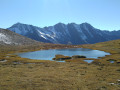
As an alternative to the classic route starting from the Agnel Refuge, this circular route allows you to enjoy the mountain pastures of Saint-Véran, the small hamlets along the way and the Lacs de la Blanche, adding more variety to the landscape on this hike. The magnificent view of the surrounding 3,000-metre peaks is a feast for the eyes, featuring Mont Viso, the Pain de Sucre and, on a clear day, Mont Blanc. The return route via the old copper mine adds an extra touch of history.
Grand Glaiza and the Malrif Lakes from Les Fonts de Cervières
11.75 mi
+5,056 ft
-5,020 ft
9h 50
Very difficult
Departure from Cervières (Hautes-Alpes)
A long walk through the Pierre Rouge valley to reach the Grand Glaiza via the Crête aux Eaux Pendantes and its rocky landscape, with the return route passing through the Lacs du Malrif to return to greenery.
Col Fromage and Col de Bramousse from Ceillac
7.73 mi
+3,199 ft
-3,179 ft
6h 20
Difficult
Departure from Ceillac (Hautes-Alpes)
A beautiful circular route in the village of Ceillac, taking in two mountain passes and a former signal station. The three ridge paths on this route offer superb panoramic views of the Queyras and the Écrins massif.