Pic de l’Har

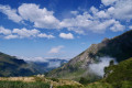
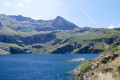
A magnificent viewpoint over the high peaks of the Couseran. An easily accessible summit, passing by the old Bentaillou Mines and the Étang d’Araing.
Please note: the return route via the Col de Clos requires a basic knowledge of navigation (especially in bad weather).

Details

58858166
Creation:
Last update:
Last review:
  • Walking
    Activity: Walking
  • ↔
    Distance: 10.69 mi
  • ◔
    Average duration: 9h 45 
  • ▲
    Difficulty: Difficult

  • ⚐
    Back to start: Yes
  • ↗
    Ascent: + 5,594 ft
  • ↘
    Descent: - 5,591 ft

  • ▲
    Highest point: 7,927 ft
  • ▼
    Lowest point: 3,189 ft

Description of the walk

Follow the D4 road to the hamlet of Eylie. Turn right towards Eylie d’en Bas, cross the Ruisseau de Rouge once, and park by the second bridge over the stream, just before Eylie d’en Haut.
The walk is well signposted, with a sign at the car park showing the route. Follow theGR®10andGRP® Tour du Biros markings, then the yellow markings for the circular return leg. Directional signs are placed along the route.

(S/E) From the car park, take the path alongside the stream, heading west, next to the large information board explaining the route. Turn left to cross the stream, then immediately right onto theGR®10, heading west, up a steep climb. Ignore all the small paths you come across along the way and stay on theGR®10to reach the Col de Catauère through the forest.

(1) Continue on theGR®10(andGRP® Tour du Biros) heading west to reach, through the mountain pastures, the ruins of the Anciennes Mines de Bentaillou.

(2) Water point (tapped spring) after passing the cavers’ hut on your left. Cross the Coume Longue stream and arrive at the Narbonne Station at a fork in the path.

(3) Leave the GRT51, which is also marked in white and red, heading south into Spain. Turn right (west) to stay on theGR®10just after passing a large gravelly stream (you can’t miss it!). Pass a commemorative stele. Climb very steeply along theGR®10and, after a final steep section, veering to the right, reach a sort of pass (elevation 2222).

(4) At the Col de Serre d’Araing, leave theGR®10and head straight ahead, climbing the ridge path to reach the Pic de l’Har. The few yellow markings may help. Caution: There are three rocky ledges along the route which can easily be bypassed via the eastern slope on the ascent to the Pic de l’Har (elevation 2422).

(5) Turn back and return to the Col de Serre d’Araing (remember to bypass the rocky ledges via the east).

(4) Turn right to stay on theGR®10(and theGRP®) heading towards the Étang d’Araing and its dam. The Étang d’Araing mountain refuge is 10 minutes away via theGR®10, should you need it.

(6) Leave theGR®10. Head down to the right, towards the north, to join theGRP® Tour du Biros (yellow and red markings).

(7) Turn left towards the Cabane d’Illau to stay on the GRP®. Pass by the Fontaine d’Illau and enter the forest.

(8) Leave theGRP®. Turn right, heading due east. From here, follow the yellow markings. Head towards the Col des Cos. Leave the forest shortly before the pass.

(9) From the pass, head down towards the Cabanes des Clos (one for the shepherd, one for walkers).

(10) Ignore the paths branching off to the right and the one running along the mountainside. Descend via a faint path heading south-east, keeping to the right of the fence at all times (do not cross it). The yellow markings are often on the other side of the fence (sometimes 3 metres further on), but you must never cross it (always stay to the right of the fence) or you risk getting lost in another valley! The path heads south-east, then south, then west again and south once more, eventually reaching the Haurendech stream, which can sometimes be difficult to cross.

(11) Be careful, this fork in the path can be tricky. There are two yellow markings here, one on the right (the old route) and one on the left. After crossing the stream, take the path that climbs slightly (at the start) on the right to stay on the hillside through the forest. Make sure you follow the markings.
After a bend to the right and a descent along a wider path, you’ll reach a 90° bend to the right.

(12) At the Eylie megalith, turn right to reach the final bend leading to Eylie d’en Haut. At the bend, head down to the left along the small road towards the car park (S/E).

Waypoints

  1. S/E : mi 0 - alt. 3,209 ft - Eylie
  2. 1 : mi 1.59 - alt. 5,666 ft - Col de la Catauère
  3. 2 : mi 2.38 - alt. 6,155 ft - Water point. Spring
  4. 3 : mi 2.54 - alt. 6,299 ft - Bentaillou Mines
  5. 4 : mi 3.53 - alt. 7,283 ft - Serre d’Araing Pass
  6. 5 : mi 4.15 - alt. 7,920 ft - Pic de l’Har
  7. 6 : mi 5.59 - alt. 6,243 ft - Barrage de l'Etang d'Araing
  8. 7 : mi 6.54 - alt. 5,016 ft - Cabanne d'Illau
  9. 8 : mi 7.11 - alt. 4,646 ft - End of the GRP
  10. 9 : mi 8.04 - alt. 4,984 ft - Col des Cos
  11. 10 : mi 8.17 - alt. 4,938 ft - Cabanes des Cos
  12. 11 : mi 9.53 - alt. 3,760 ft - Junction. Alt. 1,160 m
  13. 12 : mi 10.36 - alt. 3,189 ft - Junction. Alt. 1010 m
  14. S/E : mi 10.69 - alt. 3,212 ft - Eylie

Notes

Water points: (2) Speleologists’ hut, (8) springs, (10) (watering trough) at the Cabane de Cos, (S/E) Eylie.
There are plenty of paths through the forest to complete the circular route, but the signposts are well placed and point towards the Eylie stopover lodge to get back to the car park. Do make sure you carry a map or GPS app with you to avoid taking a wrong turn, especially in the Montagne des Cos area.

Refreshments, overnight accommodation and drinks available in Eylie.

Always be cautious and plan ahead when you're outdoors. Visorando and the author of this route cannot be held responsible for any accidents occurring on this route.

The GR® and PR® markings are the intellectual property of the Fédération Française de Randonnée Pédestre.

Reviews and comments

4.6 / 5
Based on 3 reviews

Reliability of the description
5 / 5
Ease of following the route
4 / 5
Route interest
4.7 / 5
User 3291909

Overall rating : 4.7 / 5

Date of your route : Nov 03, 2025
Reliability of the description : ★★★★★ Very good
Ease of following the route : ★★★★★ Very good
Route interest : ★★★★☆ Good
Very busy route : No

Challenging climb. The second part of the hike after the Etang is very beautiful.

Machine-translated

User 27398834

Overall rating : 4 / 5

Date of your route : Aug 25, 2025
Reliability of the description : ★★★★★ Very good
Ease of following the route : ★★☆☆☆ Disappointing
Route interest : ★★★★★ Very good
Very busy route : Yes

Don't trust the alarming information in point 10! "Do not attempt to go beyond the fence at any cost" led us to get lost on a path that no longer exists and waste nearly two hours wandering around in the wrong place without finding the marked trail (we probably followed the wrong fence, but we couldn't check on the spot). In any case, go to the two huts FIRST and follow the yellow markings on the ground. Once we found them, we saw that they were very regular and unambiguous.

Tip for the information sheet: rephrase point 10 in a less alarmist tone. While there is certainly a risk of getting lost in another valley, the risk of getting lost higher up on a path that no longer exists is also very real.

For information, at 42°50'47.6"N 0°54'59.8"E, the path shown on the map disappears before the entrance to the forest and cannot be followed to reach the marked path below. I have sent a report to have it removed from the IGN maps as it no longer exists. It should also be noted that this path is no longer shown on OpenStreetMap maps.

Machine-translated

Rémy 09
Rémy 09

Overall rating : 5 / 5

Date of your route : Jul 21, 2023
Reliability of the description : ★★★★★ Very good
Ease of following the route : ★★★★★ Very good
Route interest : ★★★★★ Very good
Very busy route : No

A challenging but very enjoyable walk; the route description is accurate, as is the signposting.
Do bear in mind the length of the walk. The section through the forest offers some welcome coolness in hot weather. Crossing the Haurendech stream can be tricky when the water is flowing strongly (the footbridge has been destroyed).

Machine-translated

Other walks in the area

For more walks, use our search engine .

The GPS track and description are the property of this route's author. Please do not copy them without permission.