Campana de Cloutou Mountain Hut – Orédon Mountain Hut

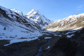
The final day of the 4-day Tour of the Néouvielle Massif. The longest and most challenging of the four stages, passing by the viewpoint of this multi-day hike: the Pic de Bastan. This peak offers a magnificent view over the entire massif and the surrounding lakes.

This walk is part of a multi-day hike: Tour du Massif de Néouvielle sur 4 jours

Details

n°54941872
Creation:
Last update:
Last review:
  • Walking
    Activity: Walking
  • ↔
    Distance: 9.03 mi
  • ◔
    Average duration: 7h 20 
  • ▲
    Difficulty: Difficult

  • ⚐
    Back to start: No
  • ↗
    Ascent: + 3,681 ft
  • ↘
    Descent: - 4,869 ft

  • ▲
    Highest point: 8,839 ft
  • ▼
    Lowest point: 5,955 ft

Description of the walk

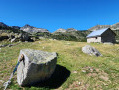
(S) From the refuge, take theGR®10access path (which leads to theGR®10) heading due south towards Lac de la Hourquette, and climb to the Col de Bastanet.

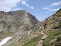
(1) At the pass, turn right onto a path heading due west to reach the summit of Pic de Bastan. The ascent is not technically difficult, and the cairns clearly mark the route. Only the section across a small ledge requires a little caution (rated T4 from the ledge onwards).

(2) From the summit, take the same route back down to the Col de Bastanet.

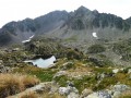
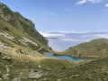
(1) Back at the pass, head down towards the south, passing by several lakes (Lac Supérieur, Lac de Bastan, Lac du Milieu and Lac Inférieur) and alongside the Refuge de Bastan, whilst staying on theGR®10access route.

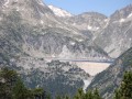
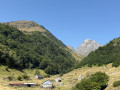
(3) After Lac Inférieur, at a fork (alt. 2130 m), continue to the right, heading south-west, now on theGR®10descending towards Lac de l’Oule through the forest.

(4) At another junction (alt. 1,950), turn right towards the north-west, staying on theGR®10to reach the head of Lac de l’Oule.

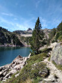
(5) At the Cabane de l’Oule, continue along theGR®10, skirting the lake along its western shore for approximately 800 m.

(6) At a fork (alt. 1,839 m), turn right onto theGR®10, following a steep path climbing through the Lude pine forest to the Col d’Estoudou.

(7) At the pass, turn right heading due north to climb to the Soum de Monpelat, following a steep, well-marked path along a ridge.

(8) At the summit of the Soum de Monpelat, a superb panorama opens up over the lakes of the Néouvielle Nature Reserve, which this Néouvielle circuit does not pass through. Descend back towards the Col d’Estoudou.

(7) Back at the pass, leave theGR®10and turn left, heading west, onto a path descending through the forest to the lake and car park at Orédon (E).

Waypoints

  1. S : mi 0 - alt. 7,283 ft - Refuge de Campana de Cloutou
  2. 1 : mi 1.26 - alt. 8,212 ft - Col de Bastanet (2509m)
  3. 2 : mi 1.71 - alt. 8,829 ft - Pic de Bastan
  4. 3 : mi 4.36 - alt. 6,939 ft - Junction (alt. 2,130 m)
  5. 4 : mi 4.88 - alt. 6,421 ft - Junction. 1950-metre mark
  6. 5 : mi 5.38 - alt. 5,971 ft - Oule Hut
  7. 6 : mi 6.09 - alt. 6,027 ft - Lude pine forest
  8. 7 : mi 7.01 - alt. 7,392 ft - Col d'Estoudou (2260m)
  9. 8 : mi 7.51 - alt. 8,100 ft - Soum du Monpelat (2475 m)
  10. E : mi 9.03 - alt. 6,089 ft - Car park/Lake Orédon

Notes

Pic de Bastan should only be attempted when there is no snow and in good weather.

This route passes through a protected area, which may be subject to special regulations:

Always be cautious and plan ahead when you're outdoors. Visorando and the author of this route cannot be held responsible for any accidents occurring on this route.

The GR® and PR® markings are the intellectual property of the Fédération Française de Randonnée Pédestre.

Reviews and comments

5 / 5
Based on 1 review

Reliability of the description
5 / 5
Ease of following the route
5 / 5
Route interest
5 / 5
VOLTIGE23
VOLTIGE23

Overall rating : 5 / 5

Date of your route : May 04, 2026
Reliability of the description : ★★★★★ Very good
Ease of following the route : ★★★★★ Very good
Route interest : ★★★★★ Very good
Very busy route : Yes

A lovely, varied route with no particularly exposed sections. The descent from the Col de Bastanet is stony but passable. The descent from the Estoudou on the Orédon side is… gruelling. Lake Supérieur is superb.

Machine-translated

Other walks in the area

For more walks, use our search engine .

The GPS track and description are the property of this route's author. Please do not copy them without permission.