Country:

 City:
City:


On the D1006, drive to the Col du Mont Cenis. After the pass, turn right towards the Refuge du Petit Mont Cenis and park in the small car park on the right just before the refuge. Alternatively, park in the large car park at the refuge.
Yellow markings and signposts lead to the summit and from the Pas de la Beccia back to the car park. There are a few cairns on the ridge path between the summit and the Pas de la Beccia
(S/E) Turn right onto the ascending track, heading due north. You’ll reach a T-junction.
(1) Turn left onto the green-marked path towards the Col de Sollières. You will reach the boundary of the Sollières Temporary Firing Range, marked on the IGN map by a broad purple line.
(2) Turn right for a round trip to the two small, unnamed lakes. Then continue the ascent to reach the Col de Sollières, a junction of several paths.
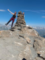
(3) Turn right onto the ridge path. A sign here warns: ‘Dangerous route’ – this applies particularly to the final few metres of the ridge, which are steeper. The long traverse along the ridge is straightforward; just take care of the loose stones. You’ll reach the Signal du Petit Mont Cenis.
(4) Continue along the eastern ridge to reach the Pas de la Beccia. Route between the summit and the Pas de la Beccia on the T5 side (Tracestrack topo map), suitable only for experienced walkers with some climbing experience. This section requires great caution and a good assessment of the terrain to avoid the most dangerous areas (rock spires). The path is barely visible or non-existent. The rock is crumbly, making it difficult to find handholds and footholds.
Warning: if you do not feel comfortable on this type of terrain, turn back at the summit and return to the car park via the same route you took on the way up.
(5) Reach a small pass at the end of the north-west/south-east-facing ridge and leave the ridge by descending the northern slope. The terrain is very loose, consisting of a mixture of sand and scree. Caution here: snowfields may persist into early summer.
(6) Descend to the right via a series of fairly steep switchbacks. You’ll reach the junction with the Vallon du Grand Plan path.
(7) Turn right to walk through this valley amongst the mountain pastures until you reach a Y-shaped junction.
(8) Turn left; after a few bends, you’ll reach the junction you passed on the way out.
(1) Turn left and, following the route in the opposite direction to the outward journey, return to the car park to the right of the Petit Mont Cenis refuge (S/E).



 Visorando Member
 Moderate
 Difficult