Le Grand Chavalard

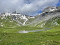
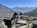
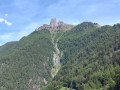
A short but challenging hike leading to the summit of the Grand Chavalard, offering superb views of the Rhône Valley below, the Mont Blanc massif and the 4,000-metre peaks of Valais.

Details

n°65121371
Creation:
Last update:
Last review:
  • Walking
    Activity: Walking
  • ↔
    Distance: 5.67 mi
  • ◔
    Average duration: 6h 05 
  • ▲
    Difficulty: Difficult

  • ⚐
    Back to start: Yes
  • ↗
    Ascent: + 4,039 ft
  • ↘
    Descent: - 4,039 ft

  • ▲
    Highest point: 9,370 ft
  • ▼
    Lowest point: 6,194 ft

Description of the walk

From Martigny, head towards Fully. Cross the town and take the mountain road towards the hamlet of Chiboz. Continue along the long gravel track to the Erié car park.

Markings: White-Red-White and White-Blue-White

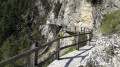
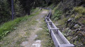
(S/E) The walk starts at the western end of the car park, winding through trees and mountain pastures along the balcony trail of the Tour du Grand Chavalard. Follow the white-red-white markings. Cross several gullies without difficulty.

(1) At an altitude of around 2,120 m, take the path heading due north. From here, follow the white-blue-white markings. This marks the start of a long, steep ascent with what seem like endless hairpin bends. The grass becomes increasingly sparse and alternates with limestone rock. Pass through a few fairly narrow rocky ledges which lead out onto the avalanche barriers.

(2) Follow the path which first veers to the right, then passes between the avalanche barriers through gaps cut into the metal beams. Continue until you reach the end of the avalanche barriers.

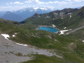
(3) Once past the last avalanche barrier, start the ridge path, still heading north. The slope is a little gentler. You can finally see the Lower and Upper Lakes of Fully on the left.

(4) Pass to the left of the Dent de Fully. From here, the path veers north-east and the summit of the Grand Chavalard comes into view. Climb the final 100 metres, which are quite steep, below the summit.

(5) From the summit, turn back and follow the route you took on the way up to return to the car park (S/E).

Waypoints

  1. S/E : mi 0 - alt. 6,194 ft - L’Erié car park
  2. 1 : mi 1.37 - alt. 6,969 ft - Junction at 2,120m
  3. 2 : mi 1.81 - alt. 7,667 ft - Avalanche protection
  4. 3 : mi 2.21 - alt. 8,301 ft - Ridge path
  5. 4 : mi 2.6 - alt. 9,045 ft - Dent de Fully
  6. 5 : mi 2.83 - alt. 9,370 ft - Grand Chavalard
  7. S/E : mi 5.67 - alt. 6,194 ft - L’Erié car park

Notes

The route is very well signposted.
This walk should only be undertaken when there is no snow.
Very steep slopes between (1) and (3), as well as in the final hundred metres below the summit.
Classification: T2 from the car park to (1), then T4 to the summit.

Reviews and comments

5 / 5
Based on 1 review

Reliability of the description
5 / 5
Ease of following the route
5 / 5
Route interest
5 / 5
User 31413092
• Edited:

Overall rating : 5 / 5

Date of your route : Oct 06, 2026
Reliability of the description : ★★★★★ Very good
Ease of following the route : ★★★★★ Very good
Route interest : ★★★★★ Very good
Very busy route : No

If you suffer from vertigo: do not attempt this!
Access road suitable for experienced drivers only (steep and narrow; little room to give way when meeting oncoming traffic)
Stunning 360° view

Machine-translated

Other walks in the area

For more walks, use our search engine .

The GPS track and description are the property of this route's author. Please do not copy them without permission.