Pic Maubic

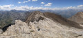
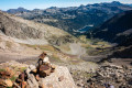
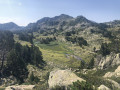
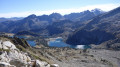
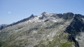
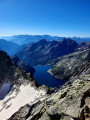
Another 3,000-metre peak in the Néouvielle range accessible by foot, yet little visited due to its more famous neighbours: the Pics d’Estaragne, Campbieil, Long, Maou and Badet. A striking rocky landscape lends it a wild appearance and, above all, a tranquillity that its neighbours must envy.

Details

n°42490599
Creation:
Last update:
Last review:
  • Walking
    Activity: Walking
  • ↔
    Distance: 7.55 mi
  • ◔
    Average duration: 6h 35 
  • ▲
    Difficulty: Difficult

  • ⚐
    Back to start: Yes
  • ↗
    Ascent: + 3,543 ft
  • ↘
    Descent: - 3,530 ft

  • ▲
    Highest point: 9,984 ft
  • ▼
    Lowest point: 7,090 ft

Description of the walk

From Fabian, take the D929 northwards towards the Cap de Long dam car park.

(S/E) From the car park, follow the southern shore of Lac de Cap de Long, taking the Pic de Campbieil path.

(1) Halfway round the lake, turn left to stay on the Pic de Campbieil path heading south-west.

(2) At the fork (alt. 2,300 m), continue straight on due south, still on the Pic de Campbieil path.

(3) At the fork (alt. 2,700 m), leave the Pic de Campbieil path and turn right towards the south-west. From there, follow the cairns leading to Pic Maubic until you reach a flat area of red stones marked with a large ‘M’ made of white stones.

(4) To the right of this ‘M’, there is a cairn indicating the best place to cross the moraine and head north-west. Follow a ridge (not difficult) heading west to climb Pic Maubic and reach a small saddle.

(5) Turn left towards the south-west , heading for the nearby Pic Maubic. Be careful: there is a slightly exposed section amongst boulders leading to the summit beyond the gap, but there are plenty of solid handholds to secure yourself.

(6) From the summit, retrace your steps to return to the car park (S/E).

Waypoints

  1. S/E : mi 0 - alt. 7,113 ft - Cap de Long Dam - Neste de Couplan (rivière) - Affluent de la Neste
  2. 1 : mi 0.64 - alt. 7,113 ft - South shore of Lac de Cap de Long
  3. 2 : mi 1.45 - alt. 7,572 ft - Junction at 2,300 m, straight ahead
  4. 3 : mi 2.85 - alt. 8,875 ft - Junction at 2,700 m, turn right
  5. 4 : mi 3.17 - alt. 9,150 ft - Flat section of red rocks
  6. 5 : mi 3.75 - alt. 9,984 ft - Pass below Pic Maubic
  7. 6 : mi 3.77 - alt. 9,895 ft - Pic Maubic
  8. S/E : mi 7.55 - alt. 7,113 ft - Cap de Long Dam

Notes

Only attempt this when there is no snow.
Exposed section over boulders between the gap and the summit, requiring the use of your hands.

Reviews and comments

4.3 / 5
Based on 2 reviews

Reliability of the description
4.5 / 5
Ease of following the route
4 / 5
Route interest
4.5 / 5
Gallo Hélène
Gallo Hélène

Overall rating : 4.3 / 5

Date of your route : Sep 15, 2025
Reliability of the description : ★★★★☆ Good
Ease of following the route : ★★★★☆ Good
Route interest : ★★★★★ Very good
Very busy route : Yes

Without Visorando's route, I would have had a lot of trouble reaching the summit. Following the cairns is not enough, especially in the middle of the scree.

Machine-translated

Mickaelmf47
Mickaelmf47

Overall rating : 4.3 / 5

Date of your route : Aug 24, 2025
Reliability of the description : ★★★★★ Very good
Ease of following the route : ★★★★☆ Good
Route interest : ★★★★☆ Good
Very busy route : No

There are not many cairns between points 4 and 5, so it is best to follow the trail.
I don't think this summit is very popular, as there is no inscription on a stone with the name of the summit and the altitude, as is usually the case on other summits.
The wide ridge between the two peaks, which are a few metres apart, presents no real difficulty.
From point 4 to the summit, it's nothing but boulders.

Machine-translated

Other walks in the area

For more walks, use our search engine .

The GPS track and description are the property of this route's author. Please do not copy them without permission.