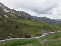
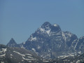
Pic de Caramantran from Saint-Véran

As an alternative to the classic route starting from the Agnel Refuge, this circular route allows you to enjoy the mountain pastures of Saint-Véran, the small hamlets along the way and the Lacs de la Blanche, adding more variety to the landscape on this hike. The magnificent view of the surrounding 3,000-metre peaks is a feast for the eyes, featuring Mont Viso, the Pain de Sucre and, on a clear day, Mont Blanc. The return route via the old copper mine adds an extra touch of history.

Details

106615553
Creation:
Last update:
Last review:
  • Walking
    Activity: Walking
  • ↔
    Distance: 13.12 mi
  • ◔
    Average duration: 9h 10 
  • ▲
    Difficulty: Very difficult

  • ⚐
    Back to start: Yes
  • ↗
    Ascent: + 3,596 ft
  • ↘
    Descent: - 3,589 ft

  • ▲
    Highest point: 9,882 ft
  • ▼
    Lowest point: 6,401 ft

Description of the walk

Park in one of the car parks in Saint-Véran; these car parks are subject to a charge during the high season.

(S/E) Follow the GR®58 trail towards the Pont Vieux along a gently descending track suitable for vehicles.

(1) Cross the Pont Vieux, then turn left to follow the Aigue Blanche along its left bank, staying on the track through woodland until you reach the ford across the river. Keep to the right on the GR®58, which becomes a standard mountain path, until you reach a footbridge over the Aigue Blanche.

(2) Cross the footbridge, then turn right, staying on the GR®58. You’ll soon reach the Grand Canal junction.

(3) Leave the GR® here and turn right onto the path running alongside the Grand Canal. Continue on to reach the Refuge de la Blanche via La Moutière.

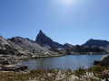
(4) Walk along the right-hand side of Lac de la Blanche, on the western shore. Once you reach the southern end of the lake, take a path heading south towards Col Blanchet. Turn left into the valley of the lakes and head for Lac Blanchet Inférieur.

(5) Carry on straight ahead to quickly reach Lac Blanchet Supérieur.

(6) Walk along its eastern shore. Ignore the path branching off to the right towards Rocca Bianca and continue along the path climbing up to the ridge marking the French-Italian border.

(7) Take the easy ridge path on the left, heading due north to the Col de Saint-Véran.

(8) Continue straight ahead, heading north-east, staying on the ridge path. Several tracks branch off from this ridge; stay on the highest one and you’ll reach a cairn with a green flag and a ‘Lollo in Vetta’ sign just below the Pic de Caramantran. Carry on to the peak.

(9) Descend to the left, heading north-west, and you’ll easily reach the Col de Chamoussière, which is visible from the summit.

(10) Join the GR®58 path again, turn left to descend into the mountain pasture and reach the crossroads you passed on the way up, near the track.

(2) Leave the GR®58, take the track on the right and you’ll first come to the marble mine car park, then the copper mine car park.

(11) Walk past this old mine, continue on and, after a long walk, you’ll reach the car park at Saint-Véran (S/E).

Waypoints

  1. S/E : mi 0 - alt. 6,588 ft - Sainte-Luce car park
  2. 1 : mi 0.6 - alt. 6,401 ft - Pont Vieux
  3. 2 : mi 3.51 - alt. 7,671 ft - Village junction (out and back) - Aigue blanche
  4. 3 : mi 3.63 - alt. 7,772 ft - Junction of the circular Lakes Loop and the border ridge
  5. 4 : mi 4.88 - alt. 8,209 ft - Refuge de la Blanche
  6. 5 : mi 5.74 - alt. 9,009 ft - Lac Blanchet Inférieur
  7. 6 : mi 6.05 - alt. 9,206 ft - Lac Blanchet supérieur
  8. 7 : mi 6.5 - alt. 9,429 ft - Ridge path
  9. 8 : mi 6.69 - alt. 9,331 ft - Col de Saint-Véran
  10. 9 : mi 7.29 - alt. 9,872 ft - Pic de Caramantran
  11. 10 : mi 7.62 - alt. 9,469 ft - Col de Chamoussière
  12. 11 : mi 10.33 - alt. 7,425 ft - Ancienne mine de cuivre
  13. S/E : mi 13.12 - alt. 6,588 ft - Sainte-Luce car park

Notes

From Saint-Véran, head to the edge of the village to the Oratory of Sainte-Luce, either by shuttle bus (in July and August) or by car (in the low season).
Towards (2) It is possible to shorten the walk by starting from the Clausis Chapel, butthe road is only open during the high season before 6.00 am and after 6.00 pm.

Worth a visit

Always be cautious and plan ahead when you're outdoors. Visorando and the author of this route cannot be held responsible for any accidents occurring on this route.

The GR® and PR® markings are the intellectual property of the Fédération Française de Randonnée Pédestre.

Other walks in the area

For more walks, use our search engine .

The GPS track and description are the property of this route's author. Please do not copy them without permission.