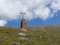
The Barrhorn

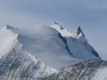
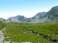
One of the highest hikes in Europe that requires no mountaineering equipment, the ascent to the Barrhorn crosses and runs alongside a variety of environments and landscapes (forest, mountain pastures, glaciers, torrents, moraines, high-altitude ridges, etc.), offering a truly breathtaking spectacle. The summit, surrounded by other peaks of similar height or even more imposing, offers a breathtaking panorama combining black rock and white glaciers.
Suitable only for experienced hikers accustomed to high altitudes.

Details

n°42170274
Creation:
Last update:
Last review:
  • Walking
    Activity: Walking
  • ↔
    Distance: 11.72 mi
  • ◔
    Duration according to the author: 10 hrs 
  • ▲
    Difficulty: Very difficult

  • ⚐
    Back to start: Yes
  • ↗
    Ascent: + 6,965 ft
  • ↘
    Descent: - 6,939 ft

  • ▲
    Highest point: 11,785 ft
  • ▼
    Lowest point: 6,240 ft

Description of the walk

Access the car park at the bottom of the Tourtemagne valley, 22 km past the village of Tourtemagne.

(S/E) At the end of the car park, turn left onto the path leading into the forest.

(1) At the fork, ignore the path on the right (which will be your return route) and turn left towards the Holustei Chapel.

(2) Turn right onto the Tourtemagne panoramic path, which overlooks the lakes. Stay on this path until you reach the mountain hut.

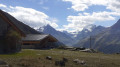
(3) Ignore the path on the right (which you’ll take on the way back) and turn left towards the mountain hut. Pass the hut and continue climbing towards Schöllijoch. You’ll come to a junction.

(4) Turn right towards Schöllijoch.

(5) Once at the pass, turn left onto the ridge path. Then, at a three-way junction about 350 m further on, turn right to climb up to the Inners Barrhorn.

(6) Continue left along the ridge path.

(7) Look out for the descent path on the left and carry on straight ahead to the Barrhorn (or Ussers Barrhorn).

(8) Once at the summit, turn back towards the three-way junction you spotted on the way up.

(7) Turn onto the path on the right.

(4) Follow the path back along the same route as on the way up to the mountain hut.

(3) Just past the refuge, leave the path on the right (the one you came up on) and continue straight on to take the path crossing an old moraine to the end of a former track

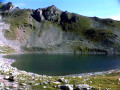
(9) Turn left onto a narrow track descending towards the Tourtemagne Lakes and following them along the right-hand bank. Then cross the Ruisseau de Tourtemagne further down (about 900 m downstream from the lake) to reach a track suitable for vehicles. Turn right.

(10) After two hairpin bends, leave the track by turning right to cross the Tourtemagne Stream again and head back into the forest.

(1) Back at the first junction of the day, keep left to return to the car park (S/E).

Waypoints

  1. S/E : mi 0 - alt. 6,240 ft - Sänntum car park
  2. 1 : mi 0.27 - alt. 6,516 ft - Crossroads of the circular loop
  3. 2 : mi 1.13 - alt. 7,667 ft - Panoramic trail from Tourtemagne
  4. 3 : mi 2.62 - alt. 8,232 ft - Turtmannhütte ou Tourtemagne (2319m)
  5. 4 : mi 4.55 - alt. 10,171 ft - Junction towards Schöllijoch
  6. 5 : mi 4.99 - alt. 10,912 ft - Schöllijoch (3343m)
  7. 6 : mi 5.43 - alt. 11,670 ft - Inners-Barrhorn (3583m)
  8. 7 : mi 5.73 - alt. 11,476 ft - Junction with the descent path
  9. 8 : mi 5.91 - alt. 11,785 ft - Ussers-Barrhorn ou Barrhorn (3610m)
  10. 9 : mi 9.81 - alt. 7,487 ft - Junction towards the lake
  11. 10 : mi 11.14 - alt. 6,690 ft - Junction towards the Tourtemagne stream
  12. S/E : mi 11.72 - alt. 6,243 ft - Sänntum car park

Notes

A challenging climb due to its elevation gain, altitude and length, but with no technical sections.
This hike is best undertaken in summer, preferably when the high-altitude snow has melted and in good weather to avoid any additional navigation difficulties.
A short, easy rocky section above the refuge, equipped with a handrail.
The ascent can be completed in a day, or you can split it into two stages by spending the night at the Tourtemagne refuge.

Worth a visit

There is the option of taking a detour to the Schöllihorn at 3,500 m (approximately 1 hour round trip from Schöllijoch (5) via a signposted path.

Reviews and comments

5 / 5
Based on 1 review

Reliability of the description
5 / 5
Ease of following the route
5 / 5
Route interest
5 / 5
User 27352322

Overall rating : 5 / 5

Date of your route : Aug 28, 2025
Reliability of the description : ★★★★★ Very good
Ease of following the route : ★★★★★ Very good
Route interest : ★★★★★ Very good
Very busy route : Yes

A very beautiful route in a superb setting

Machine-translated

Other walks in the area

For more walks, use our search engine .

The GPS track and description are the property of this route's author. Please do not copy them without permission.