Country:

 City:


From Aragnouet, take the D929 to Orédon lake/car park. Take a ticket from the machine and park.
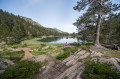
(S) From the car park, walk along Lake Orédon heading north, then west. The path winds its way up through the forest (Pinède des Passades d’Aumar) heading north-west, passing through Les Laquettes.
(1) You’ll reach the Aubert and Aumar lakes and their car park. Pass between the lakes, then climb first through a few trees heading north, then north-west through a scree slope to the Hourquette d’Aubert (elevation 2,498). Keep a close eye out for the cairns in the scree.
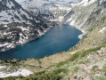
(2) Cross to the other side of the Hourquette d’Aubert, heading north-west, after taking in the view of the massif’s large lakes.
(3) Just before Lac Estagnol, at an elevation of 2,295 metres, turn left (south-west then west) onto a narrow path leading to the Hourquette de Mounicot through a scree slope. There are no markings or signposts at this junction; you’ll need to navigate using the cairns and carry a map (paper or a hiking app).
The final stretch of the climb to the Hourquette de Mounicot (elevation 2,547) is very steep, but the path is clearly marked at this point.
(4) Descend from the Hourquette de Mounicot along its western slope. From here, you must keep a close eye out for the cairns all the way to the refuge, as the path is not very well marked in several sections.
(5) At a fork in the path (alt. 2,466 m), which is not very visible, especially in bad weather, head north-west towards Lac de Mounicot, following its northern shore. Then continue westwards, passing between the lakes of Coume Escure and La Glère.
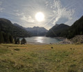
Reach the Refuge de la Glère, which overlooks the lake of the same name (E).

 Visorando Member
 Difficult
 Very difficult