Pointe de Méan Martin via the Col de la Rocheure and the Pointe du Pisset

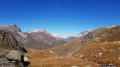
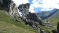
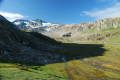
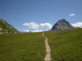
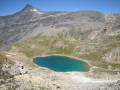
A long hike in the heart of the Vanoise National Park, through a largely rocky landscape, where you experience a striking sense of solitude when you don’t come across anyone – which isn’t necessarily unpleasant. At the summit of the Pointe de Méan Martin, a lunar-like panorama – which could be described as magnificent desolation – awaits you.
The path is well marked along almost the entire circular route. One section involves off-trail walking from the Pointe du Pisset, for 600 to 700 metres, to rejoin the path leading to the highest point of this route.

Details

40206759
Creation:
Last update:
Last review:
  • Walking
    Activity: Walking
  • ↔
    Distance: 12.37 mi
  • ◔
    Duration according to the author: 8 hrs 
  • ▲
    Difficulty: Very difficult

  • ⚐
    Back to start: Yes
  • ↗
    Ascent: + 4,836 ft
  • ↘
    Descent: - 4,836 ft

  • ▲
    Highest point: 10,906 ft
  • ▼
    Lowest point: 6,365 ft

Description of the walk

Access via Val d’Isère on the D902: in the resort, follow signs for Le Châtelard and Le Manchet. The car park is at the end of the Manchet valley, past the chairlift departure point.
Signs: yellow markings on the outward journey and red and white markings for theGR®5alternative route on the return journey.

(S/E) From the car park, head due south towards the hamlet of Le Manchet along the track. Stay on the track.

(1) Cross the Ruisseau de la Calabourdane via a footbridge. After the footbridge, ignore the path on the left (which will be the return route) and turn right, staying on the track, until you reach the junction.

(2) Ignore the path on the right and continue straight on to cross the Ruisseau du Charvet and follow its left bank until you reach a three-way junction.

(3) Take the path on the left to stay alongside the stream; cross it further on towards the Riondet chalet to follow the Ruisseau du Pisset until you reach another fork.

(4) Ignore the path on the right and carry straight on to Les Pissets.

(5) Ignore the path on the right and carry on straight ahead, climbing up a winding path. You’ll reach the Col de la Rocheure.

(6) Take the path branching off to the left until you reach a fork.

(7) Take the path on the right leading to the Pointe du Pisset.

(8) Carry on straight ahead and descend, below the ridge, towards the Col du Pisset. Please note that from here, the route is off-track for approximately 600 to 700 metres. The descent just after the Pointe du Pisset is a little steep, but very short.

(9) Cross the broad Col du Pisset, heading east-southeast, to rejoin the path leading to Pointe de Méan Martin.

(10) Turn right to climb up to Pointe de Méan Martin, across the scree. Just before the summit, standing stones line the path. Reach the summit.

(11) Turn back and return to the previous junction.

(10) Carry on straight ahead and rejoin a wide path heading towards the Refuge du Fond des Fours.

(12) Carry on to the right towards the refuge, rejoining theGR®5variant and the red and white markings.

(13) Carry on straight ahead, due north. Pass the refuge and the Ruisseau des Fours, and arrive at a fork in the path.

(14) Ignore the first path branching off to the right, then a second one, to stay on theGR®5. Cross the Ruisseau de la Calabourdane again and return to the original junction at Le Manchet.

(1) Continue straight ahead along the path and you’ll soon reach the car park (S/E).

Waypoints

  1. S/E : mi 0 - alt. 6,365 ft - Manchet chairlift
  2. 1 : mi 0.27 - alt. 6,430 ft - Le Manchet – Pont
  3. 2 : mi 0.78 - alt. 6,772 ft - Junction. Towards Le Gué
  4. 3 : mi 1.31 - alt. 6,975 ft - Junction - Charvet (ruisseau) - Affluent du ruisseau de la Calabourdane
  5. 4 : mi 2.62 - alt. 7,930 ft - Saut du Pisset
  6. 5 : mi 3.41 - alt. 8,461 ft - Les Pissets – Junction
  7. 6 : mi 4.89 - alt. 9,554 ft - Junction
  8. 7 : mi 5.18 - alt. 9,662 ft - Below the Pointe du Pisset – Fork in the path
  9. 8 : mi 5.39 - alt. 9,941 ft - Pointe du Pisset (3033m)
  10. 9 : mi 5.53 - alt. 9,708 ft - Col du Pisset (2958m)
  11. 10 : mi 5.74 - alt. 9,783 ft - Junction
  12. 11 : mi 6.75 - alt. 10,906 ft - Pointe de Méan Martin (3330m)
  13. 12 : mi 8.32 - alt. 9,114 ft - Junction
  14. 13 : mi 9.83 - alt. 8,356 ft - Junction towards the Fond des Fours mountain hut
  15. 14 : mi 11.24 - alt. 7,106 ft - Map of L’Arselle – Junction
  16. S/E : mi 12.37 - alt. 6,365 ft - Manchet chairlift

Notes

It is possible to do this hike over two days by staying overnight at the Fond des Fours mountain refuge and taking the path in the opposite direction.

(9) Alternative route: if you wish to stay on the marked paths, you can return to (7) and turn right to reach point (12). From there, turn right onto the standard path to climb to the Pointe de Méan Martin.

Always be cautious and plan ahead when you're outdoors. Visorando and the author of this route cannot be held responsible for any accidents occurring on this route.

The GR® and PR® markings are the intellectual property of the Fédération Française de Randonnée Pédestre.

Reviews and comments

4.3 / 5
Based on 4 reviews

Reliability of the description
4.3 / 5
Ease of following the route
3.8 / 5
Route interest
4.8 / 5
romain.bonnamour
romain.bonnamour

Overall rating : 4.7 / 5

Date of your route : Aug 12, 2026
Reliability of the description : ★★★★★ Very good
Ease of following the route : ★★★★☆ Good
Route interest : ★★★★★ Very good
Very busy route : No

A magnificent hike, but at point 8 (Pointe du Pisset) at 3,023 metres, I turned back because the rocks were unstable and I couldn’t see a way across the ridge. The section is also quite exposed, and I didn’t feel comfortable continuing. As I was hiking alone, I decided to turn back and took the alternative route (from point 7 to point 12), following the GR.

Machine-translated

danielfr40
danielfr40

Overall rating : 4 / 5

Date of your route : Sep 03, 2025
Reliability of the description : ★★★★☆ Good
Ease of following the route : ★★★☆☆ Average
Route interest : ★★★★★ Very good
Very busy route : No

Easy until you approach the Col de la Rocheure, where it becomes steep.
As you approach Pointe du Pisset, your trail goes along the ridge. I wanted to do the same, but the start of the ridge is narrow and jagged. I was afraid it was too exposed for me, so I turned back and went along the side on rocks that were almost always stable. But next time, I'll go all the way down to the lake, as the terrain seems easy.
I reached the Pisset Pass without any problems.
However, to climb to the Pointe de Méan Martin, your trail goes along the side.
I followed the cairns and the ridge, which is easy to do.
Nice view at the summit.
On the way back, there was no obvious path, so I descended haphazardly by what seemed easiest to me, occasionally checking your route or a cairn when I saw one
Not easy
But a beautiful summit
Thank you for this hike

Machine-translated

le dd
le dd
• Edited:

Overall rating : 5 / 5

Date of your route : Sep 20, 2024
Reliability of the description : ★★★★★ Very good
Ease of following the route : ★★★★★ Very good
Route interest : ★★★★★ Very good
Very busy route : No

Hello
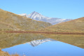
A truly beautiful hike, both for its scenery and the wildlife we encountered. Given the length of this high-mountain trek, we stopped at Pointe du Pisset so that we could fully enjoy the panoramic view at the Col de la Rocheure, near the lake of the same name. This year, despite it being 20 August, there were still plenty of snowfields.
A very quiet walk
Thanks to the author

Machine-translated

NoHa_70
NoHa_70

Overall rating : 3.3 / 5

Date of your route : Aug 02, 2024
Reliability of the description : ★★★☆☆ Average
Ease of following the route : ★★★☆☆ Average
Route interest : ★★★★☆ Good
Very busy route : No

There are a few places where you need to be careful and watch your step, but the view from the top is well worth it.
In bad weather, and especially when visibility is poor, it’s best to avoid the hike as there’s a real risk of getting lost. The lunar landscape is quite uniform and the slopes are very steep in places.
As our ascent (from the Fonds du Four mountain hut – ask the warden for advice on the route!) took place in glorious sunshine and stable weather, we had no problems at all.
The Petite Pointe du Pisset, on the other hand, is less well signposted near its summit.

Machine-translated

Other walks in the area

For more walks, use our search engine .

The GPS track and description are the property of this route's author. Please do not copy them without permission.