Pays:
Pays:

 Commune:


From Gavarnie, head towards Ossoue and Les Espécières, then turn right towards Lac d’Ossoue. Follow the road alongside the Gave d’Ossoue and stop at L’Espugne de Millas (1,714 m), 1.2 km before the Ossoue dam.
(S/E) From the car park, cross the Gave d’Ossoue and head south-west.
(1) At the fork (alt. 1,800 m), carry straight on, still heading south-west.
(2) At the fork, turn right onto theGR®10heading north.
(3) About a hundred metres further on, leave theGR®10by turning left (west/north-west) towards the Montferrat Lakes.
(4) Below Pic Rond, turn right towards the north, heading for Cabanot de Tapou. The path then heads west towards the Montferrat Lakes.
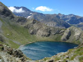
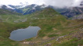
(5) Walk along the northern shore of the lake and the numerous small lakes of Montferrat, heading west. After the lakes, the path is not clearly marked in places but is always marked with cairns and always skirts the rocky outcrops overlooking the lakes. You will reach an unnamed pass between the two peaks.
(6) Turn left to reach the Pic du Milieu.
(7) Descend back towards the unnamed pass.
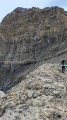
(6) Continue straight on along the north ridge towards the Grand Pic de Tapou. Take care: the start of the ridge is narrow but widens very quickly as you approach the summit. Use your hands for support at the start of the ridge.
(8) From the Grand Pic de Tapou, descend back to the unnamed pass, taking care on the narrow section of the ridge just before the pass.
(6) Back at the pass, turn left and follow the route in reverse to return to the car park (S/E).

 Visorandonneur
 Moyenne
 Tres difficile