Portella Blanca d’Andorra, Pic Negre d’Envalira and Pic d’Engaït

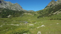
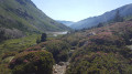
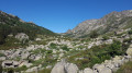
A hike leading to the French-Spanish-Andorran borders via the Chemin des Bonshommes and the final stage ofthe GR®7. It offers an alternative to the classic ascent of Pic Negre d’Envalira and Pic d’Engaït (from Pas de la Casa, which is shorter) through the magnificent Ribera de Campcardós valley.

Details

43205970
Creation:
Last update:
Last review:
  • Walking
    Activity: Walking
  • ↔
    Distance: 14.57 mi
  • ◔
    Average duration: 10h 35 
  • ▲
    Difficulty: Very difficult

  • ⚐
    Back to start: Yes
  • ↗
    Ascent: + 4,429 ft
  • ↘
    Descent: - 4,419 ft

  • ▲
    Highest point: 9,259 ft
  • ▼
    Lowest point: 4,931 ft
  • ⚐ Country: France
  • ⚐
    Area: Pyrenees
  • ⚐ City: Porta (66760)
  • ⚑
    Start/End: N 42.523714° / E 1.82045°
  • ❏
    IGN map(s): Ref. 2249OT, 2249OTR
  • Hour-by-hour weather

Photos

Description of the walk

On the N20, pass under the railway line through a small tunnel opposite the Auberge de Porta, the Campcardos. After the tunnel, turn left, cross over the River Carol and park just to the left in the small car park.
Follow the red and white markings ofthe GR®7to Portella Blanca, then the yellow markings to Pic Negre d’Envalira, following the signposts.

(S/E) From the car park, stay on theGR®7and turn left onto the track heading west. Pass by the drinking water station, head south and join the Ribera de Campcardós.

(1) At the fork, continue straight on due west along theGR®7, following the Ribera de Campcardós.

(2) Walk along the southern bank of the Estany Petit and the Estany Gros and continue alongside the stream. Stay on theGR®7until you reach the Portella Blanca d’Andorra, which marks the border between France, Spain and Andorra.

(3) Turn right, heading due north, onto the path at the foot of the ridge, which descends slightly.

(4) Walk along the eastern shore of the Estany Negre de les Passaderes and continue due north to the Coll dels Isards.

(5) Turn left towards the west to start the easy path along the ridge leading to a small, unnamed pass on the French-Spanish border.

(6) Turn right, heading due north, to climb Pic Negre d’Envalira.

(7) From Pic Negre d’Envalira, return to the unnamed pass.

(6) Turn right towards the south-west, heading for Pic d’Engaït.

(8) From Pic d’Engaït, return to the unnamed pass.

(6) Turn back and follow the ascent route in the opposite direction to return to the car park (S/E).

Waypoints

  1. S/E : mi 0 - alt. 4,931 ft - Carol (rivière) - Affluent du Sègre
  2. 1 : mi 1 - alt. 5,646 ft - Below Cortal Grasset
  3. 2 : mi 2.99 - alt. 6,759 ft - Estany Petit and Estany Gros
  4. 3 : mi 5.67 - alt. 8,251 ft - Portella Blanca d’Andorra
  5. 4 : mi 6.27 - alt. 8,406 ft - Estany Negre de les Passaderes
  6. 5 : mi 6.72 - alt. 8,707 ft - Coll dels Isards
  7. 6 : mi 7.16 - alt. 9,157 ft - Unnamed pass
  8. 7 : mi 7.22 - alt. 9,232 ft - Pic Negre d’Envalira
  9. 8 : mi 7.34 - alt. 9,259 ft - Pic d’Engaït
  10. S/E : mi 14.57 - alt. 4,931 ft - Carol (rivière) - Affluent du Sègre

Notes

There are no technical difficulties on this hike. It is only the distance and the final slopes of the two peaks that make it challenging.

Always be cautious and plan ahead when you're outdoors. Visorando and the author of this route cannot be held responsible for any accidents occurring on this route.

The GR® and PR® markings are the intellectual property of the Fédération Française de Randonnée Pédestre.

Reviews and comments

4.8 / 5
Based on 2 reviews

Reliability of the description
4.5 / 5
Ease of following the route
5 / 5
Route interest
5 / 5
BARRABES
BARRABES

Overall rating : 5 / 5

Date of your route : Aug 06, 2025
Reliability of the description : ★★★★★ Very good
Ease of following the route : ★★★★★ Very good
Route interest : ★★★★★ Very good
Very busy route : Yes

A very beautiful hike in good weather. We chose the shorter version starting from Pas de la Case via the Abelletes pond. The route is well marked until Pic Negre. No problems finding your way, with a magnificent view from the summit.
The climb to the Col des Isards is a bit steep, but after the pass, the climb to the Pic Negre d'Envahira is very easy.

Machine-translated

Pont
Pont
• Edited:

Overall rating : 4.7 / 5

Date of your route : Feb 09, 2023
Reliability of the description : ★★★★☆ Good
Ease of following the route : ★★★★★ Very good
Route interest : ★★★★★ Very good
Very busy route : No

A lovely hike – stunning but long. I did it on touring skis, and the return journey along the Campcardos valley is less tedious on snow than on a summer path.
An alternative is to leave a car at Pas de la Casa and head directly from Pic Negre to Pas de la Casa via the Col des Isards.

Machine-translated

Other walks in the area

For more walks, use our search engine .

The GPS track and description are the property of this route's author. Please do not copy them without permission.