Western Levanna

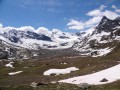
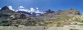
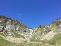
A physically demanding hike requiring a good sense of direction, with a need to carefully follow the cairns and the path leading to the French-Italian border on the Levanna Occidentale, accessible from the retreat of the Derrière les Lacs glacier.
Suitable only for experienced hikers; part of the route is off-trail between the Col des Patriotes and the summit.

Details

n°42387651
Creation:
Last update:
Last review:
  • Walking
    Activity: Walking
  • ↔
    Distance: 11.31 mi
  • ◔
    Duration according to the author: 10 hrs 
  • ▲
    Difficulty: Very difficult

  • ⚐
    Back to start: Yes
  • ↗
    Ascent: + 5,128 ft
  • ↘
    Descent: - 5,115 ft

  • ▲
    Highest point: 11,745 ft
  • ▼
    Lowest point: 6,654 ft

Description of the walk

At Bonneval-sur-Arc, leave the road leading up to the Col de l’Iseran at Pré Catin. Turn right onto the small road towards L’Écot and park in the car park by the dam.

(S/E) Head north-east along the track to the left of the dam, which forms part of theGRP® Tour de la Haute Maurienne. You’ll reach a junction at La Tuilière.

(1) Then turn left, heading due north, to stay on theGRP® and climb through the mountain pastures until you reach a fork at Plan Sec.

(2) Leave theGRP® and turn right onto the Sentier Balcon leading to the Refuge du Carro.

(3) Continue straight on, skirting Lac Blanc along its southern shore. The path is not very visible, so keep a close eye out for the cairns. After the lake, the climb takes you up through scree to the Col des Pariotes.

(4) Continue straight on, heading north-east. Caution: from here onwards, the walk is off-trail and over boulders that are not always stable. Take care where you step.
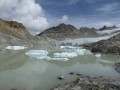
Avoid taking the ridge path that leads directly from the pass to the summit. The start of the ridge is very unstable. It is better to skirt round it lower down, on the northern side, passing above the remainder of the Derrière les Lacs glacier. Depending on the time of year, snowfields may still be present; do not hesitate to climb higher up and stick close to the foot of the ridge.

(5) At the upper edge of the glacier, continue eastwards to reach the north-west ridge of the Levanna. There are numerous cairn-marked paths, and it is not necessary to use your hands to climb. Reach the summit by following the ridge slightly below it.

(6) From the summit, retrace your steps along the same route as on the way up to the Col des Patriotes.

(4) Turn left, heading south, to reach the upper sources of the Arc and a fork in the path.

(7) Turn right, heading due west, and follow the Arc river until you reach the original fork at La Tuilière.

(1) Continue straight on along theGRP®, following the track to reach the Écot dam and the car park (S/E).

Waypoints

  1. S/E : mi 0 - alt. 6,654 ft - Écot Dam
  2. 1 : mi 1.38 - alt. 6,949 ft - Tuilière. Junction of the circular loop - Arc (rivière) - Affluent de l'Isère
  3. 2 : mi 3.62 - alt. 8,852 ft - Map Sec. Fork in the path
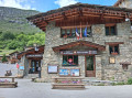
  4. 3 : mi 4.19 - alt. 9,045 ft - Refuge du Carro
  5. 4 : mi 5.49 - alt. 10,049 ft - Junction. Return to the summit - Col des Pariotes (3091m)
  6. 5 : mi 5.96 - alt. 10,817 ft - Derrière les Lacs Glacier
  7. 6 : mi 6.38 - alt. 11,745 ft - Levanna Occidentale (3593m)
  8. 7 : mi 8.56 - alt. 7,785 ft - Le Grand Clos. Junction
  9. S/E : mi 11.31 - alt. 6,654 ft - Écot Dam

Notes

High-mountain hike: only to be undertaken when there is no snow, as snow can remain throughout the summer depending on the year. Otherwise, it is best to go in thesecond half of the summer (August and early September). Ask the warden at the Refuge de Carro for advice on snow conditions.

There’s no need to set off at dawn; allow time for the slabs at the Col des Patriotes to thaw.

Watch out for loose boulders between the pass and the summit.

It is possible to stay overnight at the Refuge de Carro and complete the hike over two days.

Reviews and comments

5 / 5
Based on 1 review

Reliability of the description
5 / 5
Ease of following the route
5 / 5
Route interest
5 / 5
Renard 39
Renard 39

Overall rating : 5 / 5

Date of your route : Jul 29, 2024
Reliability of the description : ★★★★★ Very good
Ease of following the route : ★★★★★ Very good
Route interest : ★★★★★ Very good
Very busy route : No

It’s an easy alpine hike.

Machine-translated

Other walks in the area

For more walks, use our search engine .

The GPS track and description are the property of this route's author. Please do not copy them without permission.