Circular walk around the Pics d’Estaragne, Campbieil and Lentilla

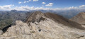
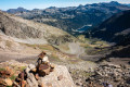
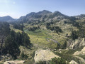
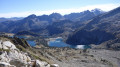
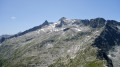
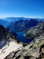
A beautiful circular route passing over three peaks at over 3,000 metres, culminating at Campbieil, which offers a sublime panorama of the Pyrenean massif. The ridge paths are not particularly technical (T2 difficulty), but the significant elevation gain requires a good level of fitness.
Suitable for experienced walkers only

Details

59008949
Creation:
Last update:
Last review:
  • Walking
    Activity: Walking
  • ↔
    Distance: 8.29 mi
  • ◔
    Average duration: 7h 25 
  • ▲
    Difficulty: Very difficult

  • ⚐
    Back to start: Yes
  • ↗
    Ascent: + 4,150 ft
  • ↘
    Descent: - 4,127 ft

  • ▲
    Highest point: 10,358 ft
  • ▼
    Lowest point: 6,778 ft

Description of the walk

From Saint-Lary-Soulan, take the D929 towards the hamlet of Fabian in Aragnouet. Turn right to stay on the D929, and head up the Route des Lacs. Just before Lac d’Orédon, turn left to stay on the D929, and continue up to Lac de Cap de Long. Park in the car park next to the lake and its dam.

(S/E) From the car park, head back down the D929 towards Lac d’Orédon.

(1) Just before the Ruisseau d’Estaragne, at a bend, turn right, heading south, onto a clearly visible path marked with a sign for “Val d’Estaragne”. Head up through the mountain pastures, following the stream.

(2) Shortly after passing the first scree slope and just after a large rock outcrop, turn left, heading south, towards the Pic d’Estaragne (do not take the path on the right leading to the Col d’Estaragne). A cairn marks the junction of the two paths. Continue along the clearly visible path, skirting a rocky outcrop which you’ll need to climb over using your hands (a short, easy climb), just before emerging below the Estaragne ridge. Follow the track through the scree on the northern slope of the Pic d’Estaragne.

(3) Once you reach the peak, descend westwards along a winding path. The path is a little crumbly for the first few metres.

(4) Please note: at this junction, you must take the path to the right, which runs below the ridge. Ignore the path at the top of the ridge, otherwise you’ll have to climb back down through very loose scree to reach the correct path! The correct path turns further on and climbs back up towards the ridge. Follow this ridge path, crossing sloping rock slabs which offer good grip in dry weather, all the way to the Pic de Campbieil (elevation 3,173).

(5) Descend south-west along a clearly visible path, though it is a little steep at the start. You’ll reach a fork in the path, about 150 m past Campbieil.

(6) At this junction, continue straight on along the easy ridge, heading towards the third 3,000-metre peak of the day, the Pic de Lentilla. Just before the summit, the terrain is covered with slate-like rocks.

(7) Reach the summit of the Pic de Lentilla. Descend from the peak, heading west, along a winding path through scree, which rejoins the easy ridge, then head due north towards the Gourg de Cap le Long. Throughout the descent, keep the Lac de Cap le Long in sight.

(8) Reach the Gourg de Cap de Long and follow its eastern bank, slightly above the water. The path is always clearly visible.

(9) Reach a junction in a rocky scree slope which joins the classic path leading up to the Pic de Campbieil. Turn left onto this path, continuing northwards.

(10) Reach an unnamed small lake (elevation 2563), which you go round to the east. From here, vegetation begins to reappear. The path alternates between rocky scree and grassy areas. Cross the Ruisseau de Cap de Long and continue north-east.

(11) At the junction, turn right to walk along the side of Lac de Cap de Long back to the car park (S/E).

Waypoints

  1. S/E : mi 0 - alt. 7,090 ft - Cap de Long Lake car park
  2. 1 : mi 0.89 - alt. 6,824 ft - Estaragne Stream
  3. 2 : mi 2.27 - alt. 8,596 ft - Below the Col d’Estaragne
  4. 3 : mi 3.03 - alt. 9,764 ft - Pic d'Estaragne
  5. 4 : mi 3.36 - alt. 9,623 ft - Junction at 2,930 m
  6. 5 : mi 3.85 - alt. 10,358 ft - Pic de Campbieil
  7. 6 : mi 3.92 - alt. 10,308 ft - Junction at 3,140 m
  8. 7 : mi 4.12 - alt. 10,335 ft - Pic de Lentilla
  9. 8 : mi 4.79 - alt. 9,429 ft - Gourg de Cap le Long
  10. 9 : mi 5.04 - alt. 9,380 ft - Junction at 2,860 m
  11. 10 : mi 5.76 - alt. 8,432 ft - Cap le Long stream
  12. 11 : mi 6.84 - alt. 7,579 ft - Junction at 2,300 m
  13. S/E : mi 8.29 - alt. 7,093 ft - Cap de Long Lake car park

Notes

This hike should only be undertaken when there is no snow and the weather is dry and clear!
The section over the slabs just before Pic de Campbieil may be daunting for those who are less confident, but the rock offers good grip in dry weather. If the slabs are wet, they can become very dangerous and there is a real risk of slipping!

This route passes through a protected area, which may be subject to special regulations:

Reviews and comments

4.5 / 5
Based on 5 reviews

Reliability of the description
4.2 / 5
Ease of following the route
4.5 / 5
Route interest
4.8 / 5
User 30427748

Overall rating : 5 / 5

Date of your route : Aug 08, 2026
Reliability of the description : ★★★★★ Very good
Ease of following the route : ★★★★★ Very good
Route interest : ★★★★★ Very good
Very busy route : No

A superb hike – the views are exceptional.
The climb up to the first peak is relatively straightforward.
You really do need to tackle the slab section beneath Pic de Campbiel when the ground is dry; otherwise, it’s a completely different story.
The ‘detour’ via Pic de la Lentilla is well worth it as it offers the best view of the Gavarnie side.
Be careful, though, not to underestimate the return journey, which is quite long and not particularly easy going.

Machine-translated

User 21820582
• Edited:

Overall rating : 5 / 5

Date of your route : Aug 08, 2026
Reliability of the description : ★★★★★ Very good
Ease of following the route : ★★★★★ Very good
Route interest : ★★★★★ Very good
Very busy route : No

A superb hike.
Breathtaking scenery, some challenging sections, but it’s a real treat to be able to tackle so many 3,000-metre peaks in the Pyrenees in a single day.
You’ll need good kit – boots and walking poles – and you’ll need to be fit as the route is long and steep.
But if you fancy taking in the stunning views from the top of Pic Campbieil, you’ve got to give it a go.

Machine-translated

User 8651722

Overall rating : 4.3 / 5

Date of your route : Jul 28, 2026
Reliability of the description : ★★★★☆ Good
Ease of following the route : ★★★★☆ Good
Route interest : ★★★★★ Very good
Very busy route : No

A lovely hike completed in late July 2026 (no snowfields encountered)
A challenging route with a few technical sections where you need to use your hands (before the summit of Estaragne and the section across the Campbieil slab).
Magnificent 360-degree views from the top of the three peaks. The cairns proved very useful in supplementing the guidebook.

Machine-translated

raylann
raylann

Overall rating : 4.3 / 5

Date of your route : Jul 18, 2026
Reliability of the description : ★★★★☆ Good
Ease of following the route : ★★★★☆ Good
Route interest : ★★★★★ Very good
Very busy route : Yes

Done on 26 June in fine weather. A very beautiful route, moderately difficult for peaks of this calibre. We encountered some difficulty during the ascent of Estaragne at a rocky ridge. The presence of snowfields made it tricky to follow the track. Everyone present took a wrong turn and tried to go round the left. The sections were all quite challenging and required the use of hands. The correct route appears to be on the right, but you only realise this once you’re above the ridge. This problem will probably no longer exist once the snowfields have melted, likely in early or mid-July!
Crossing the slab to Campbieil in dry weather poses no problem. You just need to be (as always) careful about what you’re doing. On the way back, we didn’t cross the river at the final crossing point because the current was too strong, and it would have meant wading into water up to almost mid-calf on slippery stones. We walked back up the path for 200 or 300 metres to go round the hillock running alongside the river. It’s very easy to descend into a small valley with a bit of rocky terrain at the bottom. Keep to the right. You can cross the river easily because, after the section we decided not to attempt, it flows over a waterfall and splits into several branches that you can cross with ease. Then you head back up – again, without any difficulty – to rejoin the path.
A very lovely walk to do.

Machine-translated

User 720659

No markings on the ground, just a few cairns that disappear into the scree. It is essential to follow the GPS track rather than rely on the path.

We had trouble finding our way despite having the necessary equipment suited to the terrain (map, GPS track, mountaineering boots, crampons, etc.).

Despite the directions and the GPS, we lost the trail in the snow before point 3 (below the ridge of the Pic d’Estaragne), even though we were technically equipped for the route and the snowfield crossings. We found ourselves stuck in a scree gully on the north face of the Pic d’Estaragne where there was no firm footing and where the schist crumbled away beneath our hands.
You must absolutely avoid the scree on the north face of Pic d’Estaragne!

Machine-translated

lemarcheur65
lemarcheur65 ★
• Edited:

Hello User 720659

In the introduction, it is written in bold:

⚠️ For experienced walkers only

Under ‘Important information’ it says:

Snow-covered route
This route passes through an area that is currently covered in snow. Please ensure you adapt your approach and equipment accordingly. Check the weather forecast for any potential future snowfall.

Machine-translated

User 720659
• Edited:

Overall rating : 3.5 / 5

Date of your route : Jul 05, 2026
Reliability of the description : ★★★☆☆ Average
Ease of following the route : Not used / Not applicable
Route interest : ★★★★☆ Good
Very busy route : No

The path is very poorly signposted; there are no markings on the ground, just a few cairns that disappear into the scree. It is essential to follow the GPS track rather than rely on the path itself.
Despite the directions and the GPS, we lost the trail in the snow before point 3 (below the ridge of the Pic d’Estaragne), even though we were technically equipped for the route and the snowfield crossings. We found ourselves stuck in a scree gully on the north face of Pic d’Estaragne, where there was no firm footing and the schist crumbled away beneath our hands.
You must absolutely avoid the scree on the north face of Pic d’Estaragne!

Machine-translated

Other walks in the area

For more walks, use our search engine .

The GPS track and description are the property of this route's author. Please do not copy them without permission.