Le Petit Vignemale via the Ossoue Dam

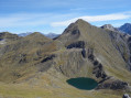
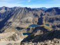
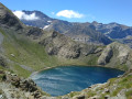
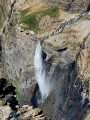
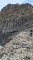
Overlooking its imposing neighbours (the Vignemale and Pique Longue), the Petit Vignemale offers a beautiful panorama of the Vignemale massif and its glacier, as well as the 3,000-metre peaks of the Cirque de Gavarnie.
A high-mountain hike, suitable only for experienced walkers.

Details

42362088
Creation:
Last update:
Last review:
  • Walking
    Activity: Walking
  • ↔
    Distance: 10.59 mi
  • ◔
    Average duration: 8h 40 
  • ▲
    Difficulty: Difficult

  • ⚐
    Back to start: Yes
  • ↗
    Ascent: + 4,347 ft
  • ↘
    Descent: - 4,344 ft

  • ▲
    Highest point: 9,885 ft
  • ▼
    Lowest point: 5,676 ft

Description of the walk

From Gavarnie, head towards Ossoue and Les Espécières, then turn right towards Lac d’Ossoue. Follow the road alongside the Gave d’Ossoue and stop at L’Espugne de Millas (1,714 m), 1.2 km before the dam. It is possible to drive up to the dam, but the road is in poor condition and the small car park fills up very quickly.

Yellow markings + signs

(S/E) From the car park, head up the track (not suitable for vehicles) to the Ossoue Dam.

GR®10signposting

(1) Follow the Gave d’Ossoue along its left bank. From here, walk along theGR®10to the Hourquette d’Ossoue.

(2) Just after the Bellevue Caves, turn right to stay on theGR®10and head towards the Bayssellance refuge.

(3) From the refuge, continue straight on along theGR®10towards the west.

End of signposting

(4) At the Hourquette d’Ossoue, leave theGR®10and turn left, heading due south along a non-technical ridge path. Here, the path is steep all the way to the summit.

(5) Follow the route back in reverse to return to the car park (S/E).

Waypoints

  1. S/E : mi 0 - alt. 5,676 ft - Espugne de Millas - Gave d'Ossoue (cours d'eau) - Affluent du Gave de Gavarnie
  2. 1 : mi 0.82 - alt. 6,033 ft - Barrage d'Ossoue
  3. 2 : mi 3.69 - alt. 7,979 ft - Grottes Bellevue
  4. 3 : mi 4.25 - alt. 8,694 ft - Refuge Baysselance (2651m)
  5. 4 : mi 4.74 - alt. 8,960 ft - Hourquette d'Ossoue (2734m)
  6. 5 : mi 5.3 - alt. 9,875 ft - Petit Vignemale (3032 m)
  7. S/E : mi 10.59 - alt. 5,676 ft - Espugne de Millas

Notes

High-mountain hike: only to be undertaken when there is no snow, particularly between the refuge and the summit. Otherwise, an ice axe and crampons are compulsory. In this case, it becomes a mountaineering expedition.
The path is very well marked and easy to follow.

After the Ossoue Dam, 2.3 km from the start, shortly after the footbridge, the gradient is approximately 19 per cent.

Always be cautious and plan ahead when you're outdoors. Visorando and the author of this route cannot be held responsible for any accidents occurring on this route.

The GR® and PR® markings are the intellectual property of the Fédération Française de Randonnée Pédestre.

Reviews and comments

4.7 / 5
Based on 2 reviews

Reliability of the description
5 / 5
Ease of following the route
5 / 5
Route interest
4 / 5
User 18087987

Overall rating : 5 / 5

Date of your route : Aug 16, 2026
Reliability of the description : ★★★★★ Very good
Ease of following the route : ★★★★★ Very good
Route interest : ★★★★★ Very good
Very busy route : No

A well-known and clearly signposted route, as it is part of the GR10. Difficult, with a section involving a snow bridge over an unstable snowfield.

Machine-translated

User 4406818
• Edited:

Overall rating : 4 / 5

Date of your route : Jun 23, 2025
Reliability of the description : Not used / Not applicable
Ease of following the route : ★★★★★ Very good
Route interest : ★★★☆☆ Average
Very busy route : No

For your information:
- The road to the starting point is closed, which adds 8 kilometres to the journey on paved roads (it's fine in the morning when it's cool, but the return journey in the blazing sun, with no shade and tired legs, is hell!
- The footbridge over the river after the dam is no longer there, having been destroyed by the 2024 floods -> diversion in place
- Wet feet!!! You have to cross several small streams and even with Gore-Tex shoes, the water gets in! This causes your feet to overheat (especially the last 8 kilometres walking on tarmac in the sun!!!).
- The last section after point 4 is the most difficult, with a steep gradient! And the GR markings are fewer and further between, or even absent.

Machine-translated

Other walks in the area

For more walks, use our search engine .

The GPS track and description are the property of this route's author. Please do not copy them without permission.