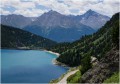
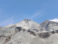
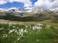
Grand Roc from the Plan d’Amont

Although often overlooked in favour of the Râteau d’Aussois (which is lower) and overshadowed by the Pointe de l’Échelle, the Grand Roc nevertheless offers a stunning view of Mont Blanc, the Écrins and the Haute-Maurienne.

Details

n°59089778
Creation:
Last update:
Last review:
  • Walking
    Activity: Walking
  • ↔
    Distance: 6.96 mi
  • ◔
    Average duration: 6h 45 
  • ▲
    Difficulty: Very difficult

  • ⚐
    Back to start: Yes
  • ↗
    Ascent: + 4,117 ft
  • ↘
    Descent: - 4,094 ft

  • ▲
    Highest point: 10,869 ft
  • ▼
    Lowest point: 6,827 ft

Description of the walk

From Aussois, take the D108 up to Plan d’Aval. Walk alongside the first lake to reach Plan d’Amont and park to the left of the dam.

(S/E) From the car park, turn right onto the path running along the western shore of Plan d’Amont. At the end of the lake, you’ll reach the Pont de la Sétéria.

(1) Turn left onto theGR®5(do not cross the bridge) and head up through the mountain pastures.

(2) At the fork (altitude 2426), leave theGR®5and continue straight on along the path winding upwards to the Col de la Masse. The terrain becomes increasingly rocky.

(3) On reaching the Col de la Masse (elevation 2922), head due north, taking a clearly visible path to the right along the ridge. The ridge is fairly wide and presents no technical difficulty (difficulty rating T3). Continue along this ridge until you reach a small, unnamed pass to the east of the Grand Roc.

(4) Once at the unnamed pass, turn left onto another, steeper ridge (grade T4) to reach the summit of the Grand Roc (elevation 3,316). This ridge is slightly narrower and requires you to use your hands a little, but the large boulders are very stable, providing secure handholds and footholds.

(5) From the summit, return along the same route to the junction at elevation 2,426.

(2) Turn right, heading due south, onto theGR®5for approximately 300 m.

(6) At the junction (alt. 2380 m), leave theGR®5and turn left towards the east to descend towards Plan d’Amont for about 200 m.

(7) At another junction (alt. 2,340 m), turn right towards the south-east in the direction of Le Pisset.

(8) At Le Pisset, continue straight on eastwards to return to the car park (S/E).

Waypoints

  1. S/E : mi 0 - alt. 6,827 ft - Plan d’Amont car park
  2. 1 : mi 0.97 - alt. 7,244 ft - GR5 - Pont de la Sétéria
  3. 2 : mi 1.71 - alt. 7,959 ft - Junction. Elevation 2,426. Return to the summit
  4. 3 : mi 2.94 - alt. 9,590 ft - Col de la Masse (2922m)
  5. 4 : mi 3.65 - alt. 10,584 ft - Unnamed pass
  6. 5 : mi 3.74 - alt. 10,869 ft - Grand Roc
  7. 6 : mi 6.01 - alt. 7,740 ft - Junction (alt. 2,380 m)
  8. 7 : mi 6.13 - alt. 7,661 ft - Junction (alt. 2,340 m)
  9. 8 : mi 6.45 - alt. 7,612 ft - Le Pisset
  10. S/E : mi 6.96 - alt. 6,827 ft - Plan d’Amont car park

Notes

This hike should only be undertaken when there is no snow, particularly between the Col de la Masse and the Grand Roc.
The final ridge may be daunting for those prone to vertigo. The ridge is graded T3 up to the unnamed pass and T4 for the final ridge from the pass to the summit.

Worth a visit

From the Col de la Masse, it is possible to climb up to the Râteau d’Aussois via sections of easy climbing.

Always be cautious and plan ahead when you're outdoors. Visorando and the author of this route cannot be held responsible for any accidents occurring on this route.

The GR® and PR® markings are the intellectual property of the Fédération Française de Randonnée Pédestre.

Reviews and comments

5 / 5
Based on 1 review

Reliability of the description
5 / 5
Ease of following the route
5 / 5
Route interest
5 / 5
millim
millim

Overall rating : 5 / 5

Date of your route : Sep 14, 2026
Reliability of the description : ★★★★★ Very good
Ease of following the route : ★★★★★ Very good
Route interest : ★★★★★ Very good
Very busy route : No

A lovely walk, enjoyed in glorious sunshine with a slight breeze.
The climb to the summit from the Col de la Masse is actually quite manageable, provided you stay alert, of course.
If I were to do it again, I’d walk the circular route in the opposite direction, as the descent from Le Pisset is steep; it would be a more leisurely finish walking alongside the lake.

Machine-translated

Other walks in the area

For more walks, use our search engine .

The GPS track and description are the property of this route's author. Please do not copy them without permission.