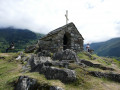
Pic d’Ayré from Lienz

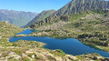
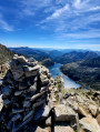
A fairly short hike, but more physically demanding than it appears, featuring a short, exposed ridge to reach thesecond summit of the Pic d’Ayré, which is slightly higher. The summit offers a beautiful view of the 3,000-metre peaks of the Néouvielle range.

Details

58123118
Creation:
Last update:
Last review:
  • Walking
    Activity: Walking
  • ↔
    Distance: 8.57 mi
  • ◔
    Average duration: 6h 35 
  • ▲
    Difficulty: Moderate

  • ⚐
    Back to start: Yes
  • ↗
    Ascent: + 3,045 ft
  • ↘
    Descent: - 3,018 ft

  • ▲
    Highest point: 7,910 ft
  • ▼
    Lowest point: 4,921 ft

Photos

Description of the walk

From Barèges, turn right about 600 metres before the Tournaboup car park onto the road towards the Refuge de la Glère. Drive up through the Bois de Culousque and park in front of the Auberge Chez Louisette

(S/E) From the car park, take a wide forest track heading west. Pass under the old funicular railway.

(1) At a place called Hountaniou, turn off onto the path on the left, heading due east. Pass under the old Ayré funicular railway, and pass under the Étoile ski lift for the first time.

(2) At Sarrat det Tan, turn right onto a path winding uphill, passing under the Étoile ski lift twice, then once more under the old funicular.

(3) At a fork at 1,760 m, ignore the path to the right and continue straight on towards the south-west until you reach another fork.

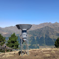
(4) At the Fontaine d’Ayré, turn left to pass beneath the old funicular railway and immediately reach the end of the ski lift. Continue along the winding path uphill until you reach the end of the old funicular railway. From there, continue along the ridge path to the Col d’Ayré (elevation 2,236).

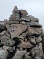
(5) From the pass, continue along the ridge to the summit of the Pic d’Ayré (2,416 metres).

(6) From the Pic d’Ayré, those who wish to do so can take the short ridge to reach thesecond summit, using their hands for support.

(7) From thesecond summit, turn back and return to the Col d’Ayré.

(5) At the pass, leave the ridge path by turning left, heading west, onto a fairly faint track, which is sometimes obstructed by branches. The track winds downwards until it joins a forest track just before a power line.

(8) At a place called Courtaou d’Ayré, rejoin the forest track and take the one on the left to return to the Fontaine d’Ayré, which you passed on the way out.

(4) Turn left onto the north-north-west path, heading in the opposite direction to the outward journey, until you reach the 1,760-metre junction, which you have already passed on the way out.

(3) Turn sharply left onto the path winding downwards to return to the Hountaniou junction, which you have already passed on the way out.

(1) Return to the Lienz car park via the same route as the ascent (S/E).

Waypoints

  1. S/E : mi 0 - alt. 4,928 ft - Lienz car park
  2. 1 : mi 0.72 - alt. 5,210 ft - Hountaniou. Junction: circular loop
  3. 2 : mi 1.36 - alt. 5,430 ft - Sarrat det Tan
  4. 3 : mi 2.08 - alt. 5,741 ft - Junction at 1,760 m, A/R
  5. 4 : mi 2.41 - alt. 5,925 ft - Junction at 1,800 m. Crossroads for the second circular loop
  6. 5 : mi 4.15 - alt. 7,346 ft - Col d’Ayré. Junction at the Pic d’Ayré
  7. 6 : mi 4.57 - alt. 7,884 ft - Pic d’Ayré
  8. 7 : mi 4.69 - alt. 7,900 ft - Second summit 2,422 m
  9. 8 : mi 6.47 - alt. 6,014 ft - Courtaou d’Ayré junction
  10. S/E : mi 8.57 - alt. 4,925 ft - Lienz car park

Notes

There are numerous possible forest tracks. Remember to bring a map or an app to help you find your way.
The ridge leading to thesecond summit may be daunting for those who are afraid of heights. Do not take this route if you do not feel comfortable on this type of terrain.

Reviews and comments

3.9 / 5
Based on 4 reviews

Reliability of the description
4 / 5
Ease of following the route
3.8 / 5
Route interest
4 / 5
User 17288369

I had done the hike just before finding this guide on Visorando.
I found it very interesting that a circular was suggested, as I had done the round trip and the descent via the same route was a little steep in places.
A wonderful hike with magnificent views!

Machine-translated

clara64
clara64

Overall rating : 3 / 5

Date of your route : Aug 22, 2025
Reliability of the description : ★★★☆☆ Average
Ease of following the route : ★★★☆☆ Average
Route interest : ★★★☆☆ Average
Very busy route : No

A pleasant and easy climb, especially in the forest, to the upper station of the funicular railway.
Then a steep and sometimes tricky climb (use your hands) to the pass. We stopped at the pass.
Return through the forest on an unfrequented, marked but unmaintained path. Lots of fallen trees across the path. Difficult to find your way. Better to do a round trip if you're not afraid of descending the steep section between the upper station and the pass.
Otherwise, there is a beautiful view from the pass.

Machine-translated

CH/MY
CH/MY
• Edited:

Overall rating : 3.7 / 5

Date of your route : Jun 17, 2025
Reliability of the description : ★★★★☆ Good
Ease of following the route : ★★★☆☆ Average
Route interest : ★★★★☆ Good
Very busy route : No

A very beautiful hike, partly through woodland. GPS is essential, especially for the return journey via Courtaou d'Ayre, where three hikers had to pass and where an avalanche had knocked down many trees, causing us to lose our way. A return trip is preferable. To reach the summit, be aware that the path is in poor condition in some very exposed sections, so don't hesitate to use your hands.A superb 360° view. Thank you to Guén for this hike.

Machine-translated

Navarre Patrick
Navarre Patrick

Overall rating : 4 / 5

Date of your route : Sep 18, 2024
Reliability of the description : ★★★★☆ Good
Ease of following the route : ★★★★☆ Good
Route interest : ★★★★☆ Good
Very busy route : No

A pleasant walk, a bit of a challenge towards the end but still manageable. There are lots of fallen trees in Ayre Forest, so be careful not to lose your way. Otherwise, it’s a lovely route, mostly through woodland.

Machine-translated

jeanpaulbernard
jeanpaulbernard

Overall rating : 5 / 5

Date of your route : Jul 29, 2024
Reliability of the description : ★★★★★ Very good
Ease of following the route : ★★★★★ Very good
Route interest : ★★★★★ Very good
Very busy route : No

A brilliant hike with a stunning 360-degree view.

Machine-translated

Other walks in the area

For more walks, use our search engine .

The GPS track and description are the property of this route's author. Please do not copy them without permission.