Côte de Lancheton and the Roches Rouges

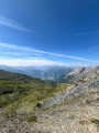
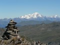
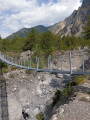
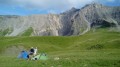
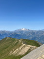
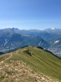
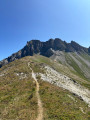
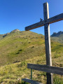
A circular walk in a remote corner of the Maurienne, along a fairly wide ridge path surrounded by mountain pastures and their cows, always with the Grand Perron des Encombres and the Cime de la Scia in view.

Details

n°40518714
Creation:
Last update:
Last review:
  • Walking
    Activity: Walking
  • ↔
    Distance: 8.18 mi
  • ◔
    Average duration: 6h 40 
  • ▲
    Difficulty: Moderate

  • ⚐
    Back to start: Yes
  • ↗
    Ascent: + 3,317 ft
  • ↘
    Descent: - 3,317 ft

  • ▲
    Highest point: 8,337 ft
  • ▼
    Lowest point: 5,220 ft

Photos

Description of the walk

Take the D79A to Montdenis, then the track via Les Rieux to climb up to the Oratoire de Sainte-Brigitte. Park in the bend above La Gardonnière.
Yellow markings and signposts.

(S/E) From the car park, head up towards La Tovière for 50 metres.

(1) Turn left straight away onto a small path running alongside the Biélère. You’ll reach Les Granges.

(2) Turn right onto a track through the woods and continue to the junction with another track.

(3) Turn right towards the Pointe du Télégraphe, along a track, until you reach a sharp right-hand bend.

(4) Continue to the right along the track towards La Chatta Folliet.

(5) Then turn left to start the long ridge path. Stay on the ridge path at all times, avoiding the many paths leading down into the valley, and head for the Cime de Lancheton.

(6) Carry on straight along the ridge until you reach the Col des Roches Rouges.

(7) Carry on straight ahead along the path which descends slightly to pass beneath the Roches Rouges.

(8) Retrace your steps and return to the Col des Roches Rouges.

(7) Turn left, heading down into the valley through the mountain pastures. The path becomes a little hard to follow amongst the tracks left by herds of cows. If in doubt, follow the Ruisseau des Chaumes stream to the Chalet de la Grande Biesse. You’ll come to a fork in the path (alt. 2,250 m).

(9) Continue straight on towards the Chalet de la Grande Biesse, which lies below. Then turn right and cross the Ruisseau des Chaumes.

(10) Turn immediately left, heading due south, towards the Plan du Cuir.

(11) Turn right to reach the Oratoire Sainte-Brigitte, then the car park (S/E).
Waypoints

  1. S/E : mi 0 - alt. 5,390 ft - La Gardonnière
  2. 1 : mi 0.04 - alt. 5,410 ft - La Tovière. Junction of the circular loop
  3. 2 : mi 0.66 - alt. 5,220 ft - Les Granges
  4. 3 : mi 1.12 - alt. 5,413 ft - Below the - Pointe du Télégraphe (1719m)
  5. 4 : mi 1.5 - alt. 5,597 ft - Les Manches
  6. 5 : mi 2.26 - alt. 6,070 ft - Chatta Folliet
  7. 6 : mi 3.74 - alt. 7,920 ft - Cime de Lancheton
  8. 7 : mi 4.57 - alt. 8,219 ft - A/R junction - Col des Roches Rouges (2510m)
  9. 8 : mi 4.82 - alt. 8,337 ft - Les Roches Rouges (2551m)
  10. 9 : mi 5.69 - alt. 7,375 ft - Combe de la Perrière
  11. 10 : mi 6.05 - alt. 7,005 ft - Ruisseau des Chaumes
  12. 11 : mi 7.19 - alt. 6,220 ft - Plan du Cuir
  13. S/E : mi 8.18 - alt. 5,390 ft - La Gardonnière

Notes

As the paths disappear into the mountain pastures on the descent from the Col des Roches Rouges, it remains easy to find your way, as the Chalet de la Grande Biesse and the Plan du Cuir are visible from a distance.

Reviews and comments

4.3 / 5
Based on 2 reviews

Reliability of the description
4.5 / 5
Ease of following the route
3.5 / 5
Route interest
5 / 5
Fabien C.
Fabien C.

Overall rating : 4.3 / 5

Date of your route : Oct 12, 2026
Reliability of the description : ★★★★☆ Good
Ease of following the route : ★★★★☆ Good
Route interest : ★★★★★ Very good
Very busy route : No

Two comments on the route:
The start doesn’t seem quite right to me; I’m not sure whether the path to the oratory is authorised, and what’s more, you have to go back down to Les Granges, whereas if you set off from Notre-Dame-des-Neiges, you climb steadily all the way to Les Granges – it’s marked with yellow and green signs.
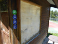
Secondly, the descent from the Col des Roches Rouges is currently signposted with posts spaced every 100 metres: it’s impossible to get lost. And the markers are numbered, both on the ascent and the descent!
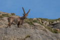
It’s a lovely walk through a stunning mountain pasture surrounded by steep and varied mountains (the Grand Perron des Encombres and the Grands Ouillons) and, the icing on the cake, a herd of ibex awaits us on the small pass behind the Roches Rouges.
What’s more, it’s a very easy walk, not exposed and on gentle, rolling terrain.

Machine-translated

Maudvnlt
Maudvnlt

Overall rating : 4.3 / 5

Date of your route : Jul 22, 2026
Reliability of the description : ★★★★★ Very good
Ease of following the route : ★★★☆☆ Average
Route interest : ★★★★★ Very good
Very busy route : No

A magnificent hike with a panoramic view from the summit!
The start of the climb is very easy, but after that you need to keep a close eye on the markings as the path must be used very, very rarely and you have to guess where it goes rather than just follow it! You go from a proper path to walking across fields and through tall grass (really tall, haha!), but the route remains very pleasant and gives the walk a real sense of the wilderness.
The final climb to the top of the ridges is a bit tough as there are no switchbacks – it’s straight up – but the view from the top is breathtaking and magnificent! After that, the path follows the ridges; the start of the trail is a bit ‘tricky’, involving a section on a slight slope with a drop-off on one side – for those prone to vertigo, this can be challenging. As I’m prone to vertigo but didn’t fancy turning back, we pressed on anyway, feeling our way with our walking poles and using our hands where necessary. After the tricky bit, the path continues along the ridges but without the drop-off at the side; it becomes a normal, standard path again, still offering stunning views of the surrounding peaks.
The descent is very pleasant too; we came across herds of cows along the way. The section through the forest is lovely and offers a bit of shade.
We didn’t come across a single person throughout the entire walk – a beautiful, off-the-beaten-track route that allows you to enjoy it to the full!

Machine-translated

Other walks in the area

For more walks, use our search engine .

The GPS track and description are the property of this route's author. Please do not copy them without permission.