Pic Hourgade via the Lacs de Nère and des Hermitans from Peyresourde

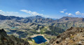
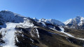
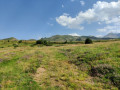
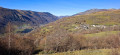
A summit that must be earned after a long and gruelling ascent, Pic Hourgade offers stunning views of the 3,000-metre peaks in the French and Spanish Pyrenees, passing by lakes nestled in their small cirques. Once you’ve left the resort of Peyresourde, you soon feel alone on the paths. It’s just you and the mountains.

Details

n°58190237
Creation:
Last update:
Last review:
  • Walking
    Activity: Walking
  • ↔
    Distance: 10.85 mi
  • ◔
    Average duration: 9h 10 
  • ▲
    Difficulty: Very difficult

  • ⚐
    Back to start: Yes
  • ↗
    Ascent: + 4,770 ft
  • ↘
    Descent: - 4,754 ft

  • ▲
    Highest point: 9,685 ft
  • ▼
    Lowest point: 5,240 ft

Description of the walk

From the Col de Peyresourde, take the D117 towards the ski resort (1,600 m), and park at the start of the ‘Le Privilège’ chairlift.

(S/E) From the car park, take the wide path heading south.

(1) Shortly after the start of the Cabanou ski lift, leave the wide path at a bend to take a small grassy track heading south-west. Then join another wide path below the Plateau ski lift. Continue until you reach the Pène de Magnéras, just past a water reservoir.

(2) Carry on for 100 m and leave the wide path to take a small track at the bend after the Pène de Magnéras. The track heads first south-west, then quickly south-east.

(3) At the 1905 mark, turn left onto theGR®10.

(4) 100 m further on, leave theGR®10by taking the path on the right heading due south along the Ruisseau de Nère. Pass a few rocky ledges – none of which are technically difficult – to reach the first lakes.

(5) Pass between the two smallest of the Lacs de Nère, continuing southwards.

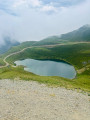
(6) Reach the largest of the Lacs de Nère, and follow a path up its eastern shore without skirting it. The path heads first south-east, then south. It passes beneath the Pic de Nère and turns westwards, towards the Lac des Hermitans.

(7) Walk along the northern shore of this lake, heading west to join a clearly visible but very steep scree path, leading up to a crumbling gully. Cross this gully, clinging to the rocks on the right for easier progress, to reach the start of the ridge path.

(8) Take the ridge path on your left, heading south, using your hands for support until you reach the summit.

(9) From the summit, head back to the small Lacs de Nère via the same route you took on the way up.

(5) Then turn off onto the path on the right, heading towards Couret d’Esquierry. Halfway along, climb down a small rocky outcrop, using your hands for support.

(10) Cross theGR®10without joining it, and take a path heading north-west until you reach the junction at Pène de Magnéras, which you passed on the way out.

(2) Turn right, following the path in the opposite direction to the outward journey, to return to the car park (S/E).

Waypoints

  1. S/E : mi 0 - alt. 5,243 ft - Peyresourde car park
  2. 1 : mi 0.45 - alt. 5,528 ft - Cabanou junction
  3. 2 : mi 0.92 - alt. 5,797 ft - Pène de Magnéras
  4. 3 : mi 2.87 - alt. 6,253 ft - GR10. Altitude 1905
  5. 4 : mi 2.93 - alt. 6,375 ft - Nère stream
  6. 5 : mi 4.03 - alt. 7,841 ft - Small lakes of Nère - Lacs de Nère
  7. 6 : mi 4.23 - alt. 7,989 ft - Grand Lac de Nère - Lacs de Nère
  8. 7 : mi 4.97 - alt. 9,177 ft - Lac des Hermitans (2860m)
  9. 8 : mi 5.15 - alt. 9,587 ft - Ridge path
  10. 9 : mi 5.23 - alt. 9,678 ft - Pic de Hourgade 2964m
  11. 10 : mi 7.5 - alt. 6,991 ft - Couret d’Esquierry
  12. S/E : mi 10.85 - alt. 5,240 ft - Peyresourde car park

Notes

This hike should only be undertaken when there is no snow and in dry weather to ensure you can safely navigate the rocky outcrops and the final ridge
Off-trail hike between Lac des Hermitans and Pic Hourgade.

Always be cautious and plan ahead when you're outdoors. Visorando and the author of this route cannot be held responsible for any accidents occurring on this route.

The GR® and PR® markings are the intellectual property of the Fédération Française de Randonnée Pédestre.

Reviews and comments

4.2 / 5
Based on 2 reviews

Reliability of the description
4.5 / 5
Ease of following the route
3.5 / 5
Route interest
4.5 / 5
smashdc
smashdc

Overall rating : 4.7 / 5

Date of your route : Jul 09, 2025
Reliability of the description : ★★★★★ Very good
Ease of following the route : ★★★★☆ Good
Route interest : ★★★★★ Very good
Very busy route : No


** Please note:
Part One:
No chairlifts (they’ve been dismantled). Heading up the side of the ‘hill’ along a path that’s not very wide at all (between 1.5 feet and 2.5 feet wide :-o) and slightly downhill. Just under 1.5 km
It’s a bit nerve-wracking as the ravine is very often close by (a short drop right in front of us)!!! So I’m taking it very slowly. Very slowly… And it’s a long way! Some sections are a bit tricky!
On the way back, though, my nerves settled because I think it’s uphill (not by much: 80 m elevation gain).
You’d better not have even a hint of a fear of heights, otherwise it’s goodbye!

Final climb:
I can clearly see the path to the pass before the Pic de Hourgade ( 2,950 m). It looks fine, except that…
… towards the end: a scree slope about fifty metres long (before the pass)…
At first it’s fine, but then it’s just fine soil or loose scree, so there’s no grip.
I went round the right because on the left it looked very crumbly right from the start and there weren’t really any stones to plant your feet on. And it’s quite slippery too (maybe too much)!
I managed to get up with great difficulty, using my hands a lot, and it was touch and go… balancing on my right side on the vertical slabs where there were handholds that were just, and I mean just, big enough!

Once I reached the top of the pass…: how on earth do I get down? A tumble is guaranteed because there are no rocks to brace my feet against, and even with the poles (as on the way up), it’s a nightmare!!!
With a gradient of 35 to 45 per cent and no real handholds. I’m not feeling confident at all! Even though I didn’t really have time to look at the left-hand side (on the way up), where I reckon it’s not much better…
Too many sections? Too much gully erosion? It doesn’t look like it’s part of the GR… It’s getting damaged by this slope too!
I very much doubt that the group of pensioners we passed earlier (heading downwards before Lac des Hermitans, without sleeping bags) went that way, given how dangerous it is going down (or perhaps they used ropes). And it looks as though there’s another path on the other side.
Phew! Made it to the pass!

  • The full hiking video coming soon…

The aim is to get to the peak, but either I can’t see the path (I don’t think so) or you have to cross some sharp ridges. Er… that’s a bit much! After a 1,400-metre climb :-o (and 250 km already under my belt)
So never mind, I’m not going there :-( And I’ve got to get down: how?? That’s the main thing to think about! I can see a path below the pass but after that, nothing really…
It’s no worse than the descent down the ‘chimney’ that I don’t want to attempt… I’ll go round it and take the longer route.
A tricky section where you can’t afford to slip up, and it adds a bit to the distance as I’m going round it.
Another tricky bit, and after that there’s some scrambling over the rocks, though it’s not exactly easy.
Phew!!
Experience (to be objective): 8,500 km of hiking up to 2,000 m elevation gain/loss
Tip: stop at the last lake or before the chimney (you’ll see the lake from above), especially if you’re on your own and/or tired, so you don’t get stuck at the top.

A top hike nonetheless, given the enormous lakes :-)
🌍 All my thousands of km of hikes 🎬 ALL OF FRANCE #toutelafrance @JeuxVoyages 💥
https://www.youtube.com/c/JeuxVoyagesIns...

Machine-translated

Tigrounou
Tigrounou

Overall rating : 3.7 / 5

Date of your route : Jun 29, 2025
Reliability of the description : ★★★★☆ Good
Ease of following the route : ★★★☆☆ Average
Route interest : ★★★★☆ Good
Very busy route : No

The route is not easy to follow in the Peyresourde resort due to numerous poorly marked paths in the grass. GPS is essential to find your way.
Between Esquirry and the first lake, there is a traverse along the side of the mountain with some exposed and dangerous sections where one wrong step could send you over the precipice.
This hike should be avoided if you are prone to vertigo due to the exposed sections.
If you have difficulty with the first challenge, do not persist and turn back, as the rest of the hike is similar.
It is not just a question of being in very good physical condition, but rather of having sure footing on the numerous slippery scree slopes, which are genuinely dangerous.
The rocky outcrop at point 8 can be bypassed by climbing over the top, although it does offer good handholds (in dry weather).
All in all, a very beautiful route with stunning scenery, but only for the most experienced climbers.
Do not take unnecessary risks as there is a high risk of falling.

Machine-translated

Other walks in the area

For more walks, use our search engine .

The GPS track and description are the property of this route's author. Please do not copy them without permission.