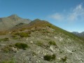
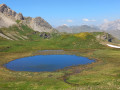
Grand Glaiza and the Malrif Lakes from Les Fonts de Cervières

A long walk through the Pierre Rouge valley to reach the Grand Glaiza via the Crête aux Eaux Pendantes and its rocky landscape, with the return route passing through the Lacs du Malrif to return to greenery.

Details

106849934
Creation:
Last update:
Last review:
  • Walking
    Activity: Walking
  • ↔
    Distance: 11.75 mi
  • ◔
    Average duration: 9h 50 
  • ▲
    Difficulty: Very difficult

  • ⚐
    Back to start: Yes
  • ↗
    Ascent: + 5,056 ft
  • ↘
    Descent: - 5,020 ft

  • ▲
    Highest point: 10,725 ft
  • ▼
    Lowest point: 6,703 ft

Description of the walk

From Cervières, take the road leading to Les Fonts de Cervières, passing through the hamlet of Le Bourgea. Park in the car park next to the refuge.

(S/E) From the car park, take the GR®58 heading south towards a footbridge.

(1) Cross the footbridge over the Torrent de Pierre Rouge, then take the path on the left to enter the Pierre Rouge valley through the mountain pastures to the Col du Petit Malrif. Just before the final climb to the pass, the mountain pastures give way to stony ground, which you’ll remain on until the descent to the lakes.

(2) Turn left to climb to the Pic du Malrif along a well-marked path signposted by the GR®58.

(3) At the summit of the Pic de Malrif, continue left towards the north to reach the Col de Malrif.

(4) Leave the GR®58 and carry on straight ahead along the easy path of the Crête aux Eaux Pendantes until you reach the Grand Glaiza.

(5) Turn back along the ridge to return to the Pic du Malrif.

(3) Continue to the left along the ridge path, clearly visible from the summit, heading south to reach Lac du Grand Laus.

(6) Cross the GR®58 path and walk along the southern shore of Lac du Grand Laus. Pass a rocky outcrop to reach Lac Mézan.

(7) Turn right and follow the lake along its northern shore. Cross another rocky outcrop to reach Lac du Petit Laus.

(8) Walk along the eastern shore of this lake and continue along the path heading north, then turn north-east to reach an unnamed pass. At this pass, continue to the right along the easy ridge path leading to the Col du Petit Malrif, which you passed on the way out.

(2) Turn left onto the GR®58 to return to the car park via the same route as on the way out (S/E).

Waypoints

  1. S/E : mi 0 - alt. 6,703 ft - Fonts de Cervières - Refuge des Fonts de Cervières
  2. 1 : mi 0.14 - alt. 6,729 ft - Footbridge
  3. 2 : mi 3.2 - alt. 9,288 ft - Junction of the Circular Lakes Loop - Petit col du Malrif
  4. 3 : mi 3.32 - alt. 9,531 ft - Junction. Return to the summit via the ridge - Pic du Malrif
  5. 4 : mi 3.56 - alt. 9,439 ft - Col du Malrif
  6. 5 : mi 4.85 - alt. 10,702 ft - Grand Glaiza (le)
  7. 6 : mi 7.12 - alt. 8,471 ft - Lac du Grand Laus
  8. 7 : mi 7.48 - alt. 8,793 ft - Lac Mézan
  9. 8 : mi 7.74 - alt. 8,970 ft - Lac du Petit Laus
  10. S/E : mi 11.75 - alt. 6,709 ft - Fonts de Cervières - Refuge des Fonts de Cervières

Notes

This walk should only be undertaken when there is no snow and in dry weather, particularly on the ridge path leading to the Grand Glaiza.

Worth a visit

Do feel free to stop off at the Refuge des Fonts after the walk – you’ll receive a very warm welcome!

Always be cautious and plan ahead when you're outdoors. Visorando and the author of this route cannot be held responsible for any accidents occurring on this route.

The GR® and PR® markings are the intellectual property of the Fédération Française de Randonnée Pédestre.

Other walks in the area

For more walks, use our search engine .

The GPS track and description are the property of this route's author. Please do not copy them without permission.