


diggi

 Visorando Member
 Premium user
 - Location: Gap (05000)
- Gender: man
Sign up:
Published route(s)
 Below the Cuchon de Charance via the Chapelle de Sauveterre (return via Rougier)
 2.98 mi
 +1,283 ft
 -1,283 ft
 2h 30
2h 30
 Moderate
 Departure from La Roche-des-Arnauds (Hautes-Alpes)
A short circular family walk (suitable for a 6-year-old who walks well) to enjoy the south-westerly views from Charance sur Cëuze, Pic de Bure, Lure, Gap, La Roche-des-Arnaud and Montmaur, all the way to Le Morgon.
Tête de la Plane and Dent de Gigors
 4.96 mi
+1,936 ft
-1,959 ft
4h 00
Moderate
Departure from Gigors (Alpes-de-Haute-Provence)
4.96 mi
+1,936 ft
-1,959 ft
4h 00
Moderate
Departure from Gigors (Alpes-de-Haute-Provence)
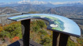
The walk takes place in a beech forest and the highest point of this hike, above Gigors—the Tête de la Plane—is the reward for a pleasant but steep climb. The view over the Turriers plain is superb and is complemented by an orientation board describing the surrounding peaks.
From Col du Tourrond to Notre-Dame du Laus
 6.01 mi
+1,460 ft
-1,444 ft
4h 00
Moderate
Departure from Jarjayes (Hautes-Alpes)
6.01 mi
+1,460 ft
-1,444 ft
4h 00
Moderate
Departure from Jarjayes (Hautes-Alpes)
A circular path in the forest above the sanctuary of Notre-Dame du Laus offers numerous views of the Avance Valley, Notre-Dame du Laus, Céüze, Bure, Charance, Gleize and the peaks of Champsaur, all the way to Mont Guillaume. No particular difficulty.
The Selle Viaduct
 2.97 mi
+659 ft
-676 ft
1h 55
2.97 mi
+659 ft
-676 ft
1h 55
 Easy
Departure from Gap (Hautes-Alpes)
Easy
Departure from Gap (Hautes-Alpes)
Explore the viaduct (55 m high and 200 m long), a truly impressive engineering feat, part of the
railway line between Briançon and Veynes, overlooking the Selle torrent. A stone’s throw from Gap town centre, with an orientation table overlooking the whole of the Gapençais region.
Forti di Genova
 4.76 mi
+1,030 ft
-1,043 ft
3h 05
Easy
Departure from Genoa
4.76 mi
+1,030 ft
-1,043 ft
3h 05
Easy
Departure from Genoa
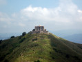
The forts of Genoa are a series of military fortifications dating from different periods that the Republic of Genoa built to defend the urban territory of the Ligurian capital throughout its history. The construction projects were also resumed and used during the Napoleonic era, the Risorgimento and during the First and Second World Wars.This defensive system represents the longest city walls in Europe and the second longest in the world.
The Furmeyer botanical trail and the Fays circular route
 2.71 mi
+696 ft
-696 ft
1h 50
Moderate
Departure from Furmeyer (Hautes-Alpes)
2.71 mi
+696 ft
-696 ft
1h 50
Moderate
Departure from Furmeyer (Hautes-Alpes)
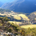
A lovely botanical route through varied habitats, starting with Mediterranean vegetation in the lower section and moving to alpine vegetation on the north-facing slopes of Le Faï. The numerous information boards highlight the area’s heritage but, above all, the plants, making the route suitable for walking in spring as well as in summer or autumn. However, May and June are the best months if you wish to see the flowers.
Not to mention the beautiful views over the Veynois and the Dévoluy.
Beaume waterfall
 4.80 mi
+1,568 ft
-1,545 ft
3h 35
Moderate
Departure from La Beaume (Hautes-Alpes)
4.80 mi
+1,568 ft
-1,545 ft
3h 35
Moderate
Departure from La Beaume (Hautes-Alpes)
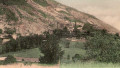
A varied hike to discover the village of La Beaume from the heights, Haute-Beaume and the surrounding area. There are many attractions: an old hermitage (in ruins), the Beaume waterfall, and flora and fauna.
Please note: this hike is not suitable for everyone, as the slopes are steep and the path is narrow and rugged in several places. It is reserved for fairly fit hikers. There is a steep climb early on.
The Curbans slate tiles
 6.12 mi
+1,293 ft
-1,293 ft
3h 55
Moderate
Departure from Curbans (Alpes-de-Haute-Provence)
6.12 mi
+1,293 ft
-1,293 ft
3h 55
Moderate
Departure from Curbans (Alpes-de-Haute-Provence)
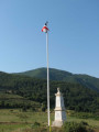
A spring walk with panoramic views of the Montagne d’Aujour and the Ceüse cliff, all the way to Bure and the old village of Chaillol!
The La Bâtie-Vieille historical trail
 3.59 mi
+545 ft
-518 ft
2h 05
Easy
Departure from La Bâtie-Vieille (Hautes-Alpes)
3.59 mi
+545 ft
-518 ft
2h 05
Easy
Departure from La Bâtie-Vieille (Hautes-Alpes)
A peaceful walk to discover some of the historical curiosities of La Bâtie-Vieille, but above all beautiful panoramic views of the Champsaur and Gapençais mountains (Charance, Chapeau de Napoléon, Piolit, Les Parias, Aiguilles de Chabrières, etc.).A trail with information panels.
On the heights above Lake Pelleautier
 3.93 mi
+528 ft
-525 ft
2h 15
Easy
Departure from La Freissinouse (Hautes-Alpes)
3.93 mi
+528 ft
-525 ft
2h 15
Easy
Departure from La Freissinouse (Hautes-Alpes)
An easy walk starting from Lake Pelleautier, with stunning views over the Gap region and the surrounding mountains.
Below the Corniche de Céüse and Lake Pelleautier
 9.76 mi
+1,335 ft
-1,329 ft
5h 40
Moderate
Departure from La Freissinouse (Hautes-Alpes)
9.76 mi
+1,335 ft
-1,329 ft
5h 40
Moderate
Departure from La Freissinouse (Hautes-Alpes)
Starting from Lake Pelleautier, enjoy a pleasant hike at the foot of Montagne de Céüse along the long forest road dominated by cliffs and offering superb panoramic views.
The Ceüse Forest Heritage Trail and the Sigot nursery
 5.38 mi
+1,171 ft
-1,142 ft
3h 30
Moderate
Departure from Sigoyer (Hautes-Alpes) (Hautes-Alpes)
5.38 mi
+1,171 ft
-1,142 ft
3h 30
Moderate
Departure from Sigoyer (Hautes-Alpes) (Hautes-Alpes)
This path leading to the Sigot Nursery allows you to discover the site’s forestry, human and historical heritage, starting with the Grotte des Maquisards.
This lovely, easy walk is dotted with wooden sculptures and information boards. Picnic tables are provided so you can enjoy a comfortable lunch break.
After a gentle warm-up as you climb up a wide track, you’ll reach the Blocs de Céüse area and the Grotte des Maquisards. The forest track continues along the hillside, then you’ll take a path restored by the ONF which leads you to the former Sigot Nursery before heading back down to the starting point.
Notre-Dame de Bois Vert - Les Farelles, via Clot de Ventecul
 4.23 mi
+778 ft
-787 ft
2h 35
Easy
Departure from La Fare-en-Champsaur (Hautes-Alpes)
4.23 mi
+778 ft
-787 ft
2h 35
Easy
Departure from La Fare-en-Champsaur (Hautes-Alpes)
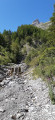
A walk in the Notre-Dame de Bois-Vert forest, on the mountainside with a magnificent view of the Champsaur valley and its typical bocage landscape.The Notre-Dame de Bois-Vert sanctuary is a true haven of peace!
Valsesia Alagna Glaciological Trail
 4.75 mi
+2,228 ft
-2,205 ft
4h 05
Moderate
Departure from Alagna Valsesia (Piedmont)
4.75 mi
+2,228 ft
-2,205 ft
4h 05
Moderate
Departure from Alagna Valsesia (Piedmont)
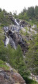
This trail will take you into the Alta Valsesia Nature Park, at the bottom of the valley beyond the village of Alagna.
This route features eight information boards describing the glacier’s evolution as it passes through the Alpe Bors cirque.
The Glaciological Trail forms part of the Alta Valsesia Nature Park, beyond Alagna. Along the route, you’ll have the chance to stop at a number of information boards (eight in total) situated at vantage points offering a clear view of the glacier’s evolution and the glacial cirque, which is clearly visible from Alpe Bors, halfway along the trail.
The Puits des Bans from Saint-Disdier
 3.39 mi
+512 ft
-512 ft
2h 00
Easy
Departure from Saint-Disdier (Hautes-Alpes)
3.39 mi
+512 ft
-512 ft
2h 00
Easy
Departure from Saint-Disdier (Hautes-Alpes)
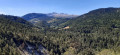
A shaded path starting from the church at Saint-Disdier, which runs along the banks of the Souloise to the Puits des Bancs. After crossing the torrent via footbridges, part of the route is somewhat steep but secured by cables and rungs to reach the top of the gorges.
A true natural gem in the heart of the Dévoluy, the luckiest visitors may spot brown trout and red-legged frogs, not to mention stunning views of the Dévoluy peaks.
Ichthyosaur Geological Site
 2.50 mi
+577 ft
-577 ft
1h 40
Easy
Departure from La Robine-sur-Galabre (Alpes-de-Haute-Provence)
2.50 mi
+577 ft
-577 ft
1h 40
Easy
Departure from La Robine-sur-Galabre (Alpes-de-Haute-Provence)
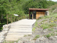
This easy hike takes you to a fossil of an ichthyosaur, a large marine reptile measuring over 4 m and dating back 183 million years. The trail runs along a fairly cool ravine before climbing up a slope covered with downy oak and beech trees to the Col du Jas. The archaeological site is located 200 m after the pass.
Around Lazer, beneath the Saint-Genis ridge
 5.36 mi
+479 ft
-482 ft
2h 55
Easy
Departure from Lazer (Hautes-Alpes)
5.36 mi
+479 ft
-482 ft
2h 55
Easy
Departure from Lazer (Hautes-Alpes)
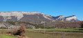
A family walk through the Buëch countryside, beneath the cliff face of the Saint-Genis ridge and near the ruined castle of Arzeliers.
A circular route via the Col and Pic de la Gardette from Les Gourniers
8.40 mi
+2,966 ft
-2,963 ft
6h 25
Moderate
Departure from Réallon (Hautes-Alpes)
A lovely circular route through the mountain pastures of the Réallon valley (Écrins National Park), offering stunning views amidst the wildlife. The panoramic view from the heights looks out over the southern Écrins, including the Mourre Froid and the Aiguilles de Chabrières.
The suggested route has several alternatives. It is possible to shorten it considerably (saving 1 to 1½ hours) by not continuing on to the peak after the Col de la Gardette, and by cutting across towards Les Tomelles rather than descending to the stream.
It is also possible to do a simple round trip by returning along the same route once you reach the pass.
Col de la Gardette en boucle depuis les Gourniers (variante courte)
7.47 mi
+2,306 ft
-2,287 ft
5h 25
Moderate
Departure from Réallon (Hautes-Alpes)
Une belle boucle dans les alpages du vallon de Réallon (Parc National des Écrins), avec des belles vues au milieu de la faune sauvage. Le panorama en hauteur donne sur le Sud des Écrins avec le Mourre Froid, les Aiguilles de Chabrières. Il s'agit d'une variante courte de la boucle, sans aller jusqu'au pic après le Col de la Gardette, et en "coupant" vers les Tomelles plutôt que de descendre jusqu'au torrent.
Circular Piolit loop via Les Chirouzes
8.28 mi
+3,438 ft
-3,435 ft
6h 50
 Difficult
Departure from Chorges (Hautes-Alpes)
Difficult
Departure from Chorges (Hautes-Alpes)
A challenging hike to the Piolit via a little-used route with a significant elevation gain.A beautiful climb through flower-filled mountain pastures, followed by a more rocky landscape, before admiring the first 3,000-metre peaks of the Écrins to the north and Lake Serre-Ponçon to the south on the horizon.
Botanical Trail and Saint-Sixte Chapel
 3.61 mi
+1,214 ft
-1,188 ft
2h 45
Moderate
Departure from Bréziers (Hautes-Alpes)
3.61 mi
+1,214 ft
-1,188 ft
2h 45
Moderate
Departure from Bréziers (Hautes-Alpes)
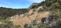
A circular walk to reach the Saint-Sixte Chapel and descend via the Bréziers road. The highest point offers a stunning panoramic view of the Bréziers valley and the Durance valley, with the peaks of Céüse, Bure and Mont Colombis in the background.
Be careful, there are two options for the end of the route: either via a wide track and then the road (safer but longer), or go ‘off-trail’ tocut across fields and a stream to reach the D951 road (shorter but more difficult).
Montsérieux ridge to Venterol
6.89 mi
+1,650 ft
-1,647 ft
4h 35
Moderate
Departure from Venterol (Alpes-de-Haute-Provence)
A walk starting from Venterol, mainly through woodland, with views of the Écrins (to the north), the Ubaye (to the east) and the Dévoluy (to the north-west). A short stretch along the ridge to the summit of Montsérieux, which offers a beautiful panorama of the Durance valley, the Champsaur, the Dévoluy and the Dormillouse massif.
The Sainte-Croix of La Saulce
7.47 mi
+2,333 ft
-2,329 ft
5h 30
Moderate
Departure from La Saulce (Hautes-Alpes)
A varied hike visiting the villages of La Saulce, Lardier and Valença, crossing the vast forests of the Bois de la Pinée. The highlight is the view from Sainte-Croix, a true promontory overlooking the Durance valley.
Céüsette (or Petite Céüse) from Les Guérins via the GRP®
3.07 mi
+1,194 ft
-1,171 ft
2h 25
Difficult
Departure from Sigoyer (Hautes-Alpes) (Hautes-Alpes)
Just a stone’s throw from the Montagne de Céüse and its famous limestone cliffs, the Petite Céüse offers a magnificent view of the cliff, the Gap basin and the peaks of the Écrins.
The summit of the Barre de la Roche-des-Arnauds via a circular route from Les Baux
6.60 mi
+3,012 ft
-2,999 ft
5h 40
Moderate
Departure from La Roche-des-Arnauds (Hautes-Alpes)
A climb to the summit of La Barre overlooking La Roche-des-Arnauds, passing through the Col des Roux and a circular route before the descent back to the mountain pasture. The ridge offers a panoramic view of the Upper Buëch valley, and the circular route allows you to discover the cabrettes, a remarkable piece of forestry heritage.
La Roche-des-Arnauds: Distillery Route (from the tower to Petit Buëch)
 5.55 mi
+860 ft
-853 ft
3h 20
Moderate
Departure from La Roche-des-Arnauds (Hautes-Alpes)
5.55 mi
+860 ft
-853 ft
3h 20
Moderate
Departure from La Roche-des-Arnauds (Hautes-Alpes)
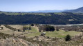
An easy route to climb above La Roche-des-Arnauds, passing under the cliffs of La Barre and along the bucolic banks of the Petit Buëch. With a panoramic view from the ruins of the tower.
La Barre, Col des Roux and Col de Garcinel as seen from Les Baux
10.42 mi
+3,284 ft
-3,310 ft
7h 40
Difficult
Departure from La Roche-des-Arnauds (Hautes-Alpes)
A circular route along the Barre ridge overlooking La Roche-des-Arnauds and descending through the Matacharre Forest, with beautiful panoramic views over the Haut Buëch valley.
The Pic de Gleize (long loop via the Chaudun circular trail)
5.53 mi
+2,028 ft
-2,011 ft
4h 20
Moderate
Departure from Gap (Hautes-Alpes)
A climb to the Pic de Gleize from the pass of the same name and a descent via the Chaudun circular trail to enjoy a beautiful route with little elevation gain but lots of rockfall.
From Bayard Golf Course to the Drac Canal
6.28 mi
+594 ft
-577 ft
3h 25
Moderate
Departure from Gap (Hautes-Alpes)
A lovely circular route offering a varied 360° view, with little elevation gain.
Bayard Plateau fitness trail
3.82 mi
+266 ft
-249 ft
2h 00
Easy
Departure from Gap (Hautes-Alpes)
This refreshing walk on the Col Bayard takes you into the heart of a plateau dedicated to sports enthusiasts at an altitude of 1,300 metres! A fairly gentle and varied route, with paths through the woodland, shaded trails and small hills with a slight elevation gain. Breathtaking views over the Champsaur.
Grand tour of Golf Bayard to the Drac Canal
6.07 mi
+591 ft
-574 ft
3h 20
Easy
Departure from Gap (Hautes-Alpes)
A beautiful circular loop around the Col Bayard oxygenation centre, very varied and without any significant elevation gain, offering 360-degree views and breathtaking vistas of the Champsaur.
Chapeau de Napoléon
 2.56 mi
+774 ft
-774 ft
1h 50
Easy
Departure from La Rochette (Hautes-Alpes) (Hautes-Alpes)
2.56 mi
+774 ft
-774 ft
1h 50
Easy
Departure from La Rochette (Hautes-Alpes) (Hautes-Alpes)
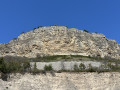
An iconic cliff and viewpoint in the Gap area, the Chapeau de Napoléon is easily accessible and offers breathtaking views of the Avance valley and the Gap basin.
La Petite Autane and the Rouanne balconies
9.21 mi
+3,251 ft
-3,248 ft
7h 05
Difficult
Departure from Ancelle (Hautes-Alpes)
This ascent to the Petite Autane leads to a popular viewpoint offering multiple 360° panoramic views of the Champsaur and the Écrins. The descent along the ledges through the mountain pastures allows you to enjoy the pretty Rouanne valley.
The Tour de la Gerle
 2.40 mi
+584 ft
-568 ft
1h 35
Easy
Departure from La Roche-des-Arnauds (Hautes-Alpes)
2.40 mi
+584 ft
-568 ft
1h 35
Easy
Departure from La Roche-des-Arnauds (Hautes-Alpes)
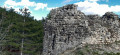
A short family circular on the heights of La Roche-des-Arnauds, with waterfalls, a scenic path and, finally, the remains of a castle offering a view of the village!
Col de Rouannette – La Coupa, circular route
10.66 mi
+3,488 ft
-3,514 ft
7h 55
Difficult
Departure from Ancelle (Hautes-Alpes)
A very beautiful high-altitude walk through the Rouanne mountain pastures, and not particularly difficult, apart from the climb to La Coupa, a rugged summit. The views over the Rouanne cirque are magnificent.
From Col de Gleize to Col de Guizière
 5.31 mi
+1,535 ft
-1,535 ft
3h 45
Difficult
Departure from Gap (Hautes-Alpes)
5.31 mi
+1,535 ft
-1,535 ft
3h 45
Difficult
Departure from Gap (Hautes-Alpes)
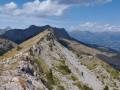
A circular route leading to the ridges of La Greysinière with exposed sections, but offering exceptional views of the Ceüze, Bure, Dévoluy, Écrins, Embrunais, Blanche and Monges mountains.
Starting at Col de Gleize helps to minimise the elevation gain.
The Odyssey Tour via the Brèche de Charance and the Col de Guizière
 3.91 mi
+1,893 ft
-1,893 ft
3h 25
Moderate
Departure from Gap (Hautes-Alpes)
3.91 mi
+1,893 ft
-1,893 ft
3h 25
Moderate
Departure from Gap (Hautes-Alpes)
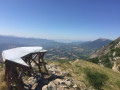
Climb up to the Brèche de Charance to enjoy the panoramic view from the ridge to the Col de Guizière, then descend through the forest. An ideal route for the summer months, just above the town of Gap.
Col de Corps via Chazal, starting from La Cluse
8.61 mi
+2,877 ft
-2,884 ft
6h 30
Difficult
Departure from La Cluse (Hautes-Alpes)
A route at the foot of Devoluy, which climbs up the Torrent de l'Abbéou, then joins the mountain pastures on the sunny side of Montagne de Lèche. The aim is to reach the Col de Corps, at the foot of Tête de Garnesier.
This route is classified as difficult becausesome of the paths through the meadows are not easy to follow after the Fontaine des Ruisseaux, and then as you approach the pass, some sections of unstable terrain are quite steep.
Clausonne Abbey circular route via the Col de Combe Escure
 6.46 mi
+1,663 ft
-1,660 ft
4h 25
Moderate
Departure from Le Saix (Hautes-Alpes)
6.46 mi
+1,663 ft
-1,660 ft
4h 25
Moderate
Departure from Le Saix (Hautes-Alpes)
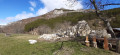
Starting from the village of Le Saix, this circular route offers a complete immersion in unspoilt nature. The route combines wild trails, arid valleys and superb Alpine panoramas.You’ll first walk through the heart of the Gouravour Gorges, a true geological wonder, then pass beneath the famous Trompes du Faï before reaching the ruins of Clausonne Abbey, a haven of tranquillity nestled in a mountainous setting. The return journey takes you via the Col de Combe Escure.
Amidst ancient ruins, peaceful mountain pastures and majestic landscapes, this hike blends history, nature and unique atmospheres. And, with a bit of luck, the mountains themselves will treat you to their song…
The Charance Gap and the Col de la Côte Gelée loop
6.67 mi
+2,792 ft
-2,785 ft
5h 30
Moderate
Departure from Gap (Hautes-Alpes)
Climb up to the breach to enjoy the view from the ridges of the Charance mountain (including the Col and Tête de Guizière), before descending via the Col de la Côte Gelée. Although most of the climb is through forest, the ridges and descent are more exposed to the sun.
The Ribiers circuit
5.30 mi
+371 ft
-358 ft
2h 45
Easy
Departure from Ribiers (Hautes-Alpes)
A peaceful route to explore the charming village of Ribiers, its many orchards and the River Buëch.
The Baisses de la Juberne circular walk
7.21 mi
+2,638 ft
-2,641 ft
5h 35
Moderate
Departure from La Motte-en-Champsaur (Hautes-Alpes)
A circular walk on the north-facing side of the Séveraissette Valley in Molines-en-Champsaur. Almost entirely shaded along its entire route, this walk is particularly suitable for hot summer days. After a gentle warm-up along the Torrent de Muande, the climb becomes steep as you reach the highest point, before descending gently along the circular path which crosses several small streams beneath the Baisses de la Juberne.
Aiguille d’Orcières from Les Audiberts
 6.76 mi
+4,298 ft
-4,298 ft
6h 50
Difficult
Departure from Orcières (Hautes-Alpes)
6.76 mi
+4,298 ft
-4,298 ft
6h 50
Difficult
Departure from Orcières (Hautes-Alpes)
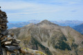
A lovely, steady and pleasant climb to this summit, which offers breathtaking views of Orcières, the Durance Valley and the highest peaks of the Écrins.
A round trip to Lac des Pisses from Prapic
8.38 mi
+3,169 ft
-3,169 ft
6h 35
Difficult
Departure from Orcières (Hautes-Alpes)
A magnificent hike starting from the pretty village of Prapic to Lac des Pisses, a small, secluded lake in the Écrins National Park, in the heart of the Champsaur. The ascent is pleasant and wild.
A circular route via the Roc d’Alibrandes and the Pointe de Méollion from Orcières
6.68 mi
+2,113 ft
-2,113 ft
4h 55
Moderate
Departure from Orcières (Hautes-Alpes)
Discover the vast network of trails around Orcières by climbing up to the Roc d’Alibrandes, then on to the Pointe de Méollion, which offers a view over the other side of the mountain and a magnificent vista of the Champsaur. A pleasant route despite its proximity to the resort.
Tour du Cuchon d'Ancelle
7.83 mi
+2,169 ft
-2,165 ft
5h 30
Moderate
Departure from Ancelle (Hautes-Alpes)
A climb to the summit overlooking the village of Wooden Roof Tile and the ski resort of Saint-Léger-les-Mélèzes. The circular offers beautiful panoramic views of Dévoluy, Champsaur and the Rouanne valley.
Col de Rouannette - La Coupa, from Archinard
6.73 mi
+3,406 ft
-3,383 ft
6h 05
Difficult
Departure from Orcières (Hautes-Alpes)
A round trip climb in a very wild (and unfrequented) valley. Following the course of the Torrent d'Archinard, between pastures and forest, the trail passes under the Cabane de la Rouannette then climbs to the pass (Crête des Autanes with a magnificent view of the Vallon d'Ancelle) and to the summit of the Coupa, which offers a beautiful panorama of the Lac de Serre-Ponçon and the peaks of the Écrins. An ideal route for hiking and snowshoeing.
The Rouanette Pass from Archinard
5.67 mi
+2,671 ft
-2,671 ft
4h 55
Moderate
Departure from Orcières (Hautes-Alpes)
An ideal round trip route for hiking and snowshoeing, which follows the course of the Torrent d'Archinard, between pastures and forest, to the Rouannette hut. The trail then climbs to the pass (Crête des Autanes), which offers a beautiful view of the Écrins peaks. It is possible to continue to the summit of La Coupa.
Tour of Neffes to Les Bonnets
 3.37 mi
+348 ft
-377 ft
1h 50
Easy
Departure from Neffes (Hautes-Alpes)
3.37 mi
+348 ft
-377 ft
1h 50
Easy
Departure from Neffes (Hautes-Alpes)
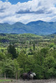
A circular loop around the village of Neffes, passing by the campsite, along small roads and paths accessible to all. It’s really more of a stroll to stretch your legs, although some open stretches offer views of Céüse, the Montagne de Charance and the Écrins.
The Tour du Puy from Superdévoluy
 3.54 mi
+571 ft
-548 ft
2h 05
Easy
Departure from Saint-Étienne-en-Dévoluy (Hautes-Alpes)
3.54 mi
+571 ft
-548 ft
2h 05
Easy
Departure from Saint-Étienne-en-Dévoluy (Hautes-Alpes)
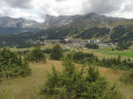
This pleasant circular route starting from the Superdévoluy resort is ideal for a family outing. It offers beautiful panoramic views throughout the route. Halfway along, a designated viewing point provides a chance to admire the Gorges des Étroits, the village of Saint-Étienne-en-Dévoluy and the Faraut mountain.
Short, easy and accessible to all-terrain pushchairs, it follows wide paths with no technical difficulties (apart from the optional climb to the summit of Le Puy). The route is also well-suited to those new to mountain biking, thanks to its gentle gradient and smooth terrain. In winter, it also makes for a pleasant snowshoe walk, snow conditions permitting.