Country:

 City:
City:


From Veynes, take the D348 towards Glaise. The road passes through the gorges before opening out onto a plateau. Continue to the end of the road, which leads into the village of Glaise. Park in the small car park just before the entrance to the hamlet (there is an information sign about the walks).
(S/E) Continue along the tarmac road towards the village, heading north, for about a hundred metres.
(1) Take the dirt track on the left towards the Col de Berthaud and Agnielles, heading west (GR®94 white and red markings). Go round a large bend to the left to reach some farm buildings.
(2) Take the path on the right just before the farm buildings, heading west, then rejoin the forest track. The track climbs gently, winding its way through pastures and heaths to the Chau crossroads.
(3) Continue along the forest track straight ahead towards the Col de Berthaud, heading west. Climb gently along this tree-lined track until you reach the Col de Berthaud.
(4) Carry on straight towards the Col de l’Angélus and La Valette, heading west (GRP® yellow and red markings). The route alternates between views of the gorges and the surrounding mountains and more wooded, shaded sections. The wide track descends slightly to the Col de la Chapelle, a major crossroads with a water tank.
(5) Take the path opposite and leave the track, heading north-west. Continue the descent until you reach the Route Forestière de Berthaud.
(6) Continue downhill to the Col de Gaudissart.
(7) Take the narrow path at the hairpin bend that descends towards Agnielles, heading west. Descend through the forest via several hairpin bends, until you can see the village of Agnielles far below.
The path is quite steep and then joins the Route Forestière de Berthaud.
(8) Take the forest road on the right towards Agnielles, heading north.
(9) Continue along the road as it bends to the left, ignoring the “Eldorado Les Agniellards” path which branches off to the right.
(10) Take the path on the right (shortcut) as you come out of the bend to head straight for the village. Take the opportunity to have a look around the village of Agnielles, where there are still a few restored houses and some ruins (inaccessible as they are dangerous). All that remains of the little church is the bell tower, which watches over the cemetery.
(11) Take the main road out of the village, heading south, for about 150 metres until you reach the junction.
(12) Turn almost right round and head left onto the Route Forestière de Berthaud, heading north-east, and return to a junction you passed earlier.
(10) Turn right onto the path you took on the way there and return to a fork you passed on the way there.
(8) Continue along the road ahead to reach the Col de l’Angélus.
(13) Continue along the Berthaud Forest Road to the left, heading east, and do not take the Combe Noire Forest Road or the small paths at this major junction. Climb gently along the hillside to the start of a short cutting before the bends (including a hairpin bend).
(14) Take the shortcut path opposite, heading north, before the bends. Climb through the woods for about 250 m before rejoining the forest road. Follow it to the left, heading west, to the Col de Gaudissart, which you have already passed on the way out.
(7) Continue along the Route Forestière de Berthaud to the right, heading east, in the opposite direction to the outward journey, until you reach the Col de Berthaud, which you passed on the outward journey.
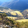
(4) Take the end of the Route Forestière des Thuilles on the left, towards the Source de la Doux and Charajaille, heading north-east. Here, admire the view of the Tête de Combe Rau, then, in the distance, the Aurouze mountain and the Pic de Bure.
Reach a circular DFCI water tank (B38) at the source of the Doux.
(15) Take the path leading down to the right (yellow markings and red mountain-bike markings for the “Grande Traversée des Hautes-Alpes”).
(16) Continue straight ahead, following the path along the hillside, ignoring the dirt track to La Chau which descends to the right. This will take you to the Col de Glaise.
(17) Turn right onto the dirt track to descend towards the village of Glaise. You’ll reach some farm buildings and join the Route Forestière d’Oriol (which descends from the Col de Tourette).
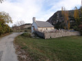
(18) Continue the descent straight ahead, heading south. Pass the Chapelle Saint-Jacques, then walk through the village of Glaise to reach the car park where you started (S/E).
 Visorando Member
 Easy
Easy  Association / Club / Walk leader