Agnielles Circular Loop via the Combe Noire Forest Road

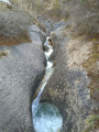
A circular walk in the heart of the Agnielles Gorges, combining the atmosphere of a canyon, woodland, scenic views and heritage, passing close to the old abandoned village of Agnielles. The route combines a spectacular walk along the Gorges Road, flanked by high limestone cliffs, followed by a return through the woodland via the Combe Noire Forest Road.

Details

90701352
Creation:
Last update:
Last review:
  • Walking
    Activity: Walking
  • ↔
    Distance: 7.85 mi
  • ◔
    Average duration: 4h 30 
  • ▲
    Difficulty: Moderate

  • ⚐
    Back to start: Yes
  • ↗
    Ascent: + 1,043 ft
  • ↘
    Descent: - 1,053 ft

  • ▲
    Highest point: 3,566 ft
  • ▼
    Lowest point: 2,664 ft

Description of the walk

From the D1075 road between Aspres-sur-Buëch and La Faurie, about 1 km after the junction with the D994A coming from Veynes, turn right onto the small road signposted ‘Gorges d’Agnielles’ (at a roadside car park). Pass under the railway line and continue along the track for about 500 m. Ignore the first car park on the right and carry on to the small car park by the climbing cliffs, situated to the left of the road.

(S/E) Take the track towards the village of Agnielles, heading east. Continue along the forest road, following the Rif d’Agnielles as it winds its way along the right-hand side at the bottom of the gorge. Pass the ‘Sentier des Falaises’ (purple signpost) on your left and carry on along the road.

(1) Carry on straight ahead along the road, heading north, ignoring the GRP® Tour du Buëch Variante, which crosses from left to right.

(2) Turn right onto the path leading down towards the Rif d’Agnielles (gate). A sign marks the ‘Les Agniellards’ nature trail (green route, PR® markings). This route, an alternative to the road, allows you to enjoy the coolness of the stream in the woodland.
Follow the stream, passing close to the remains of an old bridge, then continue towards the village, heading north.

(3) Head back up onto the track at the three-way junction and take the Route Forestière de Berthaud on the right. Here, you can take a short round trip to visit the abandoned village of Agnielles, steeped in history. Cross the bridge and head up at the first bend.

(4) Continue along the wide, motorable track, ignoring the paths branching off to the left (leaving the ‘Les Agniellards’ discovery trail). The view gradually opens up onto the Aup, the Durbonas and, in the distance, the Garnesier. Climb gently, heading south, to the Col de l’Angélus (a junction of tracks and a large clearing).

(5) Take the second dirt track on the left, heading south-east, towards the Col de Combe Noire and Pont la Dame. Follow the Route de Combe Noire for about 5 km. After a hairpin bend, you’ll reach a crossroads.

(6) Turn right to stay on the Route de Combe Noire, heading north-east.

(7) Carry on along the forest track, ignoring the paths branching off to the left and right.

(8) Stay on the forest road, ignoring the path branching off to the left.

(9) Carry on along the forest road, ignoring the path on the right (a shortcut to Rouchasson) and, after a wide bend to the left, you’ll come to a hairpin bend.

(10) Turn right onto the path, heading south-west, and walk along the mountainside.

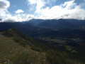
(11) At the cairn, you can head down to the left for a round trip to a large rock offering a beautiful view over the Buëch valley. Return and carry on along the track.

(12) Take the path on the right, heading north, just before the hairpin bend. Head down towards the Rif d’Agnielles.

(13) Turn right, heading north-east, ignoring the path on the left which leads to the underpass beneath the railway line. Reach the stream, follow its course, then cross it to climb back up to the Agnielles road. Return to the car park (S/E).

Waypoints

  1. S/E : mi 0 - alt. 2,687 ft - Car park at the Via Ferrata des Gorges d’Agnielles
  2. 1 : mi 1.7 - alt. 3,202 ft - Crossing the GRP® Tour du Buëch Alternative Route
  3. 2 : mi 2.06 - alt. 3,268 ft - Junction with the ‘Les Agniellards’ nature trail
  4. 3 : mi 2.45 - alt. 3,353 ft - The village of Agnielles
  5. 4 : mi 2.57 - alt. 3,346 ft - Berthaud Forest Road
  6. 5 : mi 3.39 - alt. 3,566 ft - Col de l’Angélus
  7. 6 : mi 4.58 - alt. 3,455 ft - Torrent de Combe Noire trail junction
  8. 7 : mi 4.95 - alt. 3,494 ft - Path junction
  9. 8 : mi 5.84 - alt. 3,337 ft - Path junction at the bend (elevation 1016)
  10. 9 : mi 6.47 - alt. 3,327 ft - Shortened route to Rouchasson
  11. 10 : mi 6.72 - alt. 3,278 ft - Hairpin bend junction
  12. 11 : mi 7.22 - alt. 3,041 ft - Cairn marking the way to the viewpoint from a rock
  13. 12 : mi 7.4 - alt. 2,956 ft - Junction with the Rouchasson path (elevation 895)
  14. 13 : mi 7.6 - alt. 2,677 ft - Junction with the path leading under the railway line - Buëch (rivière)
  15. S/E : mi 7.85 - alt. 2,684 ft - Car park for the Gorges d’Agnielles Via Ferrata

Notes

There is a picnic area below the car park, near the stream.

There are no drinking fountains along the route and no reliable water source in the village of Agnielles. Make sure you carry enough water.

The condition of the access road to the car park is precarious. Traffic is prohibited in snowy weather and parking is not permitted along the track outside the designated car parks.

Situated at the top of the gorges, the former hamlet of Agnielles (which had a population of nearly 283 in 1806) has two lodges open to the public:

  • theRetrouvance® Forest House in Agnielles.
  • the Auberge Les Sabots de Vénus.

Alternative route with a shortcut via Rouchasson: after a nearly straight stretch (9), take the path on the right, heading south-west, to shorten the circular route towards Rouchasson (11).

Alternative route to avoid the Rif d’Agnielles riverbed: (13) continue straight on to reach the tunnel passing under the railway line. Head up the car park on the right to join the Route Forestière d’Agnielles as far as the car park (S/E). Beware of sudden flooding in the Rif d’Agnielles riverbed in the event of a thunderstorm.

Worth a visit

The unspoilt natural site of the Gorges d’Agnielles, with its remarkable landscapes, is a Natura 2000 site. It is highly popular for outdoor activities : a climbing site suitable for beginners and families, two via ferratas, a cave for caving, a themed trail, mountain bike and e-mountain bike routes, and horse riding circular circuits.

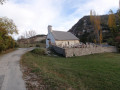
In the village of Agnielles, only a few houses remain, some of which have been restored and converted into lodges for groups by the ONF. All that remains of the little church is the bell tower, which watches over the cemetery. It was in 1933 that the Agnielles municipal council voted to merge the commune with that of Aspres-sur-Buëch. The last parish priest had left as early as 1907. In 1934, when the commune was dissolved, the school was attended by just four children. Since then, the village has seen several attempts at revival: in 1943, when the Water and Forests Department established an agricultural co-operative, some of whose members joined the Resistance; followed in the 1960s by a project led by young people from Île-de-France. To no avail; the village’s isolation proved too much even for the best of intentions. Ultimately, it is tourism (through lodges) that is breathing new life into the village today, even though no one lives there year-round.

Always be cautious and plan ahead when you're outdoors. Visorando and the author of this route cannot be held responsible for any accidents occurring on this route.

The GR® and PR® markings are the intellectual property of the Fédération Française de Randonnée Pédestre.

Other walks in the area

For more walks, use our search engine .

The GPS track and description are the property of this route's author. Please do not copy them without permission.