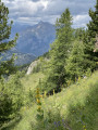
Circular loop starting from Saint-Léger-les-Mélèzes via the GR®50

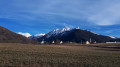
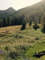
From the village resort of Saint-Léger-les-Mélèzes, this route allows you to explore the Libouze plateau, passing by some beautiful viewpoints, including the ‘Casso’, which offers a 180° panorama of the Champsaur, the Puy de Manse and the Dévoluy range. You’ll be able to enjoy beautiful scenery alternating between meadows, deciduous forests and larch groves, with the peaks of the Champsaur as a backdrop.

Details

90700992
Creation:
Last update:
Last review:
  • Walking
    Activity: Walking
  • ↔
    Distance: 6.38 mi
  • ◔
    Average duration: 4h 25 
  • ▲
    Difficulty: Moderate

  • ⚐
    Back to start: Yes
  • ↗
    Ascent: + 1,709 ft
  • ↘
    Descent: - 1,706 ft

  • ▲
    Highest point: 5,853 ft
  • ▼
    Lowest point: 4,163 ft

Description of the walk

Head to the village of Saint-Léger-les-Mélèzes and take the D13 (Routed’Ancelle) to park in the car park at the top of the resort, near the ski slopes.

(S/E) Walk up through the car park, heading south-west, keeping to the left of the Route d’Ancelle (D13) to pass the hut at the base of the Combes ski lift and arrive in front of an old fountain.

(1) Head left up the path, heading east, staying initially at the edge of the forest, then crossing through it until you reach a crossroads.

(2) Take the path on the right, heading south, to join a track leading to a large crossroads. Enjoy the 180° panoramic view over the Champsaur valley, the Puy de Manse and the Dévoluy range.

(3) Carry on straight ahead, heading south. Turn left at the three-way junction and join the GR®50 at the next junction.

(4) Turn left, heading east, and follow the GR®50 with its red and white markings. After 50 metres, ignore the path on the left and continue straight ahead along the path lined with fields, until you reach the junction at the edge of the forest.

(5) Take the track on the right, heading south-east, for about a hundred metres before turning left, heading north-east, to climb up into the Bois Fustier, following the GR®50. Cross the Ravin de l’Eyssillon as the track curves, and pass under the Cuchon chairlift before reaching a junction at a hairpin bend.

(6) Continue straight ahead, heading north-east, past the Tanchit ski lift hut and follow the green ‘Les Marmottes’ ski run. You’ll reach another junction after a hairpin bend.

(7) Head up the narrow path between the two tracks, heading south-east, to follow the GR®50. Pass under the Champets ski lift and reach a hut. Ignore the path climbing to the right and continue along the GR®50. Descend via a series of gentle hairpin bends to reach the ‘Les Chamois’ green ski run.

(8) Turn right to follow the run and the GR®50, heading north-east (there is a shortcut path opposite). You’ll reach a fork in the runs.

(9) Turn left, heading north-west, to leave the GR®50 and stay on the “Les Chamois” green ski run. Cross a path that cuts across the run and continue straight ahead to pass the first large hairpin bend, then reach a fork in the run at the second one.

(10) Continue left along the track, heading south, to descend in hairpin bends through the forest. Cross the Riou Meyrel torrent and then the Ravin de Racouestes. Take a short round trip to the cross and its viewpoint over the Drac valley, situated in the bend following the ravine. Join the path leading up to Libouze.

(11) Take the track on the right, heading north-east, to descend the path and pass the Recula fountain just after the bend.

(12) Continue to the left, heading south-west, along the green ‘La Recula’ ski run (signposted ‘retour station’). You’ll arrive near a sports ground on the right.

(13) Head up the path on the left, heading south-west, to leave the ski run via the Chemin de la Vernie. You’ll reach the top of the Vernie ski lift.

(14) Turn right, heading west, to follow the “La Vernie Verte” ski run towards the resort. Continue straight ahead at the next junction to reach the “snow carpet” (beginners’ ski lift).

(15) Head down to the left, heading south-west, following the snow conveyor and passing between the chairlift departure point and the resort’s base area buildings. Follow the footpath westwards to reach the car park (S/E).

Waypoints

  1. S/E : mi 0 - alt. 4,180 ft - Car park at the top of Saint-Léger – Route d’Ancelle
  2. 1 : mi 0.13 - alt. 4,222 ft - Path behind the Combes ski lift hut
  3. 2 : mi 0.47 - alt. 4,541 ft - Jarria junction
  4. 3 : mi 0.6 - alt. 4,636 ft - Le Casso junction (signpost)
  5. 4 : mi 0.81 - alt. 4,626 ft - Crossroads on the Chemin de Libouze
  6. 5 : mi 1.12 - alt. 4,918 ft - Fustier Wood junction
  7. 6 : mi 2.02 - alt. 5,617 ft - Tanchit ski lift station
  8. 7 : mi 2.22 - alt. 5,755 ft - Rocher Poligny junction
  9. 8 : mi 3.2 - alt. 5,499 ft - Junction with the “Les Marmottes” trail (GR50)
  10. 9 : mi 3.45 - alt. 5,387 ft - Crossing the Gariveau stream
  11. 10 : mi 4.28 - alt. 5,062 ft - Chafal bend (elevation 1,552)
  12. 11 : mi 5.12 - alt. 4,541 ft - La Recula junction
  13. 12 : mi 5.46 - alt. 4,383 ft - “Retour station” junction (the “La Recula” trail)
  14. 13 : mi 5.78 - alt. 4,314 ft - Les Chargeaoüs junction
  15. 14 : mi 5.94 - alt. 4,327 ft - Top of the Vernie ski lift
  16. 15 : mi 6.07 - alt. 4,229 ft - “La Vernie Verte” snow conveyor
  17. S/E : mi 6.38 - alt. 4,180 ft - Car park at the top of Saint-Léger – Route d’Ancelle

Notes

Water points:

  • Fountain in the village.
  • Fountain near the start of the Combes ski lift, at point (1).
  • The Recula fountain after point (11).

The flow of water from the fountains along the route is not guaranteed in summer or during periods of drought.

The Libouze plateau has been developed and features picnic tables. The restaurant “Le Domaine de Libouze” serves local, seasonal cuisine (the menu changes daily depending on the produce available). Further information is available on the estate’s website: Le Domaine de Libouze

Shops, restaurants, tourist accommodation and public toilets are available in the centre of the village of Saint-Léger-les-Mélèzes.

In winter or whilst the ski area is open, part of the route is accessible on snowshoes.

Alternative route: at point (7), you can stay on the green run “Les Chamois” (PR® route) to reach point (8) more directly, avoiding the section of the GR®50.

Worth a visit

A stroll through the streets of Saint-Léger-les-Mélèzes offers the chance to discover several old stone houses characteristic of the traditional architecture of the Champsaur region. Having been ravaged by a major fire in 1921, the village was partly rebuilt. Its heritage thus presents an interesting mix of old buildings and those dating from the reconstruction.
The castle retains its ramparts, corner towers, several buildings and its gateway. The façades, roofs, ramparts, towers, courtyard and former garden are listed as Historic Monuments.
The Church of Saint-Léger and its elegant bell tower are one of the village’s main landmarks. The communal oven and the old fountains, meanwhile, serve as a reminder of the traditional organisation of rural Alpine life.
Finally, the larch forest, which gave the village its name, is one of the area’s most iconic landscapes. Particularly striking in autumn, it offers a palette of golden colours unique to the Champsaur region.

The Libouze plateau, situated at an altitude of around 1,450 metres, is a vast open space combining mountain pastures, meadows and wooded areas. It is home to a hillside reservoir designed to supply the resort’s artificial snow-making system. The paths leading there offer open landscapes, views of the peaks and a pastoral mountain atmosphere.

A few kilometres away, the villageof Ancelle is alsowell worth a visit for its traditional architecture, its ancient alleyways and its lively summer tourist scene.

Always be cautious and plan ahead when you're outdoors. Visorando and the author of this route cannot be held responsible for any accidents occurring on this route.

The GR® and PR® markings are the intellectual property of the Fédération Française de Randonnée Pédestre.

Other walks in the area

For more walks, use our search engine .

The GPS track and description are the property of this route's author. Please do not copy them without permission.