Country:
 City:
City:


Between Florence and Siena, take the SS 68 di Val Cecinaroad to Colle di Vald’Elsa. Do not enter the town centre but continue along the SS 68 to the Bacìo car park and park there.
(S/E) From the car park, follow the footpath with its steps up to Via Dietro le Mura and Piazza Santa Caterina.
(1) Turn left onto Via Francesco Campana, then passunder the archway through the Palazzo Campana. Continue straight on, passing the Co-Cathedral of Saints Alberto and Marziale, then the Church of Santa Maria in Canonica, until you reach Piazza del Baluardo. Enjoy the view over the lower town and the Val d’Elsa.
(2) Head down to the lower town via the lift or the footpath to reach Via San Sebastiano. Continue eastwards until you reach Via Giuseppe Mazzini.
(3) Turn right into Piazza Arnolfo and cross it, heading east.
(4) Take Via Romano Bilenchi south-eastwards until you reach a small roundabout.
(5) Turn left onto Via Martiri della Libertà, heading north-east, then onto the Colligiana provincial road. Cross the bridge to reach the start of the Elsa Trail.
(6) Head down the path on the right to reach the banks of the River Elsa.
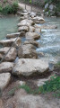
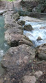
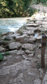
Cross the River Elsa for the first time over the rocks (handrail provided) and continue through the forest. Cross again in the same way. Admire the lovely Cascata del Diborrato (a terraced waterfall with a rocky pool, suitable for swimming), before reaching the end of the water trail and heading back up to Viale dei Mille.
(7) Take the path on the left to cross the footbridge, heading south, then continue along Via Fratelli Bandiera heading south-south-west.
(8) Turn right onto Via Carlo Pisacane, heading south-west, then rejoin the VFI-091_1 route in the Le Nove neighbourhood (signposted).
(9) Continue along the road opposite, heading west, towards Onci. The road leaves the built-up area and runs alongside the Gora Canal.
(10) Leave the road and take the path opposite, which runs alongside the Gora Canal, then joins the Botro degli Strulli river at the Mulino di Le Vene (swimming possible).
(11) Continue straight ahead on the signposted route, which now winds its way through the trees, heading south-west.
(12) Carry on along the path to the left (marked in white and red), ignoring the path leading uphill to the right. After 100 m, turn right to stay on the hillside (the path on the left that goes downhill leads to the same spot).
(13) Turn left, heading slightly downhill towards the south-west, to follow the Botro degli Strulli river below. Ignore the path coming from the right (wooden barrier) and you’ll reach a junction near a bridge.
(14) Carry on straight ahead, heading west, along a dirt track that climbs slightly. This is the Strada vicinale from La Fabbrica to Mensanello. You’ll reach a junction at the edge of the fields.
(15) Head up to the right through the fields, heading north-west, to follow the Strada vicinale from La Fabbrica to Mensanello. Pass by the ruins of the Fonte Sant’Antonio, then head towards the hamlet of Fabbrica, heading west.
(16) Walk through the hamlet, heading south-west. Note the small chapel of the Oratorio della Pietà e Munificenza de Nobili Signori Venturi Gallerani. Ignore the path coming from the left and continue along the track ‘strada vicinale da Quartaia alla Fabbrica’, heading west then south-west, until you reach the village of Quartaia.
(17) Turn right to walk through the village along Via della Concordia, still following the signposted Via Francigena route. Turn left onto Via degli Aragonesi, cross the main road (strada provinciale di Casole d’Elsa) and continue north-west along Via San Frediano and Via San Donato. The road turns into a dirt track as you leave the hamlet.
(18) Turn right to follow route VFI-091_1, heading north-west, and walk alongside the Piro e More campsite.
(19) Head uphill to the right, heading north-west, keeping to the shade of the trees. Then head downhill to the Il Timignano guesthouse.
(20) Turn right, heading north-east, to descend through the trees. Cross the Botro Vialunga stream (often dry) and stay on the main path, heading north-west, to emerge from the woods and walk alongside the fields to the strada di Buliciano.
(21) Turn right and proceed with caution along the road for about 250 m. You’ll reach a junction near the Abbazia di Santa Maria Assunta a Conèo.
(22) Head down the small path on the left through the trees. On the right, the Abbazia di Santa Maria Assunta a Conèo is worth a quick detour (even if the abbey is closed). Leave the trees behind and walk across the fields, heading north, until you reach the Val Cecina state road (SS 68).
(23) Cross the road with care to join the path continuing opposite, heading north-west, then west and finally north. Continue, alternating between sections through the fields and under the trees. Reach the junction of the two variants of the Via Francigena.
(24) Turn right, heading north-east, and climb the hill to Casa Prodeggia.
(25) Turn right, heading south then south-east, to continue the climb to the top of the hill: Casa Prodeggia. After the large hairpin bend on the left, enjoy the view of San Gimignano (to the north-east). Continue along the tarmac road, heading south, to pass through the hamlet of Camaggiori and head south-east. Pass San Savino and the Cimitero Monumentale della Misericordia in Colle di Val d’Elsa, before joining the SS 68 road near the town of Colle di Val d’Elsa.
(26) Follow Via Volterrana along the pedestrian side streets, heading north-east, then east, to reach the medieval town via the Portanuova.
(27) Pass through the gate and walk along the narrow street Via Gracco del Secco, then turn left onto Via Porta Vecchia and right onto Via Dietro le Mura to reach the Bacìo car park (S/E).
 Visorando Member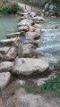
 Easy
Easy