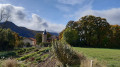
Pic Chauve as seen from the Maison Forestière des Sauvas

From the Maison Forestière des Sauvas (in the commune of Montmaur), this round-trip route is the easiest way to climb the Tête Plumée and then the Pic Chauve via the Col des Sérigons.
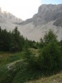
The route runs mainly through woodland, with a few clearings offering views of the landscape, all the way to the Pic Chauve, which overlooks the upper valley of the Petit Buëch and offers stunning panoramic views.

Details

92191374
Creation:
Last update:
Last review:
  • Walking
    Activity: Walking
  • ↔
    Distance: 6.83 mi
  • ◔
    Average duration: 4h 35 
  • ▲
    Difficulty: Moderate

  • ⚐
    Back to start: Yes
  • ↗
    Ascent: + 1,703 ft
  • ↘
    Descent: - 1,703 ft

  • ▲
    Highest point: 5,791 ft
  • ▼
    Lowest point: 4,259 ft

Photos

Description of the walk

On the D994 road between Veynes and Gap, head for the village of Montmaur via the D320 or the D937A. Opposite the castle, take the small D320 road heading north, following the signs for ‘la Montagne’ and ‘les Sauvas’. Drive up the winding road to the hamlet of La Montagne, then turn right, heading due east, onto the Les Sauvas forest track (easily passable by car).
Pass over the Col de Gaspardon and, about 1.5 km further on, turn left at the junction towards the car park (signposted “Pic de Bure”). Park in the large car park above the lodges, just past the picnic area.

(S/E) Walk down towards the Gîtes des Sauvas (ONF house) and take the GRP®94 on the left as it descends, ignoring the track leading uphill to the left after the last building. A signpost marked 563 indicates the direction of the Col de Matacharre and the Sigouste dam. Pass through a gate and continue the descent to a ford and a small dam near the headwaters of the Sigouste. A commemorative plaque honours the memory of forestry engineer Robert PIC.

(1) Ford the Sigouste torrent, then continue the ascent along a forest track, heading south. A little further on, ignore a wide path on the right. You’ll reach a hairpin bend with a junction.

(2) Carry on straight ahead along the track, heading south, following the sign for “Col de Matacharre”. You’ll reach another junction at a hairpin bend.

(3) Take the track on the left, heading north-east, still towards the Col de Matacharre. You’ll reach a Y-junction with a signpost.

(4) Turn right, heading south, towards the Col des Sérigons. Follow the forest track, which ends about 15 m below the pass, at a large clearing used for manoeuvring forestry machinery. Then climb up the embankment, which is often muddy, to reach the wooded pass (no view).

(5) Take the path on the left, heading north-east, towards Pic Chauve, signposted as 500 m away. Cross a wooded area, then, at the edge of the woods, climb more steeply with unobstructed views. Reach the first hillock.

(6) Continue straight ahead through a short wooded section, heading east, to reach the ridge of Pic Chauve, in open terrain. The path is poorly marked: you can make out the route by following the edge of the trees. Cross a rocky section, then spot the summit cairn.

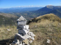
(7) Enjoy the 360° panorama, then descend via the same route. Take care when descending the peak and when reaching the platform below the pass, which is often muddy (5). Then rejoin the main forest track to return to the starting point (S/E).

Waypoints

  1. S/E : mi 0 - alt. 4,469 ft - Les Sauvas car park
  2. 1 : mi 0.56 - alt. 4,265 ft - Sigouste Torrent
  3. 2 : mi 1.22 - alt. 4,498 ft - Hairpin bend (Près Fontaine)
  4. 3 : mi 1.65 - alt. 4,711 ft - Junction at the hairpin bend (Crête de la Jasse)
  5. 4 : mi 2.19 - alt. 4,974 ft - Y-junction – Signpost no. 555
  6. 5 : mi 3.06 - alt. 5,266 ft - Marker no. 554; return to the summit - Col des Sérigons (1606m)
  7. 6 : mi 3.19 - alt. 5,443 ft - Tête Plumée
  8. 7 : mi 3.41 - alt. 5,791 ft - Pic Chauve (1771 m)
  9. S/E : mi 6.83 - alt. 4,469 ft - Les Sauvas car park

Notes

There is a water source at the Maison Forestière des Sauvas (not guaranteed), but no drinking water along the route.

Picnic tables below the Sauvas lodges. Large unpaved car park; camping is permitted, or you can arrive in a campervan.

This route should be avoided in wet weather due to rocky and muddy sections. The walk is mostly shaded, pleasant in summer, with magnificent views over the Petit Buëch valley.

Whilst the route suggested here is the easiest, the classic ascent starts from La-Roche-des-Arnauds (car park at the climbing site) and leads to the Col des Sérigons, either via the valley or via the Crête des Rortes.

Worth a visit

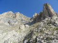
The Pic Chauve (1,771 m) is easily recognisable as the neighbouring ridges are more wooded, particularly that of the Tête de Vène. Its summit offers a remarkable 360° view of the Dévoluy, the Pic de Bure, Céüse and the Buëch valley.

The Tête Plumée (1,663 m) is a wooded hilltop situated between the Col des Sérigons and the Pic Chauve.

You can visit the Pertuis cave: at the Col des Sérigons, take the yellow-marked path heading south, descending towards “La Plaine – Montmaur”. You’ll reach a wide forest track. Turn left, heading north, then make a wide right-hand bend. You’ll reach a junction with a path coming from the right. Carry on straight ahead along the track, which descends gently until it curves slightly to the right. Look out for the cairns marking the entrance to the cave, or, failing that, the line of five large fir trees on the slope above. Climb up to the left along the embankment of earth and rocks, right next to a small fir tree at the edge of the track. The first 10 metres are steep, then the climb becomes easier through the branches and broom. Reach the entrance to the cave via a few zigzags. Be careful: the rocks are slippery inside the first chamber. The cave can be explored without difficulty as far as the ‘cauliflower’ formation at the bottom of the second chamber. Beyond this point, the floor becomes very slippery and exploration requires a rope (final obstruction at around –35 m).

On the access road to the starting point: the Château de Montmaur (14th century), now a departmental estate, is a fine example of the various periods and artistic influences in the Dauphiné. Its development and decoration spanned four hundred years. Inside, the state rooms have retained their French-style ceilings, monumental fireplaces, carved doors and painted decorations, the oldest of which date back to the Renaissance. Noble families occupied the castle in succession until the Revolution, after which private owners in turn maintained and embellished the premises. This unique testament to the heritage of the Hautes-Alpes also became a key centre of the Resistance during the Second World War. Listed as a Historic Monument, the château has maintained its tradition of hospitality, where heritage and the arts intertwine. https://www.sources-du-buech.com/chateau-de-montmaur--226228.html

Other walks in the area

For more walks, use our search engine .

The GPS track and description are the property of this route's author. Please do not copy them without permission.