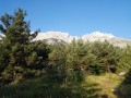
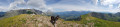
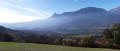
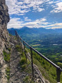
Col de la Saume, Tête du Tourneau as seen from the village of Le Noyer

Between the famous Col du Noyer and the Col la Saume, the small peak of the Tête du Tourneau offers a beautiful panoramic view of the Écrins, the Drac valley and the foothills of the eastern Dévoluy. Starting from the village of Le Noyer, and despite a short stretch along the pass road, this route allows you to extend the delightful Dominique Villars Botanical Trail (named after the leading botanist for the Alps).

Details

n°74997566
Creation:
Last update:
Last review:
  • Walking
    Activity: Walking
  • ↔
    Distance: 7.59 mi
  • ◔
    Average duration: 5h 55 
  • ▲
    Difficulty: Moderate

  • ⚐
    Back to start: Yes
  • ↗
    Ascent: + 2,828 ft
  • ↘
    Descent: - 2,815 ft

  • ▲
    Highest point: 6,230 ft
  • ▼
    Lowest point: 3,684 ft

Photos

Description of the walk

Between Gap and Corps, from the Route Napoléon (N85), take the D17 or the D617 to the village of Le Noyer. Park in the church car park, near the Maison de la Botanique Dominique Villars.

(S/E) From the fountain, take the Dominique Villars Botanical Trail (signposted) above the church, towards Saint-Étienne-de-Dévoluy. The path heads straight west and climbs very steeply for the first two kilometres. You will reach the road leading up to the Col du Noyer.

(1) Cross the road with care and continue along the botanical trail opposite, heading west, until you rejoin the Route du Col. 

(2) Cross the road with care and continue along the botanical trail opposite, which joins the road once more. 

(3) Head up to the right and follow the roadwith care until you reach the hairpin bend.

(4) Leave the road and take the GR®93 path on the right towards the Col de la Saume (Vercors Crossing). The path runs along the mountainside and there is little shade. Caution is advised for those with a fear of heights and for children: the path is narrow and the ravine is quite steep.

(5) At the pass, take the path on the left, heading south-east. Leave the GR®93 to climb up the ridges along a well-marked track, signposted with markings and cairns, to the summit of the Tête du Tourneau. 

(6) Continue to follow the markings downwards, heading west. Caution: the descent is quite steep. Join a path that winds down the hillside, heading south-east, to reach the Col du Noyer mountain hut (car park).

(7) Crosswith care and take the path that descends alongside the road, this time heading downhill. Follow it carefully until the third hairpin bend, where you’ll rejoin the Dominique Villars Botanical Trail that you took on the way up.

(4) Follow it to the right, in the opposite direction to the way up, to continue the descent.

(3) Carry on straight ahead until the next hairpin bend.

(8) Leave the road and take the GR®93 path opposite, heading south-west: look for the wooden sign marked ‘Sentier D.Villars’. Ignore the path leading down to the left and carry on straight ahead, crossing the Torrent de Font Blanche.

(9) Head down to the left to continue along the botanical trail, following the stream.

(10) Continue along the path straight ahead, ignoring the small path on the right, until you reach a wider track.

(11) Follow the track to the left until you reach the Route du Col.

(12)Carefully walk up the road to the left until you reach the first junction on the route.

(1) Turn right, heading in the opposite direction to the outward journey, to return to the car park (S/E). 

Waypoints

  1. S/E : mi 0 - alt. 3,688 ft - Church of Le Noyer
  2. 1 : mi 0.42 - alt. 4,144 ft - Junction with the 1st circular loop
  3. 2 : mi 0.71 - alt. 4,570 ft - Road junction at elevation 1394
  4. 3 : mi 0.83 - alt. 4,754 ft - Road junction at elevation 1,458
  5. 4 : mi 1.04 - alt. 4,849 ft - Hairpin bend. Junction for the 2nd circular loop
  6. 5 : mi 1.97 - alt. 5,597 ft - Col la Saume - Col la Saume (1704m)
  7. 6 : mi 2.73 - alt. 6,204 ft - La Tête du Tourneau
  8. 7 : mi 3.37 - alt. 5,456 ft - Col du Noyer - Col du Noyer
  9. 8 : mi 4.97 - alt. 4,698 ft - Hairpin bend on the Route du Col
  10. 9 : mi 5.88 - alt. 4,327 ft - Torrent de Claret junction
  11. 10 : mi 6.25 - alt. 4,049 ft - Path junction
  12. 11 : mi 6.42 - alt. 3,960 ft - L’Empare junction
  13. 12 : mi 6.74 - alt. 3,963 ft - Junction with the D17 at Serre du Pinet
  14. S/E : mi 7.59 - alt. 3,684 ft - Church of Le Noyer

Notes

There is a water source on the climb up to Col la Saume, just after a large hairpin bend (5 minutes before the pass).

At the Col du Noyer, in addition to the orientation board, a bar-restaurant is open in the former Napoléon refuge during the summer season.

Please note that the Route du Col is closed during the winter months.

Worth a visit

The Dominique Villars botanical trail, lined with information boards, offers the chance to discover the remarkable diversity of the Champsaur’s vegetation. Scots pines, firs and beech trees grow alongside meadows and flower-filled lawns. The young Dominique Villars used to walk here long before he became a doctor and a botanist recognised by his peers in the 19th century.
You can visit the ‘La Maison de la Botanique’ eco-museum in the heart of the small village of Le Noyer.

The Tête du Tourneau is a pyramid-shaped peak that can be spotted from afar. It offers a magnificent panoramic view of the Champsaur, the Écrins and the Dévoluy.

Easier alternative: to avoid the climb up to the Tête du Tourneau and its somewhat steep descent, you can go via the Combe de Saume from the Col de Saume (5), where you continue the descent opposite, heading south-west. At the junction after 1 km, turn left and follow the path which joins the track further on. Pass close to a hut and arrive at the RD17. Follow it to the left to climb up to the Col du Noyer: elevation gain 750 m, total time 5 hours.

Always be cautious and plan ahead when you're outdoors. Visorando and the author of this route cannot be held responsible for any accidents occurring on this route.

The GR® and PR® markings are the intellectual property of the Fédération Française de Randonnée Pédestre.

Reviews and comments

5 / 5
Based on 1 review

Reliability of the description
Not used
Ease of following the route
Non utilisé
Route interest
5 / 5
JODIDO
JODIDO

Overall rating : 5 / 5

Date of your route : Sep 15, 2024
Reliability of the description : Not used / Not applicable
Ease of following the route : Not used / Not applicable
Route interest : ★★★★★ Very good
Very busy route : No

I attempted to climb to the Tête de l'Aupet on 15 September 2024, but turned back after two hours because of persistent fog that refused to lift! There was no point in attempting a difficult, unmarked hike in thick fog! So I set off for Col du Noyer, almost certain that I would find sunshine there, which was indeed the case.

So, without leaving the village of Noyer, but starting from the pass, I did the Tête du Tourneau, Col de la Saume loop and returned to Col du Noyer via the Saume valley...
Magnificent views of several peaks in the Dévoluy (Pic de Bure, Rocher Rond, Grand Ferrand, Tête de l'Aupet) as well as the Champsaur and Valgaudemar.

I think that one day I will do the entire hike...

Machine-translated

Other walks in the area

For more walks, use our search engine .

The GPS track and description are the property of this route's author. Please do not copy them without permission.